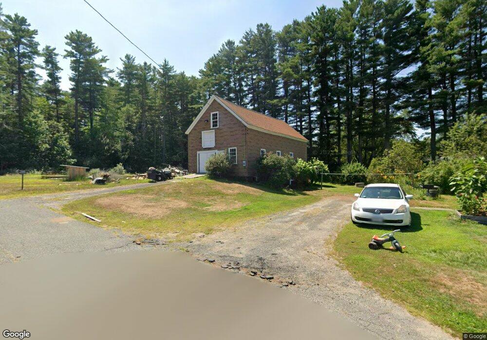
218 Prentiss St Orange, MA 01364
Estimated Value: $336,000 - $397,076
3
Beds
1
Bath
1,689
Sq Ft
$215/Sq Ft
Est. Value
About This Home
This home is located at 218 Prentiss St, Orange, MA 01364 and is currently estimated at $363,769, approximately $215 per square foot. 218 Prentiss St is a home located in Franklin County with nearby schools including Fisher Hill and Ralph C Mahar Regional School.
Ownership History
Date
Name
Owned For
Owner Type
Purchase Details
Closed on
Nov 27, 2018
Sold by
Olson-Martini Janet and Olson-Gallagher Donna
Bought by
Macdonald Vincent and Macdonald Rachel
Current Estimated Value
Home Financials for this Owner
Home Financials are based on the most recent Mortgage that was taken out on this home.
Original Mortgage
$128,000
Outstanding Balance
$112,771
Interest Rate
4.8%
Mortgage Type
New Conventional
Estimated Equity
$250,998
Purchase Details
Closed on
Apr 16, 2009
Sold by
Olson L Doris
Bought by
Olson-Martini Janet and Olson-Gallagher Donna
Create a Home Valuation Report for This Property
The Home Valuation Report is an in-depth analysis detailing your home's value as well as a comparison with similar homes in the area
Home Values in the Area
Average Home Value in this Area
Purchase History
| Date | Buyer | Sale Price | Title Company |
|---|---|---|---|
| Macdonald Vincent | $160,000 | -- | |
| Olson-Martini Janet | -- | -- |
Source: Public Records
Mortgage History
| Date | Status | Borrower | Loan Amount |
|---|---|---|---|
| Open | Macdonald Vincent | $128,000 |
Source: Public Records
Tax History Compared to Growth
Tax History
| Year | Tax Paid | Tax Assessment Tax Assessment Total Assessment is a certain percentage of the fair market value that is determined by local assessors to be the total taxable value of land and additions on the property. | Land | Improvement |
|---|---|---|---|---|
| 2025 | $5,057 | $307,400 | $60,300 | $247,100 |
| 2024 | $4,766 | $273,300 | $60,300 | $213,000 |
| 2023 | $4,389 | $244,400 | $56,900 | $187,500 |
| 2022 | $4,130 | $216,000 | $56,900 | $159,100 |
| 2021 | $3,868 | $192,900 | $75,200 | $117,700 |
| 2020 | $3,720 | $183,000 | $70,800 | $112,200 |
| 2019 | $3,702 | $164,400 | $63,600 | $100,800 |
| 2018 | $3,350 | $152,700 | $61,000 | $91,700 |
| 2017 | $3,242 | $152,700 | $61,000 | $91,700 |
| 2016 | $3,094 | $142,600 | $57,100 | $85,500 |
| 2015 | $3,005 | $144,700 | $59,200 | $85,500 |
| 2014 | $3,030 | $153,500 | $59,200 | $94,300 |
Source: Public Records
Map
Nearby Homes