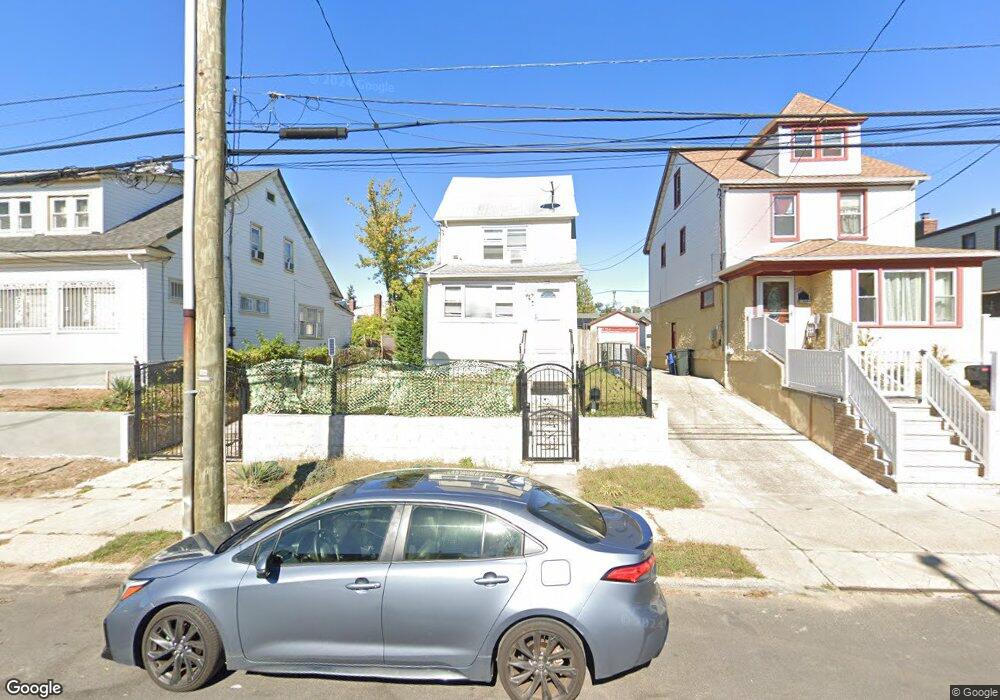
21819 132nd Ave Springfield Gardens, NY 11413
Laurelton NeighborhoodEstimated Value: $710,000 - $761,000
--
Bed
--
Bath
1,064
Sq Ft
$693/Sq Ft
Est. Value
About This Home
This home is located at 21819 132nd Ave, Springfield Gardens, NY 11413 and is currently estimated at $737,534, approximately $693 per square foot. 21819 132nd Ave is a home located in Queens County with nearby schools including P.S. 132 - Ralph Bunche, Is 59 Springfield Gardens, and Success Academy Springfield Gardens.
Ownership History
Date
Name
Owned For
Owner Type
Purchase Details
Closed on
Jul 16, 2021
Sold by
Executive Group Nyc Corp
Bought by
Armond Calvin and Armond Kenya G
Current Estimated Value
Home Financials for this Owner
Home Financials are based on the most recent Mortgage that was taken out on this home.
Original Mortgage
$666,946
Outstanding Balance
$605,427
Interest Rate
2.93%
Mortgage Type
Purchase Money Mortgage
Estimated Equity
$132,107
Purchase Details
Closed on
Jan 28, 2021
Sold by
Joseph Bernadet B and Joseph Curtis B
Bought by
Executive Group Nyc Corp
Purchase Details
Closed on
May 14, 1999
Sold by
Progress Group Inc
Bought by
Joseph Curtis B and Joseph Bernadet B
Home Financials for this Owner
Home Financials are based on the most recent Mortgage that was taken out on this home.
Original Mortgage
$203,300
Interest Rate
6.85%
Mortgage Type
FHA
Purchase Details
Closed on
Jan 27, 1999
Sold by
New York City Housing Authority
Bought by
Progress Group Inc
Create a Home Valuation Report for This Property
The Home Valuation Report is an in-depth analysis detailing your home's value as well as a comparison with similar homes in the area
Home Values in the Area
Average Home Value in this Area
Purchase History
| Date | Buyer | Sale Price | Title Company |
|---|---|---|---|
| Armond Calvin | $679,250 | -- | |
| Executive Group Nyc Corp | $380,000 | -- | |
| Joseph Curtis B | $205,000 | -- | |
| Progress Group Inc | $92,500 | -- |
Source: Public Records
Mortgage History
| Date | Status | Borrower | Loan Amount |
|---|---|---|---|
| Open | Armond Calvin | $666,946 | |
| Previous Owner | Joseph Curtis B | $203,300 |
Source: Public Records
Tax History Compared to Growth
Tax History
| Year | Tax Paid | Tax Assessment Tax Assessment Total Assessment is a certain percentage of the fair market value that is determined by local assessors to be the total taxable value of land and additions on the property. | Land | Improvement |
|---|---|---|---|---|
| 2025 | $3,998 | $21,100 | $5,451 | $15,649 |
| 2024 | $3,998 | $19,906 | $6,161 | $13,745 |
| 2023 | $3,998 | $19,906 | $5,289 | $14,617 |
| 2022 | $3,943 | $34,980 | $11,160 | $23,820 |
| 2021 | $3,922 | $31,020 | $11,160 | $19,860 |
| 2020 | $3,722 | $27,120 | $11,160 | $15,960 |
| 2019 | $3,470 | $27,960 | $11,160 | $16,800 |
| 2018 | $3,381 | $16,588 | $5,877 | $10,711 |
| 2017 | $3,356 | $16,461 | $7,994 | $8,467 |
| 2016 | $3,105 | $16,461 | $7,994 | $8,467 |
| 2015 | $1,873 | $14,653 | $6,770 | $7,883 |
| 2014 | $1,873 | $13,824 | $7,651 | $6,173 |
Source: Public Records
Map
Nearby Homes
- 21924 130th Dr
- 13049 217th St
- 21931 133rd Ave
- 130-45 220th St
- 130-25 217th St
- 218-36 133rd Rd
- 133-15 220th St
- 131-35 222nd St
- 21827 130th Ave
- 22014 130th Ave
- 22014 130th Ave
- 130-55 222nd St
- 13024 Springfield Blvd
- 19332 Williamson Ave
- 22310 131st Ave
- 12512 Nepton St
- 21608 Merrick Blvd
- 131-20 224th St
- 192-17 Williamson Ave
- 122-52 Springfield Blvd
- 218-19 132nd Ave
- 21825 132nd Ave
- 21815 132nd Ave
- 218-29 132nd Ave
- 21829 132nd Ave
- 132 Avenue
- 21820 131st Ave
- 21902 131st Ave
- 21816 131st Ave
- 21833 132nd Ave
- 21833 132nd Ave
- 21904 131st Ave
- 131-15 218th St
- 21812 131st Ave
- 21812 131st Ave
- 21812 131st Ave Unit 2
- 21812 131st Ave
- 218 W 132nd St
- 13115 218th St
- 13119 218th St