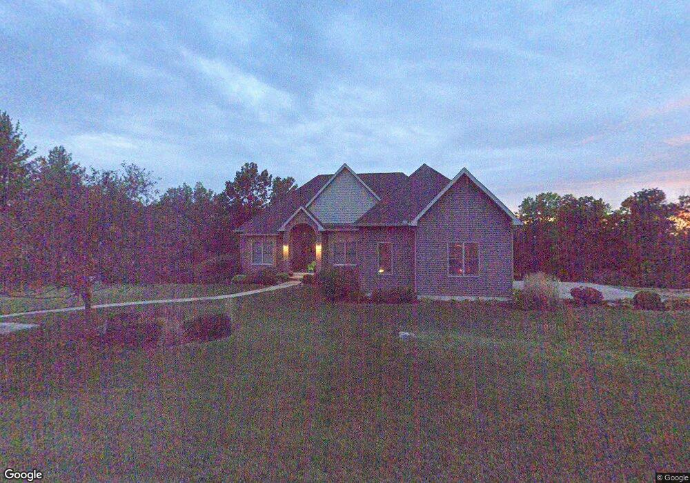
2188 West Hills Dr Fairfield, IA 52556
Estimated Value: $465,432 - $565,000
4
Beds
5
Baths
2,363
Sq Ft
$227/Sq Ft
Est. Value
About This Home
This home is located at 2188 West Hills Dr, Fairfield, IA 52556 and is currently estimated at $537,108, approximately $227 per square foot. 2188 West Hills Dr is a home located in Jefferson County with nearby schools including Fairfield High School, Maharishi School, and Cornerstone Primary School.
Ownership History
Date
Name
Owned For
Owner Type
Purchase Details
Closed on
Jul 14, 2006
Sold by
Ferrel Steven R and Ferrel Melinda D
Bought by
Seeley Troy J and Seeley Jody L
Current Estimated Value
Home Financials for this Owner
Home Financials are based on the most recent Mortgage that was taken out on this home.
Original Mortgage
$16,250
Outstanding Balance
$9,684
Interest Rate
6.72%
Mortgage Type
Future Advance Clause Open End Mortgage
Estimated Equity
$527,424
Create a Home Valuation Report for This Property
The Home Valuation Report is an in-depth analysis detailing your home's value as well as a comparison with similar homes in the area
Home Values in the Area
Average Home Value in this Area
Purchase History
| Date | Buyer | Sale Price | Title Company |
|---|---|---|---|
| Seeley Troy J | $17,000 | None Available |
Source: Public Records
Mortgage History
| Date | Status | Borrower | Loan Amount |
|---|---|---|---|
| Open | Seeley Troy J | $16,250 |
Source: Public Records
Tax History Compared to Growth
Tax History
| Year | Tax Paid | Tax Assessment Tax Assessment Total Assessment is a certain percentage of the fair market value that is determined by local assessors to be the total taxable value of land and additions on the property. | Land | Improvement |
|---|---|---|---|---|
| 2025 | $5,660 | $538,500 | $41,700 | $496,800 |
| 2024 | $5,660 | $472,100 | $41,700 | $430,400 |
| 2023 | $4,842 | $472,100 | $41,700 | $430,400 |
| 2022 | $4,932 | $391,800 | $41,700 | $350,100 |
| 2021 | $4,932 | $391,800 | $41,700 | $350,100 |
| 2020 | $5,368 | $399,300 | $41,700 | $357,600 |
| 2019 | $5,784 | $391,600 | $0 | $0 |
| 2018 | $5,494 | $391,600 | $0 | $0 |
| 2017 | $5,494 | $362,500 | $0 | $0 |
| 2016 | $5,230 | $362,500 | $0 | $0 |
| 2015 | $4,736 | $326,700 | $0 | $0 |
| 2014 | $4,736 | $326,700 | $0 | $0 |
| 2013 | $4,722 | $0 | $0 | $0 |
Source: Public Records
Map
Nearby Homes
- 1980 Libertyville Rd
- 2146 S 32nd St
- 1961 Libertyville Rd
- 1301 Liberty Dr
- 1604 Southview Cir
- 1612 Dogwood Dr
- 805 W Taylor Ave
- 1525 Lone Oak Cir
- 1500 Dogwood Dr
- 1521 Lone Oak Cir
- 2309 Kale Blvd
- 1407 Dogwood Dr
- 106 S 17th St
- 805 S 7th St
- 1201 S 5th St
- 1005 S 5th St
- 1009 S 4th St
- 0 W Grimes Ave Unit NOC6329454
- 902 W Burlington Ave
- 602 W Jefferson Ave
- 2186 West Hills Dr
- 2190 West Hills Dr
- 2189 West Hills Dr
- 2189 S 32nd St
- 2189 S 32nd St
- 2199 S 32nd St
- 2121 West Hills Dr
- 2193 West Hills Dr
- 2204 West Hills Dr
- 0 Westhills Dr Unit 5424916
- 0 Westhills Dr
- 2203 West Hills Dr
- 1980 Pine Tree Blvd
- 1985 Pine Tree Blvd
- 2238 West Hills Dr
- 0 Pinetree Blvd Unit 22015671
- 0 Pinetree Blvd Unit 5425031
- 0 Pinetree Blvd Unit 5425039
- 0 Pinetree Blvd Unit 5425032
- 2117 West Hills Dr