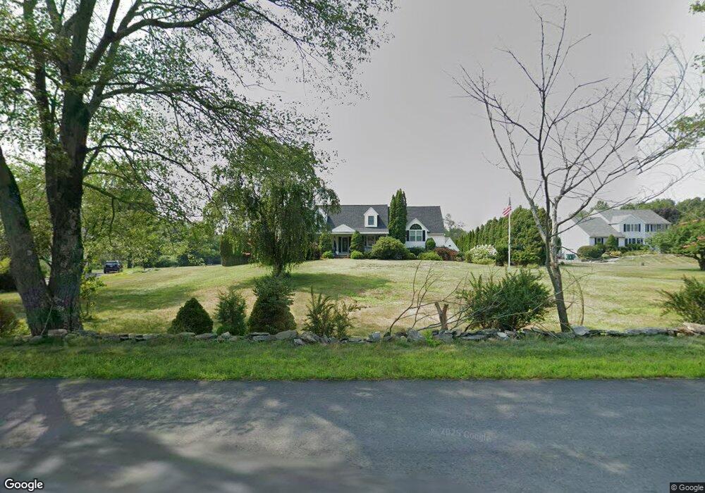
219 Foster St Littleton, MA 01460
Estimated Value: $867,000 - $1,131,000
3
Beds
3
Baths
2,486
Sq Ft
$397/Sq Ft
Est. Value
About This Home
This home is located at 219 Foster St, Littleton, MA 01460 and is currently estimated at $987,409, approximately $397 per square foot. 219 Foster St is a home located in Middlesex County with nearby schools including Shaker Lane Elementary School, Russell Street Elementary School, and Littleton Middle School.
Ownership History
Date
Name
Owned For
Owner Type
Purchase Details
Closed on
Jun 26, 2020
Sold by
Foster Street Rt
Bought by
Tjionas George A and Boumitri Michelle M
Current Estimated Value
Home Financials for this Owner
Home Financials are based on the most recent Mortgage that was taken out on this home.
Original Mortgage
$560,000
Outstanding Balance
$496,571
Interest Rate
3.1%
Mortgage Type
New Conventional
Estimated Equity
$490,838
Purchase Details
Closed on
Jun 12, 2003
Sold by
Dibacco Joseph and Dibacco Rosemarie
Bought by
Dibacco Joseph and Dibacco Rosemarie
Purchase Details
Closed on
Apr 23, 1996
Sold by
Foster Street T and Coughlan Timothy A
Bought by
Dibacco Joseph and Dibacco Rosemarie
Create a Home Valuation Report for This Property
The Home Valuation Report is an in-depth analysis detailing your home's value as well as a comparison with similar homes in the area
Home Values in the Area
Average Home Value in this Area
Purchase History
| Date | Buyer | Sale Price | Title Company |
|---|---|---|---|
| Tjionas George A | $700,000 | None Available | |
| Dibacco Joseph | -- | -- | |
| Dibacco Joseph | $258,000 | -- |
Source: Public Records
Mortgage History
| Date | Status | Borrower | Loan Amount |
|---|---|---|---|
| Open | Tjionas George A | $560,000 |
Source: Public Records
Tax History Compared to Growth
Tax History
| Year | Tax Paid | Tax Assessment Tax Assessment Total Assessment is a certain percentage of the fair market value that is determined by local assessors to be the total taxable value of land and additions on the property. | Land | Improvement |
|---|---|---|---|---|
| 2025 | $129 | $865,300 | $233,200 | $632,100 |
| 2024 | $12,489 | $841,600 | $226,600 | $615,000 |
| 2023 | $12,061 | $742,200 | $231,000 | $511,200 |
| 2022 | $11,565 | $653,000 | $231,000 | $422,000 |
| 2021 | $10,749 | $607,300 | $215,700 | $391,600 |
| 2020 | $10,618 | $597,500 | $211,400 | $386,100 |
| 2019 | $10,470 | $574,000 | $180,300 | $393,700 |
| 2018 | $9,894 | $545,400 | $180,300 | $365,100 |
| 2017 | $9,551 | $526,200 | $180,300 | $345,900 |
| 2016 | $9,209 | $520,600 | $180,300 | $340,300 |
| 2015 | $9,466 | $523,000 | $160,700 | $362,300 |
Source: Public Records
Map
Nearby Homes
- 221 Foster St
- Lot 2 Strawberry Farm
- 18 Pleasant St
- 146 Tahattawan Rd
- 305 Harwood Ave
- 3 Taylor St
- 150 Whitcomb Ave
- 17 Hartwell Ave
- 63 Leonard Rd Unit 63
- 62 Waite Rd
- 336 King St Unit 105
- 8 Edsel Rd
- 34 Baldwin Hill Rd
- 10 Baldwin Hill Rd
- 12 Paula Beth St
- 35 Queen Rd
- 4 Mars Place
- 55 Jennifer St
- 9 (Lt 44) Darrell Dr
- 115 Goldsmith St