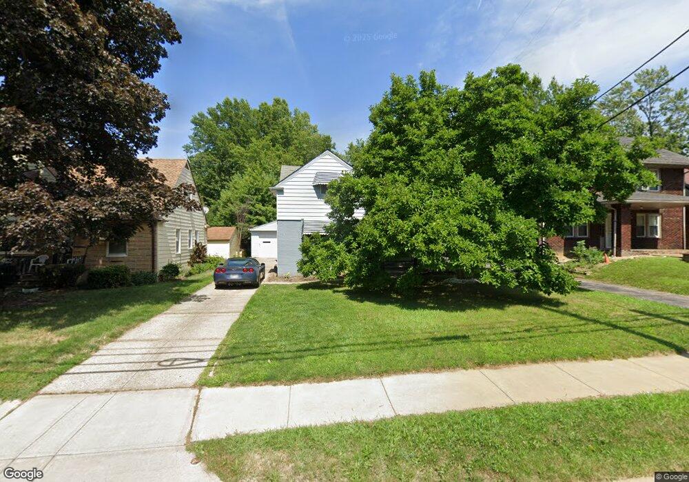
2191 N Taylor Rd Cleveland, OH 44112
Monticello-Noble NeighborhoodEstimated Value: $119,636 - $198,000
3
Beds
1
Bath
1,320
Sq Ft
$114/Sq Ft
Est. Value
About This Home
This home is located at 2191 N Taylor Rd, Cleveland, OH 44112 and is currently estimated at $150,409, approximately $113 per square foot. 2191 N Taylor Rd is a home located in Cuyahoga County with nearby schools including Shaw High School, Apex Academy, and Yeshiva Derech Hatorah.
Ownership History
Date
Name
Owned For
Owner Type
Purchase Details
Closed on
Nov 4, 2017
Sold by
The Cuyahoga County Land Reulitizaton
Bought by
Crenshaw Evangeline
Current Estimated Value
Purchase Details
Closed on
Dec 24, 2015
Sold by
Secretary Of Housing & Urban Development
Bought by
Cuyahoga County Land Reutilization Corpo
Purchase Details
Closed on
Dec 10, 2013
Sold by
U S Bank National Association
Bought by
Secretary Of Housing & Urban Development
Purchase Details
Closed on
Apr 30, 2013
Sold by
Calhoun Lillian
Bought by
U S Bank National Association
Purchase Details
Closed on
Sep 6, 2006
Sold by
Cummings Ralph S and Cummings Phyllis D
Bought by
Calhoun Lillian
Home Financials for this Owner
Home Financials are based on the most recent Mortgage that was taken out on this home.
Original Mortgage
$82,209
Interest Rate
6.59%
Mortgage Type
FHA
Purchase Details
Closed on
Aug 3, 1976
Sold by
Cummings Ralph S and Cummings Sadie
Bought by
Cummings Ralph C
Purchase Details
Closed on
Jan 1, 1975
Bought by
Cummings Ralph S and Cummings Sadie
Create a Home Valuation Report for This Property
The Home Valuation Report is an in-depth analysis detailing your home's value as well as a comparison with similar homes in the area
Home Values in the Area
Average Home Value in this Area
Purchase History
| Date | Buyer | Sale Price | Title Company |
|---|---|---|---|
| Crenshaw Evangeline | -- | None Available | |
| Cuyahoga County Land Reutilization Corpo | -- | Attorney | |
| Secretary Of Housing & Urban Development | -- | Attorney | |
| U S Bank National Association | $12,000 | None Available | |
| Calhoun Lillian | $83,500 | Enterprise Title Agency | |
| Cummings Ralph C | -- | -- | |
| Cummings Ralph S | -- | -- |
Source: Public Records
Mortgage History
| Date | Status | Borrower | Loan Amount |
|---|---|---|---|
| Previous Owner | Calhoun Lillian | $82,209 |
Source: Public Records
Tax History Compared to Growth
Tax History
| Year | Tax Paid | Tax Assessment Tax Assessment Total Assessment is a certain percentage of the fair market value that is determined by local assessors to be the total taxable value of land and additions on the property. | Land | Improvement |
|---|---|---|---|---|
| 2024 | $2,738 | $36,015 | $8,890 | $27,125 |
| 2023 | $2,214 | $20,860 | $4,340 | $16,520 |
| 2022 | $2,204 | $20,860 | $4,340 | $16,520 |
| 2021 | $2,240 | $20,860 | $4,340 | $16,520 |
| 2020 | $2,096 | $18,800 | $3,920 | $14,880 |
| 2019 | $2,292 | $53,700 | $11,200 | $42,500 |
| 2018 | $956 | $18,800 | $3,920 | $14,880 |
| 2017 | $101 | $0 | $0 | $0 |
| 2016 | $2,043 | $21,570 | $5,220 | $16,350 |
| 2015 | $2,253 | $21,570 | $5,220 | $16,350 |
| 2014 | $2,253 | $25,980 | $6,270 | $19,710 |
Source: Public Records
Map
Nearby Homes
- 2195 N Taylor Rd
- 2188 N Taylor Rd
- 16263 Oakhill Rd
- 2256 N Taylor Rd
- 2257 N Taylor Rd
- 2145 N Taylor Rd
- 2137 N Taylor Rd
- 1061 Greyton Rd
- 991 Helmsdale Rd
- 16252 Oakhill Rd
- 1073 Hereford Rd
- 955 Dresden Rd
- 936 Dresden Rd
- 945 Dresden Rd
- 939 Helmsdale Rd
- 931 Helmsdale Rd
- 3411 Hartwood Rd
- 1111 Hereford Rd
- 15908 Hazel Rd
- 965 Whitby Rd
- 2189 N Taylor Rd
- 2193 N Taylor Rd
- 2187 N Taylor Rd
- 1049 Helmsdale Rd
- 1068 Nela View Rd
- 2199 N Taylor Rd
- 2185 N Taylor Rd
- 1045 Helmsdale Rd
- 1066 Nela View Rd
- 2192 N Taylor Rd
- 2196 N Taylor Rd
- 1062 Nela View Rd
- 2184 N Taylor Rd
- 1035 Helmsdale Rd
- 1060 Nela View Rd
- 3739 Northvale Blvd
- 2180 N Taylor Rd
- 1056 Nela View Rd
- 2200 N Taylor Rd
- 1033 Helmsdale Rd