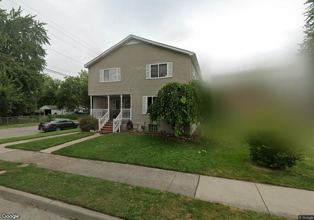
2194 Charter St Lincoln Park, MI 48146
Estimated Value: $204,000 - $337,000
5
Beds
2
Baths
2,400
Sq Ft
$102/Sq Ft
Est. Value
About This Home
This home is located at 2194 Charter St, Lincoln Park, MI 48146 and is currently estimated at $245,383, approximately $102 per square foot. 2194 Charter St is a home located in Wayne County with nearby schools including Lafayette School, Lincoln Park Middle School, and Lincoln Park High School.
Ownership History
Date
Name
Owned For
Owner Type
Purchase Details
Closed on
Mar 4, 2009
Sold by
J M S Associates Llc
Bought by
Pennington Susan J
Current Estimated Value
Purchase Details
Closed on
Apr 14, 2008
Sold by
Parklane Investments Inc
Bought by
J M S Assoc Llc
Purchase Details
Closed on
Nov 24, 2003
Sold by
Walsh Michael R and Walsh Janet S
Bought by
Pennington Susan J
Purchase Details
Closed on
Aug 18, 1994
Sold by
Walsh Michael R
Bought by
Ray E and Pennington Susan J
Create a Home Valuation Report for This Property
The Home Valuation Report is an in-depth analysis detailing your home's value as well as a comparison with similar homes in the area
Home Values in the Area
Average Home Value in this Area
Purchase History
| Date | Buyer | Sale Price | Title Company |
|---|---|---|---|
| Pennington Susan J | -- | None Available | |
| J M S Assoc Llc | -- | None Available | |
| Pennington Susan J | $58,000 | Multiple | |
| Pennington Susan | -- | Multiple | |
| Ray E | $58,000 | -- |
Source: Public Records
Tax History Compared to Growth
Tax History
| Year | Tax Paid | Tax Assessment Tax Assessment Total Assessment is a certain percentage of the fair market value that is determined by local assessors to be the total taxable value of land and additions on the property. | Land | Improvement |
|---|---|---|---|---|
| 2025 | $2,790 | $116,700 | $0 | $0 |
| 2024 | $2,790 | $101,100 | $0 | $0 |
| 2023 | $2,329 | $84,500 | $0 | $0 |
| 2022 | $2,820 | $65,200 | $0 | $0 |
| 2021 | $3,180 | $59,200 | $0 | $0 |
| 2020 | $2,198 | $51,700 | $0 | $0 |
| 2019 | $1,737 | $48,400 | $0 | $0 |
| 2018 | $2,198 | $38,600 | $0 | $0 |
| 2017 | $1,229 | $41,500 | $0 | $0 |
| 2016 | $2,222 | $42,500 | $0 | $0 |
| 2015 | $4,140 | $41,400 | $0 | $0 |
| 2013 | $4,390 | $46,100 | $0 | $0 |
| 2012 | $4,379 | $47,600 | $5,300 | $42,300 |
Source: Public Records
Map
Nearby Homes
- 819 Frank Ave
- 3603 Harlow Ave
- 000 Harlow St
- 4020 Wall Ave
- 2190 Morris Ave
- 2064 Morris Ave
- 1862 Montie Rd
- 19211 Wall St
- 24558 Outer Dr
- 14713 Morris Ave
- 14545 College Ave
- 19120 Dix Rd
- 14633 College Ave
- 2790 Blanche St
- 1840 Morris Ave
- 2105 Paris Ave
- 1826 Morris Ave
- 18949 Wall St
- 2573 Grace St
- 14823 Paris Ct Unit 19
- 2190 Charter St
- 2170 Charter St
- 907 Frank Ave
- 2210 Charter St
- 2160 Charter St
- 2181 Olive Ave
- 2195 Charter St
- 2191 Charter St
- 2205 Olive Ave
- 2171 Olive Ave
- 2181 Charter St
- 2205 Charter St
- 2211 Olive Ave
- 2145 Olive Ave
- 2146 Charter St
- 2161 Charter St
- 2215 Olive Ave
- 2141 Charter St
- 2211 Charter St
- 2136 Charter St