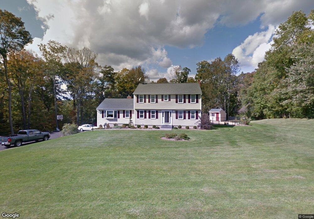
22 Rock Brook Rd Harwinton, CT 06791
Estimated Value: $429,000 - $589,000
3
Beds
3
Baths
2,292
Sq Ft
$218/Sq Ft
Est. Value
About This Home
This home is located at 22 Rock Brook Rd, Harwinton, CT 06791 and is currently estimated at $500,433, approximately $218 per square foot. 22 Rock Brook Rd is a home located in Litchfield County with nearby schools including Harwinton Consolidated School, Har-Bur Middle School, and Lewis S. Mills High School.
Ownership History
Date
Name
Owned For
Owner Type
Purchase Details
Closed on
Oct 19, 2021
Sold by
Vangilst William M
Bought by
Vangilst Ft
Current Estimated Value
Purchase Details
Closed on
Apr 27, 2020
Sold by
William M Vamgilst T
Bought by
Vangilst William M and Vangilst Lisa S
Purchase Details
Closed on
Aug 2, 2016
Sold by
Vangilst William and Vangilst Lisa
Bought by
Vangilst William M
Purchase Details
Closed on
Jun 30, 1995
Sold by
Church Douglas D and Church Noreen R
Bought by
Vangilst William and Vangilst Lisa
Home Financials for this Owner
Home Financials are based on the most recent Mortgage that was taken out on this home.
Original Mortgage
$164,000
Interest Rate
7.8%
Create a Home Valuation Report for This Property
The Home Valuation Report is an in-depth analysis detailing your home's value as well as a comparison with similar homes in the area
Home Values in the Area
Average Home Value in this Area
Purchase History
| Date | Buyer | Sale Price | Title Company |
|---|---|---|---|
| Vangilst Ft | -- | None Available | |
| Vangilst Ft | -- | None Available | |
| Vangilst William M | -- | None Available | |
| Vangilst William M | -- | None Available | |
| Vangilst William M | -- | -- | |
| Vangilst William M | -- | -- | |
| Vangilst William | $205,000 | -- | |
| Vangilst William | $205,000 | -- |
Source: Public Records
Mortgage History
| Date | Status | Borrower | Loan Amount |
|---|---|---|---|
| Previous Owner | Vangilst William | $62,950 | |
| Previous Owner | Vangilst William | $143,000 | |
| Previous Owner | Vangilst William | $164,000 |
Source: Public Records
Tax History Compared to Growth
Tax History
| Year | Tax Paid | Tax Assessment Tax Assessment Total Assessment is a certain percentage of the fair market value that is determined by local assessors to be the total taxable value of land and additions on the property. | Land | Improvement |
|---|---|---|---|---|
| 2025 | $6,557 | $285,070 | $71,540 | $213,530 |
| 2024 | $6,528 | $285,070 | $71,540 | $213,530 |
| 2023 | $5,801 | $198,660 | $51,100 | $147,560 |
| 2022 | $5,662 | $198,660 | $51,100 | $147,560 |
| 2021 | $5,702 | $198,660 | $51,100 | $147,560 |
| 2020 | $5,563 | $198,670 | $51,100 | $147,570 |
| 2019 | $5,563 | $198,670 | $51,100 | $147,570 |
| 2018 | $5,954 | $212,660 | $65,980 | $146,680 |
| 2017 | $5,912 | $212,660 | $65,980 | $146,680 |
| 2016 | $5,912 | $212,660 | $65,980 | $146,680 |
| 2015 | $5,806 | $212,660 | $65,980 | $146,680 |
| 2014 | $5,721 | $212,660 | $65,980 | $146,680 |
Source: Public Records
Map
Nearby Homes
- 83 Shingle Mill Rd
- 25 Plymouth Rd
- 28 Lily Pond Rd
- 12 Break Maiden Ln
- 21 South Rd
- 9 Steeple Chase Rd
- 67 Warren Glen
- 66 Warren Glen
- 530 Wildcat Hill Rd
- 183 Wildcat Hill Rd
- 164 Birge Park Rd
- 2 Warren Glen
- 760 Plymouth Rd
- 604 Wildcat Hill Rd
- 0 Campville Hill Rd
- 74 Pine Ridge Dr
- 39 Orchard Hill Rd
- 448 Litchfield Rd
- 75 Saw Mill Rd
- Lot 2 Birch Hill Rd
- 21 Rock Brook Rd
- 12 Rock Brook Rd
- 27 Rock Brook Rd
- 36 Rock Brook Rd
- 179 Plymouth Rd
- 2 Rock Brook Rd
- 185 Plymouth Rd
- 48 Rock Brook Rd
- 37 Rock Brook Rd
- 153 Plymouth Rd
- 157 Plymouth Rd
- 45 Rock Brook Rd
- 160 Plymouth Rd
- 147 Plymouth Rd
- 104 Wake Robin Ln
- 133 Plymouth Rd
- 99 Wake Robin Ln
- 92 Wake Robin Ln
- 111 Shingle Mill Rd
- 103 Shingle Mill Rd