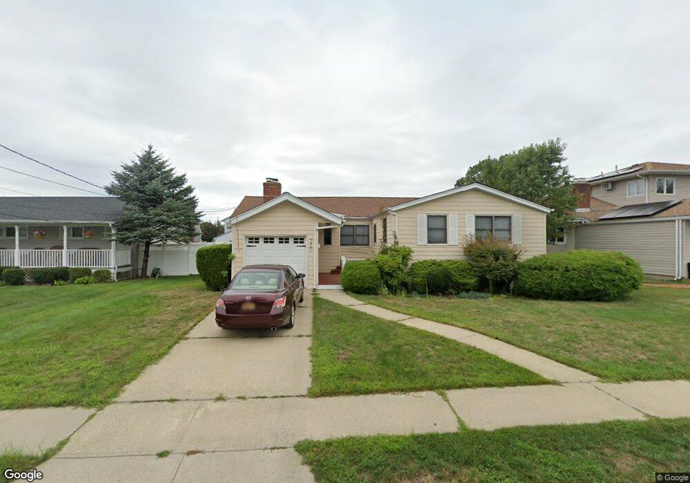
220 1st Ave Massapequa Park, NY 11762
Estimated Value: $808,000 - $822,879
4
Beds
2
Baths
1,429
Sq Ft
$571/Sq Ft
Est. Value
About This Home
This home is located at 220 1st Ave, Massapequa Park, NY 11762 and is currently estimated at $815,440, approximately $570 per square foot. 220 1st Ave is a home located in Nassau County with nearby schools including Massapequa High School - Ames Campus, Berner Middle School, and Massapequa High School.
Ownership History
Date
Name
Owned For
Owner Type
Purchase Details
Closed on
Feb 11, 2025
Sold by
Rodier Deborah M and Rodier Edward
Bought by
Dipalo Robert J
Current Estimated Value
Home Financials for this Owner
Home Financials are based on the most recent Mortgage that was taken out on this home.
Original Mortgage
$405,000
Outstanding Balance
$402,242
Interest Rate
6.91%
Mortgage Type
New Conventional
Estimated Equity
$413,198
Purchase Details
Closed on
Jul 13, 2001
Create a Home Valuation Report for This Property
The Home Valuation Report is an in-depth analysis detailing your home's value as well as a comparison with similar homes in the area
Home Values in the Area
Average Home Value in this Area
Purchase History
| Date | Buyer | Sale Price | Title Company |
|---|---|---|---|
| Dipalo Robert J | $810,000 | Chicago Title Insurance Co | |
| Dipalo Robert J | $810,000 | Chicago Title Insurance Co | |
| Dipalo Robert J | $810,000 | Chicago Title Insurance Co | |
| Dipalo Robert J | $810,000 | Chicago Title Insurance Co | |
| -- | -- | -- | |
| -- | -- | -- |
Source: Public Records
Mortgage History
| Date | Status | Borrower | Loan Amount |
|---|---|---|---|
| Open | Dipalo Robert J | $405,000 | |
| Closed | Dipalo Robert J | $405,000 |
Source: Public Records
Tax History Compared to Growth
Tax History
| Year | Tax Paid | Tax Assessment Tax Assessment Total Assessment is a certain percentage of the fair market value that is determined by local assessors to be the total taxable value of land and additions on the property. | Land | Improvement |
|---|---|---|---|---|
| 2025 | $11,495 | $465 | $194 | $271 |
| 2024 | $3,385 | $468 | $195 | $273 |
| 2023 | $12,407 | $486 | $203 | $283 |
| 2022 | $12,407 | $486 | $203 | $283 |
| 2021 | $13,019 | $469 | $196 | $273 |
| 2020 | $13,889 | $952 | $672 | $280 |
| 2019 | $14,492 | $952 | $672 | $280 |
| 2018 | $13,302 | $952 | $0 | $0 |
| 2017 | $8,023 | $952 | $672 | $280 |
| 2016 | $11,660 | $952 | $672 | $280 |
| 2015 | $3,214 | $952 | $672 | $280 |
| 2014 | $3,214 | $952 | $672 | $280 |
| 2013 | $3,007 | $952 | $672 | $280 |
Source: Public Records
Map
Nearby Homes
- 204 Broadway
- 251 Roosevelt Ave
- 118 Broadway
- 170 Lindbergh St
- 168 von Huenfeld St
- 229 Philadelphia Ave
- 94 Charles Ave
- 97 Pacific St
- 312 Ocean Ave
- 89 3rd Ave
- 201 Cypress St
- 117 Ocean Ave
- 208 Oak St
- 366 Broadway
- 1130 Lakeshore Dr
- 384 Connecticut Ave
- 179 Park Ln
- 72 Koehl St
- 332 Eastlake Ave
- 136 Fulton St