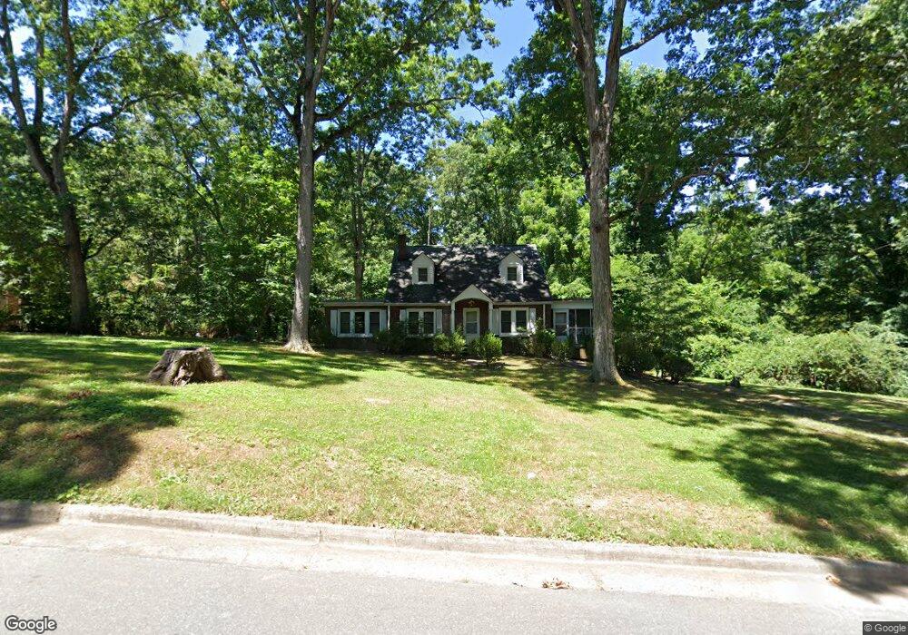
220 Spring Garden St Asheboro, NC 27203
Estimated Value: $231,000 - $270,000
--
Bed
2
Baths
1,938
Sq Ft
$129/Sq Ft
Est. Value
About This Home
This home is located at 220 Spring Garden St, Asheboro, NC 27203 and is currently estimated at $249,532, approximately $128 per square foot. 220 Spring Garden St is a home located in Randolph County with nearby schools including Donna L. Loflin Elementary School, South Asheboro Middle School, and Asheboro High School.
Ownership History
Date
Name
Owned For
Owner Type
Purchase Details
Closed on
Jan 25, 2006
Sold by
Walker Michael L and Estate Of Georgia Lorene Walke
Bought by
Walker Chad David and Walker Richard C
Current Estimated Value
Home Financials for this Owner
Home Financials are based on the most recent Mortgage that was taken out on this home.
Original Mortgage
$125,000
Interest Rate
6.21%
Mortgage Type
New Conventional
Create a Home Valuation Report for This Property
The Home Valuation Report is an in-depth analysis detailing your home's value as well as a comparison with similar homes in the area
Home Values in the Area
Average Home Value in this Area
Purchase History
| Date | Buyer | Sale Price | Title Company |
|---|---|---|---|
| Walker Chad David | $110,000 | None Available |
Source: Public Records
Mortgage History
| Date | Status | Borrower | Loan Amount |
|---|---|---|---|
| Closed | Walker Chad David | $125,000 |
Source: Public Records
Tax History Compared to Growth
Tax History
| Year | Tax Paid | Tax Assessment Tax Assessment Total Assessment is a certain percentage of the fair market value that is determined by local assessors to be the total taxable value of land and additions on the property. | Land | Improvement |
|---|---|---|---|---|
| 2025 | $2,598 | $196,030 | $24,410 | $171,620 |
| 2024 | $2,598 | $196,030 | $24,410 | $171,620 |
| 2023 | $2,598 | $196,030 | $24,410 | $171,620 |
| 2022 | $1,981 | $137,440 | $16,910 | $120,530 |
| 2021 | $1,981 | $137,440 | $16,910 | $120,530 |
| 2020 | $1,938 | $134,440 | $16,910 | $117,530 |
| 2019 | $1,938 | $134,440 | $16,910 | $117,530 |
| 2018 | $1,825 | $124,330 | $16,910 | $107,420 |
| 2016 | $1,824 | $124,327 | $16,910 | $107,417 |
| 2015 | $1,828 | $124,327 | $16,910 | $107,417 |
| 2014 | -- | $124,327 | $16,910 | $107,417 |
Source: Public Records
Map
Nearby Homes
- 135 West St
- 830 Sunset Ave
- 401 Uwharrie St
- 711 Sunset Ave Unit E
- 617 Uwharrie St Unit N
- 1263 Winslow Ave Unit A, B & C
- 631 W Kivett St
- 612 Sunset Ave Unit 6
- 135 Dixon St
- 806 Windermere Ct
- 923 Arnold St
- 627 Lee St
- 828 Windermere Ct
- 855 Lee St
- 737 Britt Ave
- 435 Peachtree St
- 516 and 518 Peachtree St
- 960 Lee St
- 1037 Robbins St
- 211 Armfield Ave
- 226 Spring Garden St
- 206 Spring Garden St
- 232 Spring Garden St
- 211 Spring Garden St
- 225 Spring Garden St
- 139 Farmer Rd
- 200 Spring Garden St
- 229 Spring Garden St
- 207 Spring Garden St
- 147 Farmer Rd
- 133 Farmer Rd
- 201 Spring Garden St
- 151 Farmer Rd
- 914 Ashdol St
- 143 Spring Garden St
- 240 Spring Garden St
- 921 Ashdol St
- 132 Spring Garden St
- 137 Spring Garden St
- 309 Farmer Rd