Estimated Value: $609,000 - $643,266
3
Beds
3
Baths
2,268
Sq Ft
$278/Sq Ft
Est. Value
About This Home
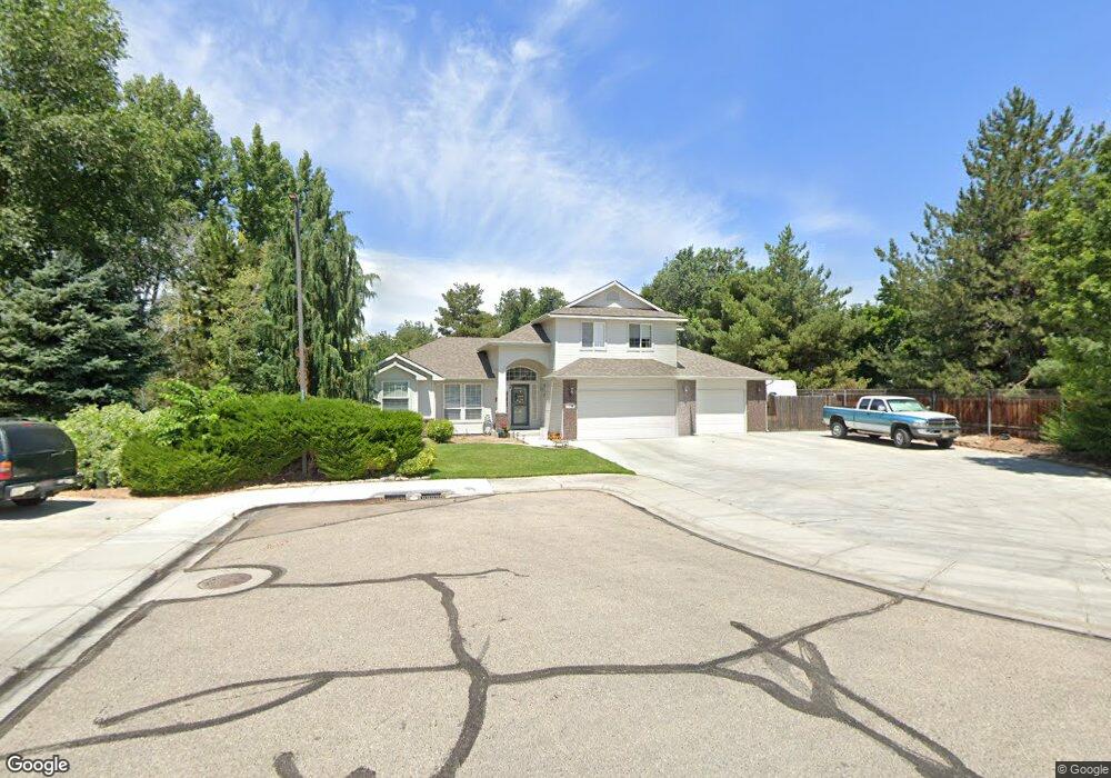
This home is located at 2200 E El Jay Ct, Nampa, ID 83686 and is currently estimated at $630,567, approximately $278 per square foot. 2200 E El Jay Ct is a home located in Canyon County with nearby schools including Greenhurst Elementary School, South Middle School, and Skyview High School.
Ownership History
Date
Name
Owned For
Owner Type
Purchase Details
Closed on
Dec 18, 2021
Sold by
Wright Bruce T and Wright Cheryl A
Bought by
Noah Lynda and Noah Mark
Current Estimated Value
Home Financials for this Owner
Home Financials are based on the most recent Mortgage that was taken out on this home.
Original Mortgage
$271,800
Outstanding Balance
$249,023
Interest Rate
2.98%
Mortgage Type
New Conventional
Estimated Equity
$381,544
Create a Home Valuation Report for This Property
The Home Valuation Report is an in-depth analysis detailing your home's value as well as a comparison with similar homes in the area
Home Values in the Area
Average Home Value in this Area
Purchase History
| Date | Buyer | Sale Price | Title Company |
|---|---|---|---|
| Noah Lynda | -- | Titleone Boise |
Source: Public Records
Mortgage History
| Date | Status | Borrower | Loan Amount |
|---|---|---|---|
| Open | Noah Lynda | $271,800 |
Source: Public Records
Tax History Compared to Growth
Tax History
| Year | Tax Paid | Tax Assessment Tax Assessment Total Assessment is a certain percentage of the fair market value that is determined by local assessors to be the total taxable value of land and additions on the property. | Land | Improvement |
|---|---|---|---|---|
| 2025 | $2,615 | $558,800 | $164,400 | $394,400 |
| 2024 | $2,615 | $547,300 | $155,000 | $392,300 |
| 2023 | $2,561 | $556,000 | $155,000 | $401,000 |
| 2022 | $4,397 | $595,700 | $180,800 | $414,900 |
| 2021 | $3,744 | $442,800 | $94,500 | $348,300 |
| 2020 | $3,524 | $372,100 | $68,500 | $303,600 |
| 2019 | $3,968 | $347,300 | $68,500 | $278,800 |
| 2018 | $3,268 | $0 | $0 | $0 |
| 2017 | $2,499 | $0 | $0 | $0 |
| 2016 | $2,333 | $0 | $0 | $0 |
| 2015 | $2,373 | $0 | $0 | $0 |
| 2014 | $2,455 | $209,900 | $32,500 | $177,400 |
Source: Public Records
Map
Nearby Homes
- 2622 Boulder Ave
- 2019 Kentucky Dr
- 1835 E Kentucky Ave
- 2714 S Almond Ct
- 1921 E Explorer Ct
- 946 S Almond Ct
- 945 S Almond Ct
- 1612 E York Ave
- 3601 S Angel Falls Way
- 2040 W Ibis Dr
- 3630 S Angel Falls Way
- 7232 E Merlin Hawk Ct
- 11623 W Black Dog Dr
- 1426 Chicago St
- 2020 E Lost River Ave
- 1801 E Iowa Ave
- 2912 E Iowa Ave
- 2121 Lambert Dr
- 2441 S Bluegrass Dr
- 2225 Lexi's Ln
- 2200 E El Jay C
- 2205 E El Jay Ct
- 2209 E El Jay Ct
- 2115 E Greenhurst Rd
- 2208 E El Jay Ct
- 2207 E Greenhurst Rd
- 2425 Aaron Dr
- 2213 E El Jay Ct
- 2411 Aaron Dr
- 2419 Aaron Dr
- 2405 Aaron Dr
- 2217 E El Jay Ct
- 2120 Ranch Rd
- 2327 S Chicago St
- 2327 Aaron Dr
- 2319 S Chicago St
- 2323 S Chicago St
- 0 Chicago St
- 2317 S Chicago St
- 2413 S Chicago St