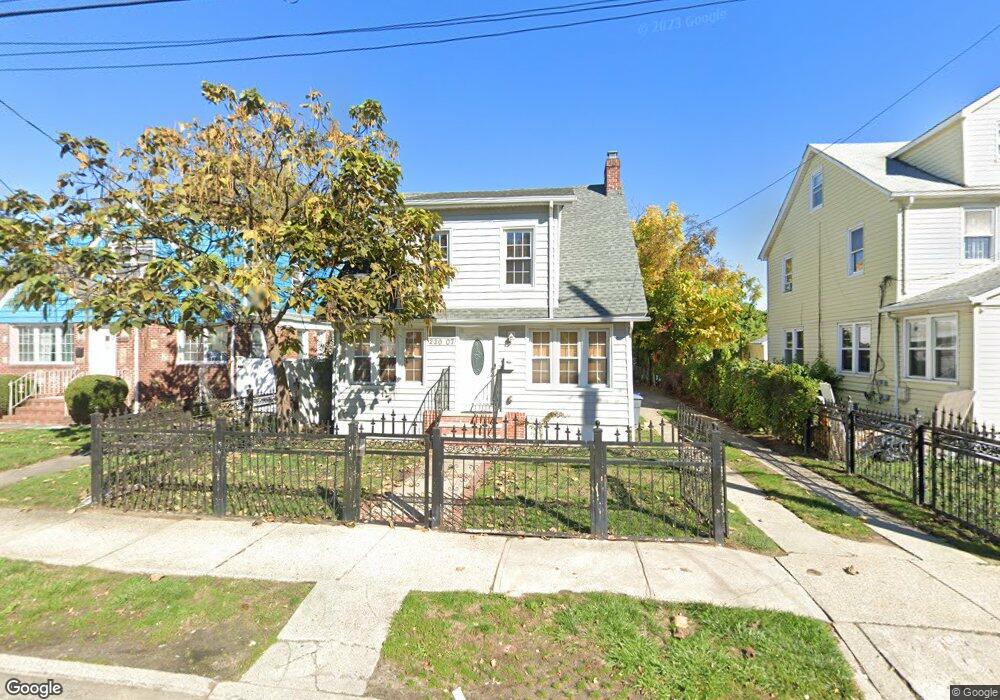
22007 133rd Ave Laurelton, NY 11413
Laurelton NeighborhoodEstimated Value: $610,000 - $701,000
4
Beds
1
Bath
1,248
Sq Ft
$522/Sq Ft
Est. Value
About This Home
This home is located at 22007 133rd Ave, Laurelton, NY 11413 and is currently estimated at $651,653, approximately $522 per square foot. 22007 133rd Ave is a home located in Queens County with nearby schools including P.S. 132 - Ralph Bunche, Is 59 Springfield Gardens, and Success Academy Springfield Gardens.
Ownership History
Date
Name
Owned For
Owner Type
Purchase Details
Closed on
Nov 19, 2018
Sold by
45 Commander Ave Corp
Bought by
Singleton Gloria
Current Estimated Value
Home Financials for this Owner
Home Financials are based on the most recent Mortgage that was taken out on this home.
Original Mortgage
$444,000
Outstanding Balance
$391,198
Interest Rate
4.9%
Mortgage Type
New Conventional
Estimated Equity
$260,455
Purchase Details
Closed on
Dec 14, 2017
Sold by
John R Dietz Esq As Referee
Bought by
45 Commander Ave Corp
Purchase Details
Closed on
Jan 19, 1995
Sold by
Edouard Carolle and Desir Roger
Bought by
Edouard Carolle and Desir Roger
Create a Home Valuation Report for This Property
The Home Valuation Report is an in-depth analysis detailing your home's value as well as a comparison with similar homes in the area
Home Values in the Area
Average Home Value in this Area
Purchase History
| Date | Buyer | Sale Price | Title Company |
|---|---|---|---|
| Singleton Gloria | $555,000 | -- | |
| Singleton Gloria | $555,000 | -- | |
| 45 Commander Ave Corp | $325,000 | -- | |
| 45 Commander Ave Corp | $325,000 | -- | |
| Edouard Carolle | -- | -- | |
| Edouard Carolle | -- | -- |
Source: Public Records
Mortgage History
| Date | Status | Borrower | Loan Amount |
|---|---|---|---|
| Open | Singleton Gloria | $444,000 | |
| Closed | Singleton Gloria | $444,000 |
Source: Public Records
Tax History Compared to Growth
Tax History
| Year | Tax Paid | Tax Assessment Tax Assessment Total Assessment is a certain percentage of the fair market value that is determined by local assessors to be the total taxable value of land and additions on the property. | Land | Improvement |
|---|---|---|---|---|
| 2025 | $5,785 | $29,860 | $8,981 | $20,879 |
| 2024 | $5,785 | $28,805 | $9,161 | $19,644 |
| 2023 | $5,636 | $28,060 | $9,321 | $18,739 |
| 2022 | $5,285 | $34,860 | $11,640 | $23,220 |
| 2021 | $5,353 | $33,000 | $11,640 | $21,360 |
| 2020 | $5,267 | $32,400 | $11,640 | $20,760 |
| 2019 | $5,021 | $31,680 | $11,640 | $20,040 |
| 2018 | $4,767 | $23,383 | $8,860 | $14,523 |
| 2017 | $4,497 | $22,062 | $8,699 | $13,363 |
| 2016 | $4,238 | $22,062 | $8,699 | $13,363 |
| 2015 | $2,290 | $20,736 | $10,065 | $10,671 |
| 2014 | $2,290 | $20,004 | $11,646 | $8,358 |
Source: Public Records
Map
Nearby Homes
- 133-15 220th St
- 218-36 133rd Rd
- 134-15 221st St
- 220-24 134th Rd
- 131-35 222nd St
- 22126 134th Rd
- 21608 Merrick Blvd
- 223-12 134th Rd
- 13512 223rd St
- 22111 136th Ave
- 133-23 225th St
- 22310 131st Ave
- 131-20 224th St
- 136-3 220th St
- 21924 130th Dr
- 130-45 220th St
- 133-22 226th St
- 21611 135th Ave
- 136-18 221st St
- 13538 223rd St
- 22007 133rd Ave
- 22003 133rd Ave
- 22011 133rd Ave
- 220-07 133rd Ave
- 22006 133rd Ave
- 220-03 133rd Ave
- 13178 221st St
- 13245 220th St
- 22008 133rd Ave
- 22006 133rd Ave
- 13170 221st St
- 22008 133rd Ave
- 220-02 133rd Ave
- 131-70 221st St
- 22002 133rd Ave
- 22014 133rd Ave
- 13241 220th St
- 13166 221st St
- 22018 133rd Ave
- 13256 220th St