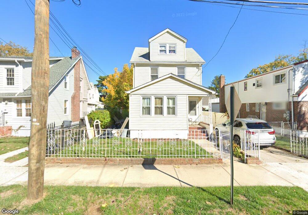
22011 133rd Ave Springfield Gardens, NY 11413
Laurelton NeighborhoodEstimated Value: $671,147 - $813,000
--
Bed
--
Bath
1,700
Sq Ft
$428/Sq Ft
Est. Value
About This Home
This home is located at 22011 133rd Ave, Springfield Gardens, NY 11413 and is currently estimated at $727,287, approximately $427 per square foot. 22011 133rd Ave is a home located in Queens County with nearby schools including P.S. 132 - Ralph Bunche, Is 59 Springfield Gardens, and Success Academy Springfield Gardens.
Ownership History
Date
Name
Owned For
Owner Type
Purchase Details
Closed on
Jun 26, 2019
Sold by
Freeman Patricia S
Bought by
Barnaby Mabel
Current Estimated Value
Purchase Details
Closed on
Aug 3, 1998
Sold by
Goodman Carlos
Bought by
Freeman Patricia S
Home Financials for this Owner
Home Financials are based on the most recent Mortgage that was taken out on this home.
Original Mortgage
$150,100
Interest Rate
6.74%
Purchase Details
Closed on
Oct 17, 1994
Sold by
Campbell Marjorie E
Bought by
Goodman Carlos
Home Financials for this Owner
Home Financials are based on the most recent Mortgage that was taken out on this home.
Original Mortgage
$132,750
Interest Rate
8.71%
Create a Home Valuation Report for This Property
The Home Valuation Report is an in-depth analysis detailing your home's value as well as a comparison with similar homes in the area
Home Values in the Area
Average Home Value in this Area
Purchase History
| Date | Buyer | Sale Price | Title Company |
|---|---|---|---|
| Barnaby Mabel | -- | -- | |
| Freeman Patricia S | $158,000 | Trw Title Insurance | |
| Goodman Carlos | -- | Ticor Title Guarantee Compan |
Source: Public Records
Mortgage History
| Date | Status | Borrower | Loan Amount |
|---|---|---|---|
| Previous Owner | Freeman Patricia S | $150,100 | |
| Previous Owner | Goodman Carlos | $132,750 |
Source: Public Records
Tax History Compared to Growth
Tax History
| Year | Tax Paid | Tax Assessment Tax Assessment Total Assessment is a certain percentage of the fair market value that is determined by local assessors to be the total taxable value of land and additions on the property. | Land | Improvement |
|---|---|---|---|---|
| 2025 | $6,117 | $30,743 | $8,608 | $22,135 |
| 2024 | $6,117 | $30,455 | $8,666 | $21,789 |
| 2023 | $5,835 | $28,732 | $8,926 | $19,806 |
| 2022 | $5,414 | $37,320 | $12,600 | $24,720 |
| 2021 | $5,392 | $33,060 | $12,600 | $20,460 |
| 2020 | $5,423 | $32,280 | $12,600 | $19,680 |
| 2019 | $5,309 | $32,220 | $12,600 | $19,620 |
| 2018 | $4,881 | $23,943 | $8,947 | $14,996 |
| 2017 | $4,607 | $22,602 | $8,855 | $13,747 |
| 2016 | $4,268 | $22,602 | $8,855 | $13,747 |
| 2015 | $2,352 | $21,349 | $10,428 | $10,921 |
| 2014 | $2,352 | $21,150 | $11,990 | $9,160 |
Source: Public Records
Map
Nearby Homes
- 133-15 220th St
- 218-36 133rd Rd
- 134-15 221st St
- 220-24 134th Rd
- 131-35 222nd St
- 22126 134th Rd
- 21608 Merrick Blvd
- 223-12 134th Rd
- 13512 223rd St
- 22111 136th Ave
- 133-23 225th St
- 22310 131st Ave
- 131-20 224th St
- 136-3 220th St
- 21924 130th Dr
- 130-45 220th St
- 133-22 226th St
- 21611 135th Ave
- 136-18 221st St
- 13538 223rd St
- 22007 133rd Ave
- 13178 221st St
- 22007 133rd Ave
- 13170 221st St
- 131-70 221st St
- 22003 133rd Ave
- 13245 220th St
- 13166 221st St
- 13241 220th St
- 22006 133rd Ave
- 220-07 133rd Ave
- 22008 133rd Ave
- 220-03 133rd Ave
- 13162 221st St
- 131-75 221st St
- 13175 221st St
- 22014 133rd Ave
- 22008 133rd Ave
- 22006 133rd Ave
- 22018 133rd Ave