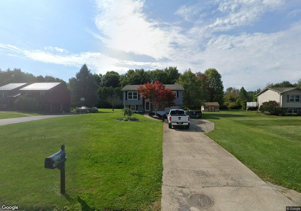
22023 Crimson Dr Meadville, PA 16335
Estimated Value: $120,000 - $163,000
3
Beds
1
Bath
1,152
Sq Ft
$122/Sq Ft
Est. Value
About This Home
This home is located at 22023 Crimson Dr, Meadville, PA 16335 and is currently estimated at $140,432, approximately $121 per square foot. 22023 Crimson Dr is a home located in Crawford County with nearby schools including Neason Hill Elementary School, Meadville Middle School, and Meadville Area Senior High School.
Ownership History
Date
Name
Owned For
Owner Type
Purchase Details
Closed on
Mar 4, 2020
Sold by
Pnc Bank National Association
Bought by
Ream Robert L and Ream Amanda M
Current Estimated Value
Home Financials for this Owner
Home Financials are based on the most recent Mortgage that was taken out on this home.
Original Mortgage
$67,687
Interest Rate
3.3%
Mortgage Type
New Conventional
Purchase Details
Closed on
Oct 30, 2019
Sold by
Warham Melinda A and Magee Daniel T
Bought by
Pnc Bank National Association
Create a Home Valuation Report for This Property
The Home Valuation Report is an in-depth analysis detailing your home's value as well as a comparison with similar homes in the area
Home Values in the Area
Average Home Value in this Area
Purchase History
| Date | Buyer | Sale Price | Title Company |
|---|---|---|---|
| Ream Robert L | $71,250 | National Link Reo | |
| Pnc Bank National Association | $19,600 | None Available |
Source: Public Records
Mortgage History
| Date | Status | Borrower | Loan Amount |
|---|---|---|---|
| Previous Owner | Ream Robert L | $67,687 |
Source: Public Records
Tax History Compared to Growth
Tax History
| Year | Tax Paid | Tax Assessment Tax Assessment Total Assessment is a certain percentage of the fair market value that is determined by local assessors to be the total taxable value of land and additions on the property. | Land | Improvement |
|---|---|---|---|---|
| 2025 | $942 | $34,750 | $3,700 | $31,050 |
| 2024 | $1,359 | $34,750 | $3,700 | $31,050 |
| 2023 | $1,393 | $34,750 | $3,700 | $31,050 |
| 2022 | $2,800 | $34,750 | $3,700 | $31,050 |
| 2021 | $2,735 | $34,750 | $3,700 | $31,050 |
| 2020 | $2,735 | $34,750 | $3,700 | $31,050 |
| 2019 | $2,735 | $34,750 | $3,700 | $31,050 |
| 2018 | $2,605 | $34,750 | $3,700 | $31,050 |
| 2017 | $2,577 | $34,750 | $3,700 | $31,050 |
| 2016 | $803 | $34,750 | $3,700 | $31,050 |
| 2015 | $803 | $34,750 | $3,700 | $31,050 |
| 2014 | -- | $34,750 | $3,700 | $31,050 |
Source: Public Records
Map
Nearby Homes
- 21757 Star Route
- 21427 Phelps Rd
- 12336 Leslie Rd
- 20899 Star Route
- 20231 Homecroft Rd
- 826 Irvin Ave
- 12988 Raymond Dr
- 10845 Graff St
- 24155 State Route 27
- 970 S Morgan St
- 802 Brawley Ave
- 703-705 Chestnut St
- 908 Fairview Ave
- 685 Chestnut St
- 673 Washington St
- 626 Walnut St
- 20865 Blooming Valley Rd
- 3214-024 Blooming Valley Rd
- 3210-72-6 Blooming Valley Rd
- 3210-072-6 Blooming Valley Rd
- 22041 Crimson Dr
- 22003 Crimson Dr
- 22055 Crimson Dr
- 22028 Crimson Dr
- 22012 Crimson Dr
- 21998 Crimson Dr
- 22071 Crimson Dr
- 22058 Crimson Dr
- 21978 Crimson Dr
- 21957 Crimson Dr
- 22074 Crimson Dr
- 21964 Crimson Dr
- 22027 Russet Dr
- 22011 Russet Dr
- 21939 Crimson Dr
- 22043 Russet Dr
- 21997 Russet Dr
- 22057 Russet Dr
- 21983 Russet Dr
- 22075 Russet Dr