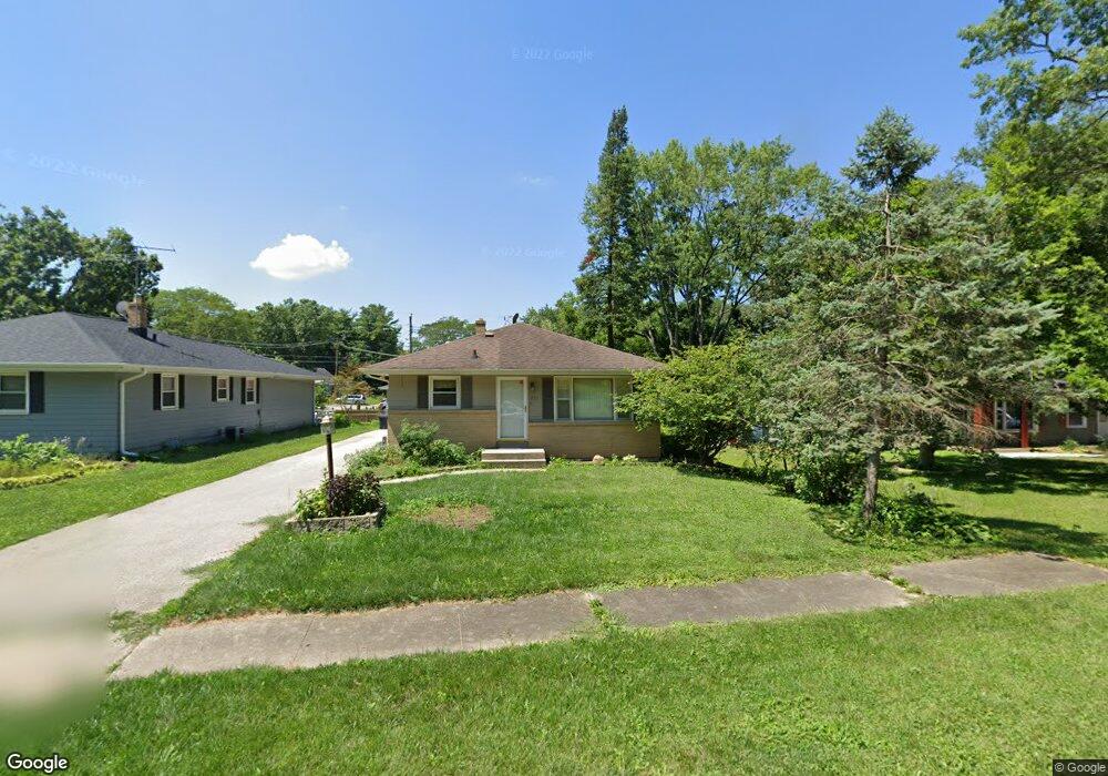
221 Morningside Dr Rockford, IL 61108
Estimated Value: $151,067 - $183,000
2
Beds
2
Baths
1,064
Sq Ft
$154/Sq Ft
Est. Value
About This Home
This home is located at 221 Morningside Dr, Rockford, IL 61108 and is currently estimated at $164,267, approximately $154 per square foot. 221 Morningside Dr is a home located in Winnebago County with nearby schools including Maud E. Johnson Elementary School, Abraham Lincoln Middle School, and Rockford East High School.
Ownership History
Date
Name
Owned For
Owner Type
Purchase Details
Closed on
Jul 19, 2021
Sold by
Salisbury Trust
Bought by
Fc Apartments Llc
Current Estimated Value
Home Financials for this Owner
Home Financials are based on the most recent Mortgage that was taken out on this home.
Original Mortgage
$6,620,000
Outstanding Balance
$5,817,353
Interest Rate
2.9%
Mortgage Type
New Conventional
Estimated Equity
-$5,653,086
Create a Home Valuation Report for This Property
The Home Valuation Report is an in-depth analysis detailing your home's value as well as a comparison with similar homes in the area
Home Values in the Area
Average Home Value in this Area
Purchase History
| Date | Buyer | Sale Price | Title Company |
|---|---|---|---|
| Fc Apartments Llc | $8,279,000 | Barrick Switzer Long Balsley & |
Source: Public Records
Mortgage History
| Date | Status | Borrower | Loan Amount |
|---|---|---|---|
| Open | Fc Apartments Llc | $6,620,000 |
Source: Public Records
Tax History Compared to Growth
Tax History
| Year | Tax Paid | Tax Assessment Tax Assessment Total Assessment is a certain percentage of the fair market value that is determined by local assessors to be the total taxable value of land and additions on the property. | Land | Improvement |
|---|---|---|---|---|
| 2024 | $2,945 | $37,076 | $4,327 | $32,749 |
| 2023 | $3,395 | $32,692 | $3,815 | $28,877 |
| 2022 | $2,653 | $29,221 | $3,410 | $25,811 |
| 2021 | $3,284 | $26,794 | $3,127 | $23,667 |
| 2020 | $2,286 | $23,778 | $2,956 | $20,822 |
| 2019 | $2,232 | $22,663 | $2,817 | $19,846 |
| 2018 | $2,171 | $21,358 | $2,655 | $18,703 |
| 2017 | $2,142 | $20,440 | $2,541 | $17,899 |
| 2016 | $2,123 | $20,057 | $2,493 | $17,564 |
| 2015 | $2,150 | $20,057 | $2,493 | $17,564 |
| 2014 | $2,428 | $23,187 | $3,120 | $20,067 |
Source: Public Records
Map
Nearby Homes
- 3419 Oak Grove Ave
- 3615 Marieme Dr
- 3715 Marieme Dr
- 106 Oriole Cir
- 407 28th St
- 3121 Crosby St
- 320 Vale Ave S
- 3619 Crosby St
- 414 Hilton Ave
- 336 Kenilworth Dr
- 2737 Broadmoor Dr
- 233 N Calvin Park Blvd
- 4016 Dempster Ave
- 404 Vale Ave
- 4121 Crosby St
- 1112 Blenheim Dr
- 215 Robert Ave
- 3903 Charles St
- 430 Hollister Ave
- 3016 12th Ave
- 3520 Shirley Rd
- 215 Morningside Dr
- 212 Fairview Ave
- 208 Fairview Ave
- 3509 Oak Grove Ave
- 3517 Shirley Rd
- 204 Fairview Ave
- 3600 Shirley Rd
- 216 Morningside Dr
- 3501 Shirley Rd
- 307 Morningside Dr
- 202 Fairview Ave
- 3607 Marieme Dr
- 3607 Oak Grove Ave
- 311 Morningside Dr
- 3616 Marieme Dr
- 306 Fairview Ave
- 3426 Shirley Rd
- 209 Fairview Ave
- 3611 Marieme Dr