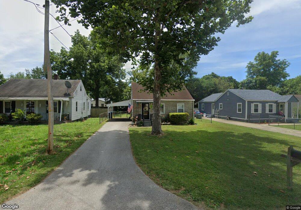
2210 Thomas Ave Louisville, KY 40216
Pleasure Ridge Park NeighborhoodEstimated Value: $147,042 - $160,000
2
Beds
1
Bath
864
Sq Ft
$178/Sq Ft
Est. Value
About This Home
This home is located at 2210 Thomas Ave, Louisville, KY 40216 and is currently estimated at $153,511, approximately $177 per square foot. 2210 Thomas Ave is a home located in Jefferson County with nearby schools including Trunnell Elementary School, Stonestreet Elementary School, and Crums Lane Elementary School.
Ownership History
Date
Name
Owned For
Owner Type
Purchase Details
Closed on
Jan 31, 2011
Sold by
Brennan Lela E and Brennan Charles
Bought by
Miller Jeremy J and Easton Sarah
Current Estimated Value
Home Financials for this Owner
Home Financials are based on the most recent Mortgage that was taken out on this home.
Original Mortgage
$28,000
Outstanding Balance
$19,169
Interest Rate
4.79%
Mortgage Type
New Conventional
Estimated Equity
$134,342
Create a Home Valuation Report for This Property
The Home Valuation Report is an in-depth analysis detailing your home's value as well as a comparison with similar homes in the area
Home Values in the Area
Average Home Value in this Area
Purchase History
| Date | Buyer | Sale Price | Title Company |
|---|---|---|---|
| Miller Jeremy J | $35,000 | None Available |
Source: Public Records
Mortgage History
| Date | Status | Borrower | Loan Amount |
|---|---|---|---|
| Open | Miller Jeremy J | $28,000 |
Source: Public Records
Tax History Compared to Growth
Tax History
| Year | Tax Paid | Tax Assessment Tax Assessment Total Assessment is a certain percentage of the fair market value that is determined by local assessors to be the total taxable value of land and additions on the property. | Land | Improvement |
|---|---|---|---|---|
| 2024 | $983 | $84,410 | $15,000 | $69,410 |
| 2023 | $1,011 | $84,410 | $15,000 | $69,410 |
| 2022 | $820 | $68,250 | $15,000 | $53,250 |
| 2021 | $884 | $68,250 | $15,000 | $53,250 |
| 2020 | $790 | $68,250 | $15,000 | $53,250 |
| 2019 | $774 | $68,250 | $15,000 | $53,250 |
| 2018 | $704 | $62,810 | $15,000 | $47,810 |
| 2017 | $659 | $62,810 | $15,000 | $47,810 |
| 2013 | $628 | $62,810 | $15,000 | $47,810 |
Source: Public Records
Map
Nearby Homes
- 4729 Graston Ave
- 2306 Franklin Ave
- 2306 Briargate Ave
- 4906 Graston Ave
- 4801 Dyer Ave
- 2419 Elmhurst Ave
- 2405 Elmore St
- 1925 Farrington Dr
- 2516 Elmhurst Ave
- 2006 Rockford Ln
- 2304 Quinn Dr
- 2606 Elmhurst Ave
- 2301 Quinn Dr
- 2414 Helen Ave
- 2612 Franklin Ave
- 4819 Determine Ln
- 4929 Determine Ln
- 2555 Martin Ave
- 2561 Trubart Ln
- 2427 Donna Rd
- 2212 Thomas Ave
- 2208 Thomas Ave
- 2214 Thomas Ave
- 2209 Franklin Ave
- 2211 Franklin Ave
- 2207 Franklin Ave
- 2220 Thomas Ave
- 2213 Franklin Ave
- 2211 Thomas Ave
- 2209 Thomas Ave
- 2213 Thomas Ave
- 2215 Thomas Ave
- 2200 Thomas Ave
- 2207 Thomas Ave
- 2201 Franklin Ave
- 4715 Graston Ave
- 2203 Thomas Ave
- 2210 Franklin Ave
- 2212 Franklin Ave
- 2208 Franklin Ave