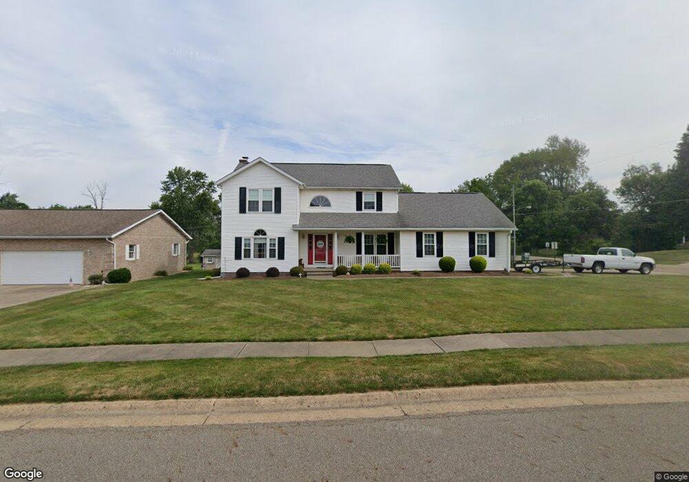
2215 Briarwood St Louisville, OH 44641
Estimated Value: $316,000 - $343,000
3
Beds
3
Baths
2,074
Sq Ft
$158/Sq Ft
Est. Value
About This Home
This home is located at 2215 Briarwood St, Louisville, OH 44641 and is currently estimated at $328,519, approximately $158 per square foot. 2215 Briarwood St is a home located in Stark County with nearby schools including Louisville High School and St. Thomas Aquinas High School & Middle School.
Ownership History
Date
Name
Owned For
Owner Type
Purchase Details
Closed on
Aug 29, 2000
Sold by
Daum and Dolores
Bought by
Wolf Robert P and Wolf Kathy A
Current Estimated Value
Home Financials for this Owner
Home Financials are based on the most recent Mortgage that was taken out on this home.
Original Mortgage
$131,000
Outstanding Balance
$45,712
Interest Rate
7.5%
Mortgage Type
Purchase Money Mortgage
Estimated Equity
$282,807
Purchase Details
Closed on
Aug 12, 1993
Purchase Details
Closed on
May 23, 1991
Create a Home Valuation Report for This Property
The Home Valuation Report is an in-depth analysis detailing your home's value as well as a comparison with similar homes in the area
Home Values in the Area
Average Home Value in this Area
Purchase History
| Date | Buyer | Sale Price | Title Company |
|---|---|---|---|
| Wolf Robert P | $179,000 | -- | |
| -- | $140,500 | -- | |
| -- | $15,000 | -- |
Source: Public Records
Mortgage History
| Date | Status | Borrower | Loan Amount |
|---|---|---|---|
| Open | Wolf Robert P | $131,000 |
Source: Public Records
Tax History Compared to Growth
Tax History
| Year | Tax Paid | Tax Assessment Tax Assessment Total Assessment is a certain percentage of the fair market value that is determined by local assessors to be the total taxable value of land and additions on the property. | Land | Improvement |
|---|---|---|---|---|
| 2025 | -- | $99,860 | $18,970 | $80,890 |
| 2024 | -- | $99,860 | $18,970 | $80,890 |
| 2023 | $2,916 | $77,040 | $17,890 | $59,150 |
| 2022 | $2,941 | $77,040 | $17,890 | $59,150 |
| 2021 | $2,949 | $77,040 | $17,890 | $59,150 |
| 2020 | $2,467 | $70,810 | $16,140 | $54,670 |
| 2019 | $2,477 | $70,810 | $16,140 | $54,670 |
| 2018 | $2,468 | $70,810 | $16,140 | $54,670 |
| 2017 | $2,229 | $62,830 | $14,180 | $48,650 |
| 2016 | $2,642 | $62,830 | $14,180 | $48,650 |
| 2015 | $2,650 | $62,830 | $14,180 | $48,650 |
| 2014 | $464 | $54,320 | $12,250 | $42,070 |
| 2013 | $1,236 | $54,320 | $12,250 | $42,070 |
Source: Public Records
Map
Nearby Homes
- 2110 Edmar St
- 1812 E Broad St
- 1715 High St
- 2015 E Main St
- 3390 Meese Rd NE
- 641 S Nickelplate St
- 308 Superior St
- 0 Michigan Blvd
- 520 S Silver St
- 728 E Broad St
- 908 Sand Lot Cir
- 510 S Bauman Ct
- 204 E Broad St
- 1170 Winding Ridge Ave
- 325 Lincoln Ave
- 107 E Broad St
- 910 Crosswyck Cir
- 8225 Georgetown St
- 5495 Meese Rd NE
- 1702 View Pointe Ave
- 2205 Briarwood St
- 808 Meese Rd
- 814 Meese Rd
- 4201 Meese Rd
- 814 Meese Rd NE
- 2133 Briarwood St
- 2212 Briarwood St
- 822 Meese Rd
- 2202 Briarwood St
- 4221 Meese Rd
- 832 Meese Rd
- 4221 Meese Rd NE
- 2125 Briarwood St
- 2128 Briarwood St
- 909 Meese Rd
- 904 Meese Rd
- 2118 Briarwood St
- 4255 Meese Rd
- 2105 Briarwood St
- 2106 Briarwood St