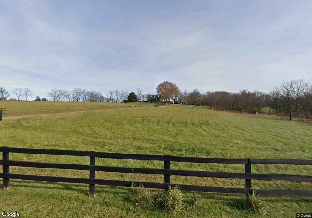
22172 Trappe Rd Upperville, VA 20184
Estimated Value: $2,295,000 - $3,283,219
5
Beds
4
Baths
4,504
Sq Ft
$627/Sq Ft
Est. Value
About This Home
This home is located at 22172 Trappe Rd, Upperville, VA 20184 and is currently estimated at $2,823,740, approximately $626 per square foot. 22172 Trappe Rd is a home located in Loudoun County with nearby schools including Banneker Elementary School, Blue Ridge Middle School, and Loudoun Valley High School.
Ownership History
Date
Name
Owned For
Owner Type
Purchase Details
Closed on
Mar 12, 2024
Sold by
Mcgill Mary Welby
Bought by
Kirkby Farm Llc
Current Estimated Value
Purchase Details
Closed on
Sep 1, 2021
Sold by
Brown Mary Welby and Armstrong Lucy Brown
Bought by
Kirkby Farm Llc
Purchase Details
Closed on
Jun 14, 2021
Sold by
Kirkby Farm Llc
Bought by
Old Dominion Land Conservation Inc
Purchase Details
Closed on
May 2, 2018
Sold by
Brown Mary Welby
Bought by
Armstrong Lucy Brown and Mcgill Mary Welby
Create a Home Valuation Report for This Property
The Home Valuation Report is an in-depth analysis detailing your home's value as well as a comparison with similar homes in the area
Home Values in the Area
Average Home Value in this Area
Purchase History
| Date | Buyer | Sale Price | Title Company |
|---|---|---|---|
| Kirkby Farm Llc | -- | None Listed On Document | |
| Kirkby Farm Llc | -- | None Available | |
| Old Dominion Land Conservation Inc | -- | None Listed On Document | |
| Armstrong Lucy Brown | -- | None Available |
Source: Public Records
Tax History Compared to Growth
Tax History
| Year | Tax Paid | Tax Assessment Tax Assessment Total Assessment is a certain percentage of the fair market value that is determined by local assessors to be the total taxable value of land and additions on the property. | Land | Improvement |
|---|---|---|---|---|
| 2025 | $7,713 | $958,130 | $356,450 | $601,680 |
| 2024 | $8,715 | $1,007,560 | $330,730 | $676,830 |
| 2023 | $7,926 | $905,820 | $254,600 | $651,220 |
| 2022 | $7,623 | $856,500 | $210,700 | $645,800 |
| 2021 | $7,833 | $1,643,860 | $1,034,100 | $609,760 |
| 2020 | $8,141 | $1,623,490 | $1,034,100 | $589,390 |
| 2019 | $16,793 | $1,606,960 | $1,034,100 | $572,860 |
| 2018 | $7,885 | $1,574,550 | $1,034,100 | $540,450 |
| 2017 | $7,325 | $1,505,530 | $1,035,200 | $470,330 |
| 2016 | $7,421 | $648,120 | $0 | $0 |
| 2015 | $7,682 | $676,820 | $182,070 | $494,750 |
| 2014 | $7,421 | $642,530 | $157,290 | $485,240 |
Source: Public Records
Map
Nearby Homes
- 1170 Parker St
- 1610 Delaplane Grade Rd
- 21281 Belle Grey Ln
- 21515 Trappe Rd
- 10157 John s Mosby Hwy
- 1787 Light Horse Ln
- 21826 Blue Ridge Mountain Rd
- 0 Blue Ridge Mountain Rd
- 0 Blue Ridge Mountain Rd Unit VALO2105128
- 22379 Cavalry Heights Cir
- 34679 Atoka Chase Ln
- 20596 Airmont Rd
- 23117 Pantherskin Ln
- W-10-121 On Beaverdam
- 19488 Blueridge Mountain Rd
- 35162 Notre Dame Ln
- 19935 Foggy Bottom Rd
- 0 Cliff Ln
- 1661 Frogtown Rd
- Mount Carmel Road Lot Unit WP001
- 22202 Trappe Rd
- 32513 Llangollen Rd
- 22286 Trappe Rd
- 22378 Trappe Rd
- 32398 Llangollen Rd
- 32293 Cavalcade Ln
- 32389 Cavalcade Ln
- 22440 Trappe Rd
- 32200 Cavalcade Ln
- 21846 Trappe Rd
- 1071 Trappe Rd
- 32921 Sunken Ln
- 9192 John s Mosby Hwy
- 9146 John s Mosby Hwy
- 9184 John s Mosby Hwy
- 9150 John s Mosby Hwy
- 9190 John s Mosby Hwy
- 9200 John s Mosby Hwy
- 9200 John s Mosby Hwy
- 9200 John s Mosby Hwy
