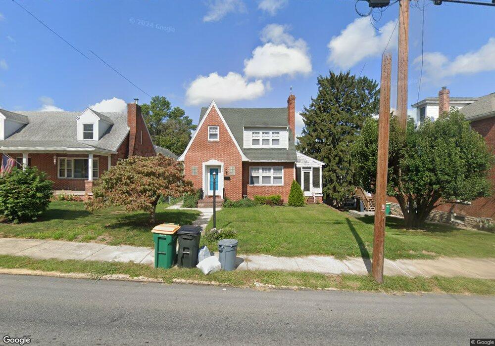
222 N Grant St Waynesboro, PA 17268
Estimated Value: $158,474 - $294,000
3
Beds
3
Baths
--
Sq Ft
6,534
Sq Ft Lot
About This Home
This home is located at 222 N Grant St, Waynesboro, PA 17268 and is currently estimated at $236,119. 222 N Grant St is a home located in Franklin County with nearby schools including Waynesboro Area Senior High School, St. Andrew Catholic School, and Noah's Ark Christian Child Care Center.
Ownership History
Date
Name
Owned For
Owner Type
Purchase Details
Closed on
Apr 27, 2010
Sold by
Mcleod Katie
Bought by
Dreyfus Adam R
Current Estimated Value
Home Financials for this Owner
Home Financials are based on the most recent Mortgage that was taken out on this home.
Original Mortgage
$124,901
Outstanding Balance
$84,044
Interest Rate
5.13%
Mortgage Type
New Conventional
Estimated Equity
$152,075
Purchase Details
Closed on
Aug 18, 2006
Sold by
Baker Edward S and Baker Karen E
Bought by
Mcleod Katie
Home Financials for this Owner
Home Financials are based on the most recent Mortgage that was taken out on this home.
Original Mortgage
$159,900
Interest Rate
6.5%
Mortgage Type
Adjustable Rate Mortgage/ARM
Create a Home Valuation Report for This Property
The Home Valuation Report is an in-depth analysis detailing your home's value as well as a comparison with similar homes in the area
Home Values in the Area
Average Home Value in this Area
Purchase History
| Date | Buyer | Sale Price | Title Company |
|---|---|---|---|
| Dreyfus Adam R | $124,900 | None Available | |
| Mcleod Katie | $199,900 | None Available |
Source: Public Records
Mortgage History
| Date | Status | Borrower | Loan Amount |
|---|---|---|---|
| Open | Dreyfus Adam R | $124,901 | |
| Previous Owner | Mcleod Katie | $159,900 | |
| Previous Owner | Mcleod Katie | $29,950 |
Source: Public Records
Tax History Compared to Growth
Tax History
| Year | Tax Paid | Tax Assessment Tax Assessment Total Assessment is a certain percentage of the fair market value that is determined by local assessors to be the total taxable value of land and additions on the property. | Land | Improvement |
|---|---|---|---|---|
| 2025 | $3,666 | $20,230 | $1,100 | $19,130 |
| 2024 | $3,575 | $20,230 | $1,100 | $19,130 |
| 2023 | $3,497 | $20,230 | $1,100 | $19,130 |
| 2022 | $3,385 | $20,230 | $1,100 | $19,130 |
| 2021 | $3,213 | $20,230 | $1,100 | $19,130 |
| 2020 | $3,188 | $20,230 | $1,100 | $19,130 |
| 2019 | $3,128 | $20,230 | $1,100 | $19,130 |
| 2018 | $2,951 | $20,230 | $1,100 | $19,130 |
| 2017 | $2,895 | $20,230 | $1,100 | $19,130 |
| 2016 | $580 | $20,230 | $1,100 | $19,130 |
| 2015 | $540 | $20,230 | $1,100 | $19,130 |
| 2014 | $540 | $20,230 | $1,100 | $19,130 |
Source: Public Records
Map
Nearby Homes
- 300 N Franklin St
- 109 Garfield St
- 223 Wayne Ave
- 303 Grandview Ave
- 305 Grandview Ave
- 520 N Potomac St
- 251 Wayne Ave
- 405 Guard Ln
- 145 W Main St
- 336 Fairmount Ave
- 144 W Main St
- 112 N Church St
- 110 N Church St
- 7 Mount Airy Ave
- 403 Sunny Dr
- Frankford Plan at Pheasant Run
- Ruby Plan at Pheasant Run
- Pearl Plan at Pheasant Run
- Emerald Plan at Pheasant Run
- Hanover Plan at Pheasant Run
- 228 N Grant St
- 214 N Grant St
- 230 N Grant St
- 232 N Grant St
- 210 N Grant St
- 234 N Grant St
- 236 N Grant St
- 211 Harrison Ave
- 209 Harrison Ave
- 213 Harrison Ave
- 215 N Grant St
- 217 N Grant St
- 215 Harrison Ave
- 242 N Grant St
- 149 W King St
- 219 N Grant St
- 200 N Grant St
- 207 Harrison Ave
- 217 Harrison Ave
- 207 W King St