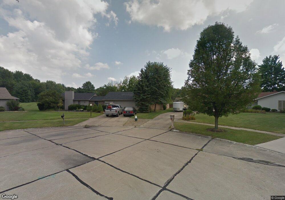
22214 Rock Creek Cir Strongsville, OH 44149
Estimated Value: $374,000 - $400,000
4
Beds
3
Baths
2,634
Sq Ft
$147/Sq Ft
Est. Value
About This Home
This home is located at 22214 Rock Creek Cir, Strongsville, OH 44149 and is currently estimated at $386,705, approximately $146 per square foot. 22214 Rock Creek Cir is a home located in Cuyahoga County with nearby schools including Strongsville High School, St Mary School, and Sts Joseph & John Interparochial School.
Ownership History
Date
Name
Owned For
Owner Type
Purchase Details
Closed on
Jan 15, 1988
Bought by
Puzzuoli Philip D
Current Estimated Value
Purchase Details
Closed on
Sep 22, 1980
Bought by
Title Guarantee & Trust Co
Purchase Details
Closed on
Jul 10, 1978
Sold by
Schmitt Robert F
Bought by
Bob Schmitt Homes Inc
Purchase Details
Closed on
Jun 20, 1978
Bought by
Schmitt Robert F
Purchase Details
Closed on
Jan 1, 1978
Bought by
Bob Schmitt Homes Inc
Create a Home Valuation Report for This Property
The Home Valuation Report is an in-depth analysis detailing your home's value as well as a comparison with similar homes in the area
Home Values in the Area
Average Home Value in this Area
Purchase History
| Date | Buyer | Sale Price | Title Company |
|---|---|---|---|
| Puzzuoli Philip D | $103,800 | -- | |
| Title Guarantee & Trust Co | -- | -- | |
| Bob Schmitt Homes Inc | -- | -- | |
| Schmitt Robert F | -- | -- | |
| Bob Schmitt Homes Inc | -- | -- |
Source: Public Records
Tax History Compared to Growth
Tax History
| Year | Tax Paid | Tax Assessment Tax Assessment Total Assessment is a certain percentage of the fair market value that is determined by local assessors to be the total taxable value of land and additions on the property. | Land | Improvement |
|---|---|---|---|---|
| 2024 | $5,282 | $112,490 | $25,165 | $87,325 |
| 2023 | $5,299 | $84,630 | $21,840 | $62,790 |
| 2022 | $5,261 | $84,630 | $21,840 | $62,790 |
| 2021 | $5,219 | $84,630 | $21,840 | $62,790 |
| 2020 | $5,175 | $74,240 | $19,150 | $55,090 |
| 2019 | $5,023 | $212,100 | $54,700 | $157,400 |
| 2018 | $3,861 | $74,240 | $19,150 | $55,090 |
| 2017 | $4,588 | $69,160 | $17,010 | $52,150 |
| 2016 | $4,551 | $69,160 | $17,010 | $52,150 |
| 2015 | $4,480 | $69,160 | $17,010 | $52,150 |
| 2014 | $4,480 | $67,130 | $16,520 | $50,610 |
Source: Public Records
Map
Nearby Homes
- 22300 Rock Creek Cir
- 0 Priem Rd
- 9829 Plum Brook Ln
- 9598 Pebble Brook Ln
- 10353 Oak Branch Trail
- 10842 Fence Row Dr
- 10824 Watercress Rd
- 10001 N Marks Rd
- 11030 Southwind Ct
- 10800 Meadow Trail
- 8746 Barton Dr
- 21292 Creekside Dr
- 8902 Lincolnshire Blvd
- 21176 Hickory Branch Trail
- 9384 N Marks Rd
- 21359 Briar Bush Ln
- 10839 Prospect Rd
- 8627 Courtland Dr
- 20684 Albion Rd
- 12515 Countryside Dr
- 22236 Rock Creek Cir
- 22209 Rock Creek Cir
- 22268 Rock Creek Cir
- 22221 Rock Creek Cir
- 22182 Meadownorth Ct
- 22194 Meadownorth Ct
- 22170 Meadownorth Ct
- 22243 Rock Creek Cir
- 22158 Meadownorth Ct
- 22206 Meadownorth Ct
- 10021 Plum Brook Ln
- 22287 Rock Creek Cir
- 22134 Meadownorth Ct
- 22230 Meadownorth Ct
- 9989 Plum Brook Ln
- 22309 Rock Creek Cir
- 22221 Meadownorth Ct
- 22090 Shagbark Trail
- 10769 Waterfall Rd
- 22331 Rock Creek Cir