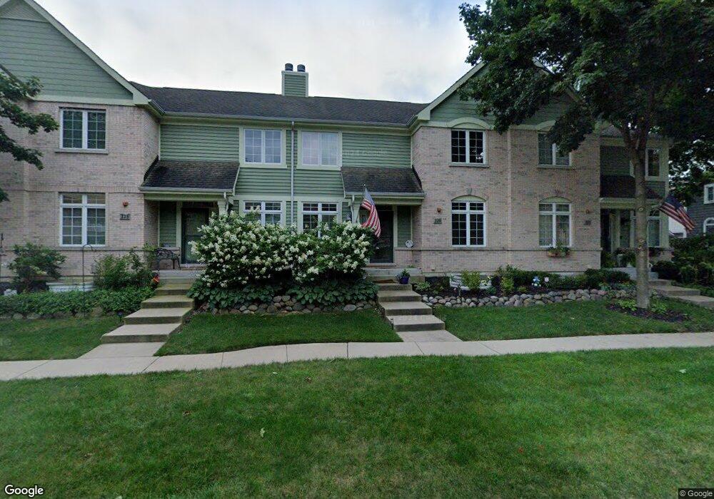
223 Newberry Ave Libertyville, IL 60048
Estimated Value: $610,000 - $757,000
3
Beds
3
Baths
2,260
Sq Ft
$300/Sq Ft
Est. Value
About This Home
This home is located at 223 Newberry Ave, Libertyville, IL 60048 and is currently estimated at $677,918, approximately $299 per square foot. 223 Newberry Ave is a home located in Lake County with nearby schools including Butterfield School, Highland Middle School, and Libertyville High School.
Ownership History
Date
Name
Owned For
Owner Type
Purchase Details
Closed on
Mar 24, 2005
Sold by
State Bank Of The Lakes
Bought by
Morgan Wendy L
Current Estimated Value
Home Financials for this Owner
Home Financials are based on the most recent Mortgage that was taken out on this home.
Original Mortgage
$356,000
Outstanding Balance
$149,058
Interest Rate
3.12%
Mortgage Type
Purchase Money Mortgage
Estimated Equity
$528,860
Create a Home Valuation Report for This Property
The Home Valuation Report is an in-depth analysis detailing your home's value as well as a comparison with similar homes in the area
Home Values in the Area
Average Home Value in this Area
Purchase History
| Date | Buyer | Sale Price | Title Company |
|---|---|---|---|
| Morgan Wendy L | $445,000 | Ticor Title Insurance Compan |
Source: Public Records
Mortgage History
| Date | Status | Borrower | Loan Amount |
|---|---|---|---|
| Open | Morgan Wendy L | $356,000 |
Source: Public Records
Tax History Compared to Growth
Tax History
| Year | Tax Paid | Tax Assessment Tax Assessment Total Assessment is a certain percentage of the fair market value that is determined by local assessors to be the total taxable value of land and additions on the property. | Land | Improvement |
|---|---|---|---|---|
| 2024 | $12,739 | $188,840 | $43,623 | $145,217 |
| 2023 | $10,889 | $174,174 | $40,235 | $133,939 |
| 2022 | $10,889 | $147,157 | $38,672 | $108,485 |
| 2021 | $10,474 | $143,990 | $37,840 | $106,150 |
| 2020 | $10,072 | $141,569 | $37,204 | $104,365 |
| 2019 | $11,750 | $160,658 | $36,850 | $123,808 |
| 2018 | $9,665 | $137,593 | $38,333 | $99,260 |
| 2017 | $9,529 | $133,249 | $37,123 | $96,126 |
| 2016 | $9,209 | $126,339 | $35,198 | $91,141 |
| 2015 | $9,121 | $118,084 | $32,898 | $85,186 |
| 2014 | $8,647 | $107,869 | $30,052 | $77,817 |
| 2012 | $8,353 | $111,027 | $30,933 | $80,094 |
Source: Public Records
Map
Nearby Homes
- 224 Newberry Ave
- 217 E Church St
- 922 N Milwaukee Ave Unit A
- 1211 Parliament Ct
- 204 W Ellis Ave
- 212 Elm Ct
- 208 W Ellis Ave
- 601 Broadway St
- 212 W Ellis Ave
- 505 Lange Ct
- 420 W Cook Ave
- 121 4th St
- 112 3rd St
- 619 Parkside Ct
- 616 Parkside Ct
- 662 Parkside Ct
- 694 Parkside Ct
- 308 Mckinley Ave
- 1754 Glenmore Rd
- 31132-31140 N Milwaukee Ave