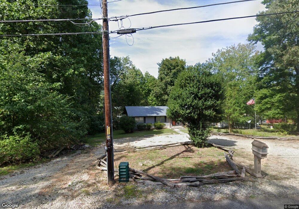
223 Underwood Farm Rd Cleveland, GA 30528
Estimated Value: $287,000 - $312,000
3
Beds
2
Baths
1,222
Sq Ft
$247/Sq Ft
Est. Value
About This Home
This home is located at 223 Underwood Farm Rd, Cleveland, GA 30528 and is currently estimated at $301,285, approximately $246 per square foot. 223 Underwood Farm Rd is a home located in White County with nearby schools including White County 9th Grade Academy, Tesnatee Gap Elementary (Old White County Intermediate), and Jack P. Nix Elementary School.
Ownership History
Date
Name
Owned For
Owner Type
Purchase Details
Closed on
May 10, 2020
Sold by
Kahle Stephen
Bought by
Digbee Llc
Current Estimated Value
Purchase Details
Closed on
Mar 1, 2007
Sold by
Not Provided
Bought by
Kahle Steven and Kahle Kelly
Home Financials for this Owner
Home Financials are based on the most recent Mortgage that was taken out on this home.
Original Mortgage
$111,000
Interest Rate
6.22%
Mortgage Type
New Conventional
Create a Home Valuation Report for This Property
The Home Valuation Report is an in-depth analysis detailing your home's value as well as a comparison with similar homes in the area
Home Values in the Area
Average Home Value in this Area
Purchase History
| Date | Buyer | Sale Price | Title Company |
|---|---|---|---|
| Digbee Llc | -- | -- | |
| Kahle Steven | -- | -- | |
| Kahle Steven | $111,000 | -- |
Source: Public Records
Mortgage History
| Date | Status | Borrower | Loan Amount |
|---|---|---|---|
| Previous Owner | Kahle Steven | $111,000 |
Source: Public Records
Tax History Compared to Growth
Tax History
| Year | Tax Paid | Tax Assessment Tax Assessment Total Assessment is a certain percentage of the fair market value that is determined by local assessors to be the total taxable value of land and additions on the property. | Land | Improvement |
|---|---|---|---|---|
| 2025 | $1,805 | $86,628 | $16,344 | $70,284 |
| 2024 | $1,805 | $86,628 | $16,344 | $70,284 |
| 2023 | $1,296 | $57,144 | $12,260 | $44,884 |
| 2022 | $1,167 | $49,176 | $11,576 | $37,600 |
| 2021 | $1,065 | $39,720 | $9,128 | $30,592 |
| 2020 | $1,044 | $37,080 | $8,592 | $28,488 |
| 2019 | $1,047 | $37,080 | $8,592 | $28,488 |
| 2018 | $1,047 | $37,080 | $8,592 | $28,488 |
| 2017 | $952 | $34,024 | $8,592 | $25,432 |
| 2016 | $952 | $34,024 | $8,592 | $25,432 |
| 2015 | $908 | $85,060 | $8,592 | $25,432 |
| 2014 | $841 | $78,600 | $0 | $0 |
Source: Public Records
Map
Nearby Homes
- 0 Underwood Farm Rd Unit 10620914
- 179 Garrison Dr
- 256 Dogwood Ln
- 329 Leisure Acres Dr
- 0 Grand View Dr Unit 10479899
- 488 Old Highway 75 S
- 611 Highway 75 S
- 61 Pine Ln
- 152 Grand View Dr
- 250 Truelove Rd
- 0 Old Highway 75 S Unit 7656742
- 221 Grand View Dr
- 109 Driskell Rd
- 1407 Daybreak Rd
- 1335 Daybreak Rd
- 150 Hardwood Dr
- 0 Daybreak Rd Unit TR 4 10598729
- 0 Daybreak Rd Unit 10640786
- 0 Daybreak Rd Unit 10388898
- 0 Bryant St
- 23 Mossy Trail
- 0 Mossy Trail
- 0 Mossy Trail Unit 8711660
- 0 Mossy Trail Unit 7467884
- 0 Mossy Trail Unit 8149672
- 0 Mossy Trail Unit 7269532
- 0 Mossy Trail Unit 7288627
- 0 Mossy Trail Unit 7517825
- 12 Caraway Dr
- 31 Mossy Trail
- 47 Mossy Trail
- 32 Mossy Trail
- 0 Pelican Dr Unit 7579164
- 0 Pelican Dr
- 55 Mossy Trail
- 1706 S Main St
- 70 Mossy Trail Unit 14
- 70 Mossy Trail
- 71 Mossy Trail
- 52 Pelican Dr