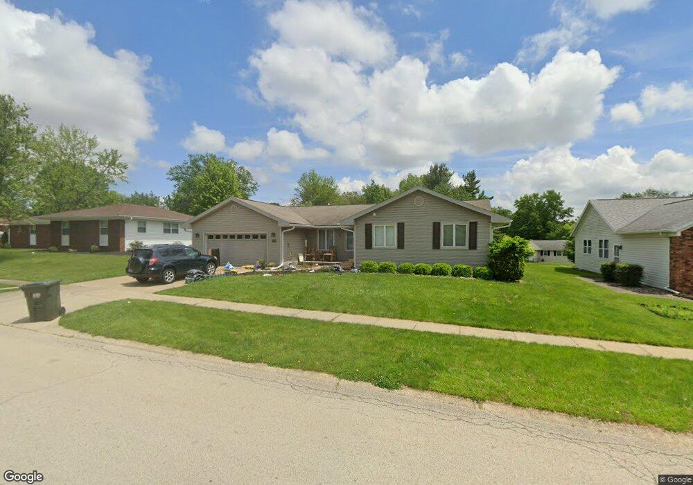
2235 Eden Dr Charleston, IL 61920
Estimated Value: $214,852 - $244,000
3
Beds
2
Baths
1,861
Sq Ft
$123/Sq Ft
Est. Value
About This Home
This home is located at 2235 Eden Dr, Charleston, IL 61920 and is currently estimated at $228,713, approximately $122 per square foot. 2235 Eden Dr is a home located in Coles County with nearby schools including Charleston High School, Charleston Christian Academy, and Charleston Christian Academy High School.
Ownership History
Date
Name
Owned For
Owner Type
Purchase Details
Closed on
May 12, 2023
Sold by
Dawson Marsha A
Bought by
Jackson Tyler and Jackson Lindsay
Current Estimated Value
Purchase Details
Closed on
Dec 17, 2021
Sold by
Dawson Marsha A
Bought by
Dawson Marsha A and Lauwers Adam S
Purchase Details
Closed on
Nov 18, 2013
Sold by
Dawson Marsha A
Bought by
Brown Margaret M
Purchase Details
Closed on
Aug 1, 2008
Sold by
Miller F Joyce
Bought by
Dawson Fred E and Dawson Marsha A
Home Financials for this Owner
Home Financials are based on the most recent Mortgage that was taken out on this home.
Original Mortgage
$55,000
Interest Rate
5.95%
Mortgage Type
New Conventional
Create a Home Valuation Report for This Property
The Home Valuation Report is an in-depth analysis detailing your home's value as well as a comparison with similar homes in the area
Home Values in the Area
Average Home Value in this Area
Purchase History
| Date | Buyer | Sale Price | Title Company |
|---|---|---|---|
| Jackson Tyler | $185,000 | None Listed On Document | |
| Dawson Marsha A | -- | None Listed On Document | |
| Brown Margaret M | -- | -- | |
| Dawson Fred E | $127,000 | None Available |
Source: Public Records
Mortgage History
| Date | Status | Borrower | Loan Amount |
|---|---|---|---|
| Previous Owner | Dawson Fred E | $55,000 |
Source: Public Records
Tax History Compared to Growth
Tax History
| Year | Tax Paid | Tax Assessment Tax Assessment Total Assessment is a certain percentage of the fair market value that is determined by local assessors to be the total taxable value of land and additions on the property. | Land | Improvement |
|---|---|---|---|---|
| 2024 | $4,073 | $52,488 | $10,130 | $42,358 |
| 2023 | $2,760 | $47,934 | $9,251 | $38,683 |
| 2022 | $2,812 | $47,142 | $9,098 | $38,044 |
| 2021 | $2,884 | $45,242 | $8,731 | $36,511 |
| 2020 | $2,964 | $45,564 | $7,736 | $37,828 |
| 2019 | $3,021 | $43,976 | $7,466 | $36,510 |
| 2018 | $2,989 | $43,976 | $7,466 | $36,510 |
| 2017 | $2,949 | $43,976 | $7,466 | $36,510 |
| 2016 | $2,924 | $43,976 | $7,466 | $36,510 |
| 2015 | $3,110 | $43,976 | $7,466 | $36,510 |
| 2014 | $3,110 | $43,976 | $7,466 | $36,510 |
Source: Public Records
Map
Nearby Homes
- 715 W Coolidge Ave
- 1071 Woodberry Ln
- 634 Fox Lake Dr
- 1035 Woodberry Ln
- 911 W Hayes Ave
- 926 Westgate Dr
- 27 Heather Dr
- 0 Whitetail Dr
- 711 Kenton Dr
- 9 Orchard Dr
- 2408 4th St
- 1528 Division St
- W Hayes Ave Lot Unit WP001
- 405 Cedar Dr
- 0 Timberlake Lot 17 Estates
- 929 Reynolds Dr
- 921 Reynolds Dr
- 942 E St
- 124 Polk Ave
- 926 Division St
- 2243 Eden Dr
- 2304 Saratoga Place
- 2251 Eden Dr
- 720 Suffolk Place
- 2226 Eden Dr
- 727 Suffolk Place
- 2305 Saratoga Place
- 2250 Reynolds Dr
- 712 Suffolk Place
- 2256 Reynolds Dr
- 719 Suffolk Place
- 2244 Reynolds Dr
- 2310 Saratoga Place
- 2262 Reynolds Dr
- 2242 Eden Dr
- 758 Glenwood Dr
- 708 Suffolk Place
- 711 Suffolk Place
- 2317 Saratoga Place
- 746 Glenwood Dr