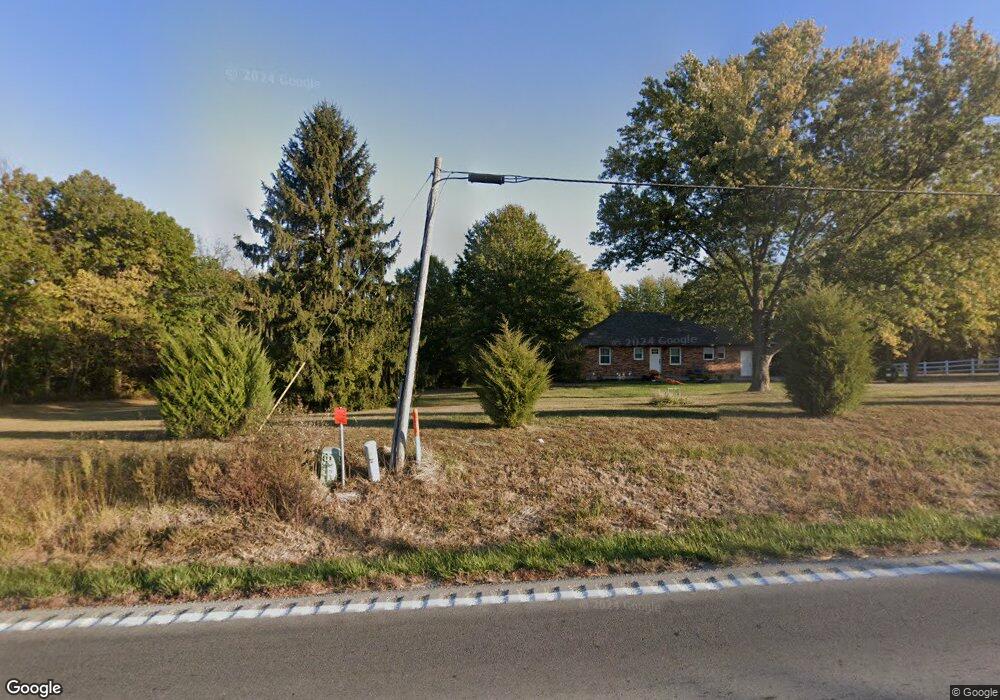
22406 State Route 92 Kearney, MO 64060
Estimated Value: $407,000 - $467,000
3
Beds
2
Baths
1,215
Sq Ft
$357/Sq Ft
Est. Value
About This Home
This home is located at 22406 State Route 92, Kearney, MO 64060 and is currently estimated at $433,827, approximately $357 per square foot. 22406 State Route 92 is a home located in Clay County with nearby schools including Kearney Junior High School and Kearney High School.
Ownership History
Date
Name
Owned For
Owner Type
Purchase Details
Closed on
Aug 25, 2025
Sold by
Deuel Nathan and Deuel Jorden
Bought by
Zvacek Alice and Zvacek Shannon
Current Estimated Value
Home Financials for this Owner
Home Financials are based on the most recent Mortgage that was taken out on this home.
Original Mortgage
$368,000
Outstanding Balance
$368,000
Interest Rate
5.92%
Mortgage Type
New Conventional
Estimated Equity
$65,827
Purchase Details
Closed on
Feb 19, 2021
Sold by
Kiter Papadopoulos Penny and Papadopoulos Gregory
Bought by
Deuel Nathan and Deuel Jorden
Home Financials for this Owner
Home Financials are based on the most recent Mortgage that was taken out on this home.
Original Mortgage
$173,375
Interest Rate
2.9%
Mortgage Type
New Conventional
Create a Home Valuation Report for This Property
The Home Valuation Report is an in-depth analysis detailing your home's value as well as a comparison with similar homes in the area
Home Values in the Area
Average Home Value in this Area
Purchase History
| Date | Buyer | Sale Price | Title Company |
|---|---|---|---|
| Zvacek Alice | -- | Alliance Nationwide Title | |
| Zvacek Alice | -- | Alliance Nationwide Title | |
| Deuel Nathan | -- | Stewart Title Company |
Source: Public Records
Mortgage History
| Date | Status | Borrower | Loan Amount |
|---|---|---|---|
| Open | Zvacek Alice | $368,000 | |
| Previous Owner | Deuel Nathan | $173,375 |
Source: Public Records
Tax History Compared to Growth
Tax History
| Year | Tax Paid | Tax Assessment Tax Assessment Total Assessment is a certain percentage of the fair market value that is determined by local assessors to be the total taxable value of land and additions on the property. | Land | Improvement |
|---|---|---|---|---|
| 2025 | $2,710 | $49,210 | -- | -- |
| 2024 | $2,710 | $42,830 | -- | -- |
| 2023 | $2,700 | $42,830 | $0 | $0 |
| 2022 | $2,568 | $39,460 | $0 | $0 |
| 2021 | $2,513 | $39,463 | $10,450 | $29,013 |
| 2020 | $2,452 | $34,980 | $0 | $0 |
| 2019 | $2,438 | $34,980 | $0 | $0 |
| 2018 | $2,279 | $31,600 | $0 | $0 |
| 2017 | $2,169 | $31,590 | $7,730 | $23,860 |
| 2016 | $2,169 | $30,430 | $7,730 | $22,700 |
| 2015 | $2,170 | $30,430 | $7,730 | $22,700 |
| 2014 | $2,113 | $29,490 | $7,730 | $21,760 |
Source: Public Records
Map
Nearby Homes
- 15617 Oakmont Dr
- 21619 NE 150th St
- 15025 Jesse James Farm Rd
- 16115 Kountry Ridge Dr
- 16211 Dr
- 25607 High Dr
- 1210 E 15th St
- 1610 Renea Ct
- 1812 Lauren Ln
- 1300 Melissa Ct
- 1043 E 14th St
- 1302 Melissa Ct
- 1710 Clear Creek Dr
- 1307 Stonecrest Dr
- 804 Southbrook Pkwy
- 610 E Porter Ridge Ct
- 817 Porter Ridge Rd
- 808 E 16th St
- 1204 Susan St
- 1205 Noah's Ln
- 22416 State Route 92
- 15602 Oakmont Dr
- 15610 Oakmont Dr
- 15625 Oakmont Dr
- 15626 Oakmont Dr
- 15709 Oakmont Dr
- 15702 Oakmont Dr
- 22624 State Route 92
- 22624 State Route 92
- 15710 Oakmont Dr
- 15723 Oakmont Dr
- 15724 Oakmont Dr
- 15810 Oakmont Cir
- 15811 Oakmont Cir
- 22223 NE 159th St
- 22207 NE 159th St
- 15824 Oakmont Cir
- 15806 Oakmont Dr
- 15824 Oakmont Dr
- 22216 NE 159th St