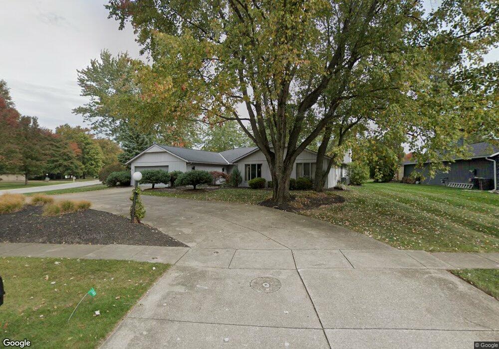
22454 Rock Creek Cir Strongsville, OH 44149
Estimated Value: $393,000 - $426,553
4
Beds
3
Baths
2,778
Sq Ft
$148/Sq Ft
Est. Value
About This Home
This home is located at 22454 Rock Creek Cir, Strongsville, OH 44149 and is currently estimated at $410,638, approximately $147 per square foot. 22454 Rock Creek Cir is a home located in Cuyahoga County with nearby schools including Strongsville High School, St Mary School, and Sts Joseph & John Interparochial School.
Ownership History
Date
Name
Owned For
Owner Type
Purchase Details
Closed on
Aug 30, 1985
Sold by
Title Guarantee
Bought by
Schiller Samuel A
Current Estimated Value
Purchase Details
Closed on
Feb 13, 1980
Sold by
Bob Schmitt Homes Inc
Bought by
Title Guarantee
Purchase Details
Closed on
Jul 10, 1978
Sold by
Schmitt Robert F
Bought by
Bob Schmitt Homes Inc
Purchase Details
Closed on
Jun 20, 1978
Bought by
Schmitt Robert F
Purchase Details
Closed on
Jan 1, 1978
Bought by
Bob Schmitt Homes Inc
Create a Home Valuation Report for This Property
The Home Valuation Report is an in-depth analysis detailing your home's value as well as a comparison with similar homes in the area
Home Values in the Area
Average Home Value in this Area
Purchase History
| Date | Buyer | Sale Price | Title Company |
|---|---|---|---|
| Schiller Samuel A | $108,500 | -- | |
| Title Guarantee | -- | -- | |
| Bob Schmitt Homes Inc | -- | -- | |
| Schmitt Robert F | -- | -- | |
| Bob Schmitt Homes Inc | -- | -- |
Source: Public Records
Tax History Compared to Growth
Tax History
| Year | Tax Paid | Tax Assessment Tax Assessment Total Assessment is a certain percentage of the fair market value that is determined by local assessors to be the total taxable value of land and additions on the property. | Land | Improvement |
|---|---|---|---|---|
| 2024 | $5,579 | $128,625 | $25,270 | $103,355 |
| 2023 | $4,878 | $87,080 | $21,910 | $65,170 |
| 2022 | $4,869 | $87,080 | $21,910 | $65,170 |
| 2021 | $4,831 | $87,080 | $21,910 | $65,170 |
| 2020 | $4,714 | $76,370 | $19,220 | $57,160 |
| 2019 | $4,576 | $218,200 | $54,900 | $163,300 |
| 2018 | $4,028 | $76,370 | $19,220 | $57,160 |
| 2017 | $3,975 | $68,670 | $17,080 | $51,590 |
| 2016 | $3,943 | $68,670 | $17,080 | $51,590 |
| 2015 | $3,866 | $68,670 | $17,080 | $51,590 |
| 2014 | $3,866 | $66,680 | $16,590 | $50,090 |
Source: Public Records
Map
Nearby Homes
- 22300 Rock Creek Cir
- 9598 Pebble Brook Ln
- 9829 Plum Brook Ln
- 0 Priem Rd
- 10001 N Marks Rd
- 8746 Barton Dr
- 10800 Meadow Trail
- 10824 Watercress Rd
- 10842 Fence Row Dr
- 9384 N Marks Rd
- 8902 Lincolnshire Blvd
- 10353 Oak Branch Trail
- 11030 Southwind Ct
- 21292 Creekside Dr
- 8627 Courtland Dr
- 21176 Hickory Branch Trail
- 8896 Firethorne Dr
- 8981 Leatherleaf Dr
- 8960 Leatherleaf Dr
- 21359 Briar Bush Ln
- 22432 Rock Creek Cir
- 9837 Pebble Brook Ln
- 22410 Rock Creek Cir
- 9854 Pebble Brook Ln
- 9805 Pebble Brook Ln
- 9802 Brookstone Way
- 22441 Rock Creek Cir
- 9822 Pebble Brook Ln
- 22398 Rock Creek Cir
- 22419 Rock Creek Cir
- 9918 Pebble Brook Ln
- 9774 Brookstone Way
- 9773 Pebble Brook Ln
- 9790 Pebble Brook Ln
- 9820 Brookstone Way
- 22397 Rock Creek Cir
- 22386 Rock Creek Cir
- 9746 Brookstone Way
- 9758 Pebble Brook Ln
- 22375 Rock Creek Cir