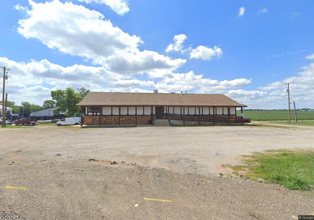
22461 Illinois 9 Tremont, IL 61568
Estimated Value: $295,000 - $382,000
2
Beds
2
Baths
5,120
Sq Ft
$68/Sq Ft
Est. Value
About This Home
This home is located at 22461 Illinois 9, Tremont, IL 61568 and is currently estimated at $346,669, approximately $67 per square foot. 22461 Illinois 9 is a home located in Tazewell County with nearby schools including Tremont Elementary School, Tremont Middle School, and Tremont High School.
Ownership History
Date
Name
Owned For
Owner Type
Purchase Details
Closed on
Oct 3, 2024
Sold by
Lang Virginia
Bought by
Lang Rebecca
Current Estimated Value
Purchase Details
Closed on
Mar 14, 2023
Sold by
Lang Arthur R
Bought by
Lang Virginia
Purchase Details
Closed on
Sep 29, 2022
Sold by
Lang Virginia
Bought by
People Of The State Of Illinois Department Of
Purchase Details
Closed on
Sep 29, 2021
Sold by
Lang Virginia
Bought by
Lang Virginia and Lang Arthur
Purchase Details
Closed on
Mar 12, 2015
Sold by
Lang Arthur R and Lang Virginia
Bought by
Lang Arthur R and Lang Virginia
Create a Home Valuation Report for This Property
The Home Valuation Report is an in-depth analysis detailing your home's value as well as a comparison with similar homes in the area
Home Values in the Area
Average Home Value in this Area
Purchase History
| Date | Buyer | Sale Price | Title Company |
|---|---|---|---|
| Lang Rebecca | -- | None Listed On Document | |
| Lang Virginia | -- | -- | |
| People Of The State Of Illinois Department Of | $3,550 | Wheatland Title | |
| Lang Virginia | -- | None Listed On Document | |
| Lang Arthur R | -- | -- |
Source: Public Records
Tax History Compared to Growth
Tax History
| Year | Tax Paid | Tax Assessment Tax Assessment Total Assessment is a certain percentage of the fair market value that is determined by local assessors to be the total taxable value of land and additions on the property. | Land | Improvement |
|---|---|---|---|---|
| 2024 | $9,027 | $126,630 | $12,610 | $114,020 |
| 2023 | $9,027 | $116,260 | $11,580 | $104,680 |
| 2022 | $8,765 | $108,240 | $10,780 | $97,460 |
| 2021 | $7,612 | $104,080 | $10,370 | $93,710 |
| 2020 | $7,515 | $102,040 | $10,170 | $91,870 |
| 2019 | $7,526 | $102,040 | $10,170 | $91,870 |
| 2018 | $7,310 | $101,060 | $5,960 | $95,100 |
| 2017 | $7,179 | $101,060 | $5,960 | $95,100 |
| 2016 | $3,630 | $56,150 | $5,840 | $50,310 |
| 2015 | $7,036 | $0 | $0 | $0 |
| 2013 | $6,942 | $109,950 | $5,840 | $104,110 |
Source: Public Records
Map
Nearby Homes
- 313 W South St
- 316 N Locust St
- 0 Illinois 9
- 16810 Springfield Rd
- 5859 Broadway Rd
- 116 Lost Creek Ct
- 1920-1922 Mayflower Dr
- 1960-1962 Mayflower Dr
- 107 Lost Creek Ct
- 105 Royal Point Ct
- 5559 Broadway Rd
- 3858 Sunset Dr
- 2100 S 2nd Ave Unit 2100
- 2020 S 2nd Ave Unit 2020
- 4851 Sheridan Rd
- 10109 Arrow Rd
- 50 Brooke Cir Unit 50
- 305 Conaghan Dr
- 17902 Red Shale Hill Rd
- 13694 Egg Ranch Rd
- 22387 Old Route 9
- 22454 State Route 9
- 22454 State Route 9
- 201 N Hannibal St
- 508 W Pearl St
- 305 N Hannibal St
- 309 N Hannibal St
- 301 N Hannibal St
- 313 N Hannibal St
- 317 N Hannibal St
- 504 W Pearl St
- 401 N Hannibal St
- 501 W Tazewell St
- 405 N Hannibal St
- 506 W Pearl St
- 304 N Hannibal St
- 308 N Hannibal St
- 312 N Hannibal St
- 411 N Hannibal St
- 316 N Hannibal St