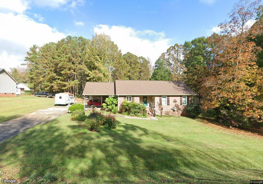
2247 Airport Rd Lancaster, SC 29720
Estimated Value: $190,000 - $252,000
--
Bed
2
Baths
1,347
Sq Ft
$165/Sq Ft
Est. Value
About This Home
This home is located at 2247 Airport Rd, Lancaster, SC 29720 and is currently estimated at $222,064, approximately $164 per square foot. 2247 Airport Rd is a home located in Lancaster County with nearby schools including Brooklyn Springs Elementary School, South Middle School, and Lancaster High School.
Ownership History
Date
Name
Owned For
Owner Type
Purchase Details
Closed on
Jul 17, 2013
Sold by
Byrdic Donna
Bought by
Byrdic Donna and Byrdic Charles F
Current Estimated Value
Purchase Details
Closed on
Nov 4, 2005
Sold by
Steele Rebecca A
Bought by
Byrdic Donna
Home Financials for this Owner
Home Financials are based on the most recent Mortgage that was taken out on this home.
Original Mortgage
$21,400
Interest Rate
5.9%
Mortgage Type
Credit Line Revolving
Create a Home Valuation Report for This Property
The Home Valuation Report is an in-depth analysis detailing your home's value as well as a comparison with similar homes in the area
Home Values in the Area
Average Home Value in this Area
Purchase History
| Date | Buyer | Sale Price | Title Company |
|---|---|---|---|
| Byrdic Donna | -- | -- | |
| Byrdic Donna | $107,400 | -- |
Source: Public Records
Mortgage History
| Date | Status | Borrower | Loan Amount |
|---|---|---|---|
| Closed | Byrdic Donna | $21,400 | |
| Open | Byrdic Donna | $85,920 |
Source: Public Records
Tax History Compared to Growth
Tax History
| Year | Tax Paid | Tax Assessment Tax Assessment Total Assessment is a certain percentage of the fair market value that is determined by local assessors to be the total taxable value of land and additions on the property. | Land | Improvement |
|---|---|---|---|---|
| 2024 | $563 | $5,668 | $876 | $4,792 |
| 2023 | $561 | $5,668 | $876 | $4,792 |
| 2022 | $559 | $5,668 | $876 | $4,792 |
| 2021 | $547 | $5,668 | $876 | $4,792 |
| 2020 | $509 | $5,316 | $876 | $4,440 |
| 2019 | $1,799 | $5,316 | $876 | $4,440 |
| 2018 | $1,731 | $5,316 | $876 | $4,440 |
| 2017 | $497 | $0 | $0 | $0 |
| 2016 | $485 | $0 | $0 | $0 |
| 2015 | $635 | $0 | $0 | $0 |
| 2014 | $635 | $0 | $0 | $0 |
| 2013 | $635 | $0 | $0 | $0 |
Source: Public Records
Map
Nearby Homes
- 2282 White Pine Ct
- 2315 State Road S-29-395
- 0 Powell Ave
- 1678 Old Lynwood Cir
- 1675 Old Lynwood Cir
- 3017 Crenson Dr
- Lots 1-5 Evans Dr
- 1641 Converse St
- 3047 Crenson Dr
- 3028 Crenson Dr
- 2132 Athena Rd
- 3005 Crenson Dr
- 3038 Crenson Dr
- 3042 Crenson Dr
- 1670 Lynwood Dr
- 2060 Athena Rd
- 2156 Evans Dr
- 2112 Evans Dr
- 2200 Florence Cir
- 2040 Athena Rd
- 2275 Airport Rd Unit 40
- 2211 Airport Rd
- 2258 White Pine Ct
- 2267 Airport Rd Unit 41
- 2252 White Pine Ct
- 2229 Airport Rd
- 1849 Bardell St
- 2251 White Pine Ct
- 2283 Airport Rd
- 2244 White Pine Ct
- 1841 Bardell St
- 1834 Bridgewood Dr
- 2243 White Pine Ct
- 2266 White Pine Ct
- 2236 White Pine Ct
- 1820 Bridgewood Dr
- 1854 Bardell St
- 2295 Airport Rd
- 2235 White Pine Ct
- 0 Country Club Dr Unit 2023537