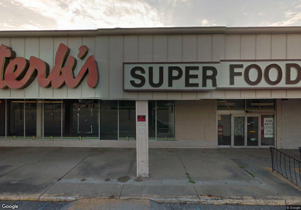
225 Gold Coast Ln Calumet City, IL 60409
--
Bed
--
Bath
--
Sq Ft
3.2
Acres
About This Home
This home is located at 225 Gold Coast Ln, Calumet City, IL 60409. 225 Gold Coast Ln is a home located in Cook County with nearby schools including Hoover Elementary School, Schrum Memorial Middle School, and Thornton Fractional North High School.
Ownership History
Date
Name
Owned For
Owner Type
Purchase Details
Closed on
Jun 11, 2024
Sold by
Giles Cedric
Bought by
County Of Cook
Purchase Details
Closed on
Jul 11, 2008
Sold by
Suburban Bank & Trust Co
Bought by
Riverside Investment Group Llc #3
Home Financials for this Owner
Home Financials are based on the most recent Mortgage that was taken out on this home.
Original Mortgage
$1,000,000
Interest Rate
6.42%
Mortgage Type
Commercial
Create a Home Valuation Report for This Property
The Home Valuation Report is an in-depth analysis detailing your home's value as well as a comparison with similar homes in the area
Home Values in the Area
Average Home Value in this Area
Purchase History
| Date | Buyer | Sale Price | Title Company |
|---|---|---|---|
| County Of Cook | -- | None Listed On Document | |
| Riverside Investment Group Llc #3 | $1,500,000 | First American Title |
Source: Public Records
Mortgage History
| Date | Status | Borrower | Loan Amount |
|---|---|---|---|
| Previous Owner | Riverside Investment Group Llc #3 | $1,000,000 |
Source: Public Records
Tax History Compared to Growth
Tax History
| Year | Tax Paid | Tax Assessment Tax Assessment Total Assessment is a certain percentage of the fair market value that is determined by local assessors to be the total taxable value of land and additions on the property. | Land | Improvement |
|---|---|---|---|---|
| 2024 | $62,962 | $83,679 | $83,679 | -- |
| 2023 | $284,357 | $95,739 | $83,679 | $12,060 |
| 2022 | $284,357 | $333,483 | $209,198 | $124,285 |
| 2021 | $279,003 | $333,480 | $209,197 | $124,283 |
| 2020 | $235,670 | $333,480 | $209,197 | $124,283 |
| 2019 | $179,623 | $241,594 | $122,031 | $119,563 |
| 2018 | $180,751 | $241,594 | $122,031 | $119,563 |
| 2017 | $171,656 | $241,594 | $122,031 | $119,563 |
| 2016 | $77,238 | $114,611 | $104,598 | $10,013 |
| 2015 | $76,075 | $114,594 | $104,598 | $9,996 |
| 2014 | $90,266 | $141,369 | $104,598 | $36,771 |
| 2013 | $76,077 | $128,792 | $104,598 | $24,194 |
Source: Public Records
Map
Nearby Homes
- 1374 Kenilworth Dr
- 1375 Forest Place
- 1373 Stanley Blvd
- 1404 Wentworth Ave Unit 1
- 1304 Freeland Ave
- 1313 Gordon Ave
- 1395 Freeland Ave
- 1341 Gordon Ave
- 1420 Wentworth Ave
- 1351 Gordon Ave
- 107 163rd St
- 302 161st St
- 43 163rd St
- 305 River Oaks Dr
- 1387 Price Ave
- 1461 Wentworth Ave
- 1366 Price Ave
- 100 Michigan City Rd
- 1295 Hirsch Ave
- 1473 Wentworth Ave
- 213 Gold Coast Ln
- 1332 Wentworth Ave
- 1332 Wentworth Ave Unit 1334
- 1334 1/2 Wentworth Ave
- 1328 Wentworth Ave
- 1330 Wentworth Ave
- 1334 Wentworth Ave
- 1336 Wentworth Ave
- 1336 Wentworth Ave Unit 1-2
- 1336 Wentworth Ave Unit 1
- 1338 Wentworth Ave Unit 1-2
- 1338 Wentworth Ave Unit 1
- 1340 Wentworth Ave
- 1340 Wentworth Ave
- 1369 Forest Ave
- 1367 Forest Ave
- 1365 Forest Ave
- 1354 Wentworth Ave
- 1361 Forest Ave
- 1371 Forest Ave