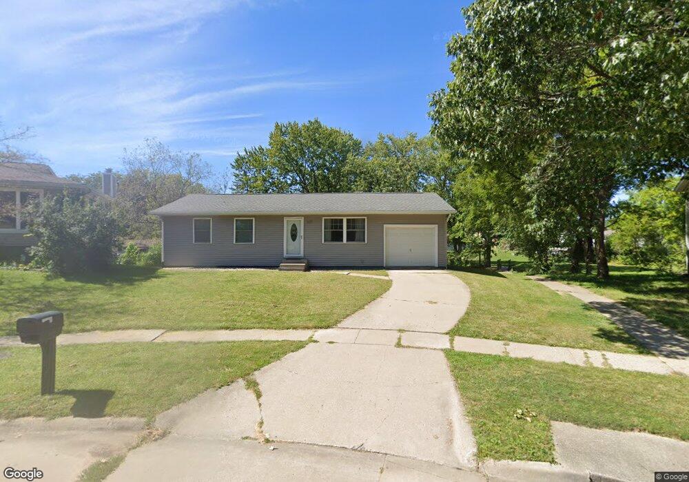
225 Juniper Ct North Liberty, IA 52317
Estimated Value: $254,000 - $294,000
4
Beds
2
Baths
962
Sq Ft
$279/Sq Ft
Est. Value
About This Home
This home is located at 225 Juniper Ct, North Liberty, IA 52317 and is currently estimated at $268,612, approximately $279 per square foot. 225 Juniper Ct is a home located in Johnson County with nearby schools including Buford Garner Elementary School, North Central Junior High School, and Liberty High School.
Ownership History
Date
Name
Owned For
Owner Type
Purchase Details
Closed on
Mar 23, 2005
Sold by
Bennett William W and Bennett Roxann
Bought by
Thys Joshua J
Current Estimated Value
Home Financials for this Owner
Home Financials are based on the most recent Mortgage that was taken out on this home.
Original Mortgage
$142,176
Outstanding Balance
$73,365
Interest Rate
5.88%
Mortgage Type
FHA
Estimated Equity
$195,247
Create a Home Valuation Report for This Property
The Home Valuation Report is an in-depth analysis detailing your home's value as well as a comparison with similar homes in the area
Home Values in the Area
Average Home Value in this Area
Purchase History
| Date | Buyer | Sale Price | Title Company |
|---|---|---|---|
| Thys Joshua J | $143,500 | None Available |
Source: Public Records
Mortgage History
| Date | Status | Borrower | Loan Amount |
|---|---|---|---|
| Open | Thys Joshua J | $142,176 |
Source: Public Records
Tax History Compared to Growth
Tax History
| Year | Tax Paid | Tax Assessment Tax Assessment Total Assessment is a certain percentage of the fair market value that is determined by local assessors to be the total taxable value of land and additions on the property. | Land | Improvement |
|---|---|---|---|---|
| 2025 | $3,952 | $245,900 | $60,500 | $185,400 |
| 2024 | $3,864 | $240,100 | $60,500 | $179,600 |
| 2023 | $3,564 | $240,100 | $60,500 | $179,600 |
| 2022 | $3,378 | $192,600 | $30,200 | $162,400 |
| 2021 | $3,412 | $192,600 | $30,200 | $162,400 |
| 2020 | $3,412 | $185,500 | $30,200 | $155,300 |
| 2019 | $3,142 | $185,500 | $30,200 | $155,300 |
| 2018 | $3,078 | $171,400 | $30,200 | $141,200 |
| 2017 | $2,616 | $171,400 | $30,200 | $141,200 |
| 2016 | $2,542 | $146,200 | $29,900 | $116,300 |
| 2015 | $2,542 | $146,200 | $29,900 | $116,300 |
| 2014 | $2,380 | $136,900 | $29,900 | $107,000 |
Source: Public Records
Map
Nearby Homes
- 200 Juniper Ct
- 270 & 280 Chestnut St
- 25 Birch Ct
- 110 Whitman Ave
- 285 Autumn Ct
- 60 David Lee Ct Unit C60
- 100 E Weston Dr
- 70 Heidi Ln
- 90 Heidi Ln Unit F90
- 155 N Front St
- 95 E Weston Dr
- 815 Yorkshire St
- 830 Yorkshire St
- 840 Yorkshire St
- 845 Yorkshire St
- 915 Yorkshire St
- 935 Yorkshire St
- 415 Heritage Place Unit 417
- 940 Yorkshire St
- Lot 66 Greenbelt Trail Part 5
- 235 Juniper Ct
- 185 Juniper Ct
- 245 Juniper Ct
- 175 Juniper Ct
- 255 Juniper Ct
- 130 Birch Ct
- 165 Juniper Ct
- 240 Juniper Ct
- 280 S Chestnut St
- 265 Juniper Ct
- 120 Birch Ct
- 150 Juniper Ct
- 155 Juniper Ct
- 280 Juniper St
- 275 Juniper Ct
- 110 Birch Ct
- 260 S Chestnut St
- 260 S Chestnut St Unit 260 & 260 1/2
- 145 Juniper Ct
- 130 Juniper Ct