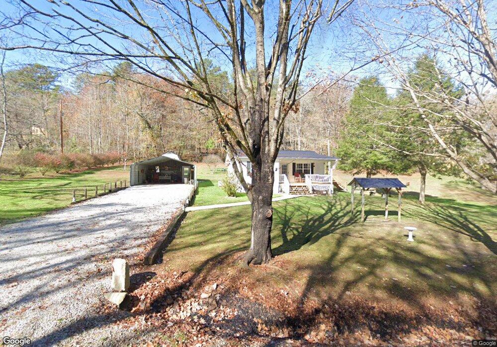
225 Martin Ln Palmer, TN 37365
Estimated Value: $87,000 - $158,000
--
Bed
1
Bath
880
Sq Ft
$134/Sq Ft
Est. Value
About This Home
This home is located at 225 Martin Ln, Palmer, TN 37365 and is currently estimated at $117,732, approximately $133 per square foot. 225 Martin Ln is a home located in Grundy County.
Ownership History
Date
Name
Owned For
Owner Type
Purchase Details
Closed on
May 3, 2002
Sold by
Bryant Mary E
Bought by
Tate Rogers Dwight
Current Estimated Value
Home Financials for this Owner
Home Financials are based on the most recent Mortgage that was taken out on this home.
Original Mortgage
$22,500
Outstanding Balance
$9,628
Interest Rate
7.12%
Estimated Equity
$108,104
Purchase Details
Closed on
Aug 28, 1990
Bought by
Bryant Mary E
Purchase Details
Closed on
Jun 19, 1989
Bought by
United States Of America
Purchase Details
Closed on
Oct 21, 1983
Bought by
Worley Elton J and Worley Ella B
Create a Home Valuation Report for This Property
The Home Valuation Report is an in-depth analysis detailing your home's value as well as a comparison with similar homes in the area
Home Values in the Area
Average Home Value in this Area
Purchase History
| Date | Buyer | Sale Price | Title Company |
|---|---|---|---|
| Tate Rogers Dwight | $25,000 | -- | |
| Bryant Mary E | $25,000 | -- | |
| United States Of America | -- | -- | |
| Worley Elton J | -- | -- |
Source: Public Records
Mortgage History
| Date | Status | Borrower | Loan Amount |
|---|---|---|---|
| Open | Worley Elton J | $22,500 |
Source: Public Records
Tax History Compared to Growth
Tax History
| Year | Tax Paid | Tax Assessment Tax Assessment Total Assessment is a certain percentage of the fair market value that is determined by local assessors to be the total taxable value of land and additions on the property. | Land | Improvement |
|---|---|---|---|---|
| 2024 | $311 | $21,825 | $2,350 | $19,475 |
| 2023 | $311 | $21,825 | $2,350 | $19,475 |
| 2022 | $288 | $13,025 | $1,525 | $11,500 |
| 2021 | $288 | $13,025 | $1,525 | $11,500 |
| 2020 | $288 | $13,025 | $1,525 | $11,500 |
| 2019 | $254 | $10,400 | $1,450 | $8,950 |
| 2018 | $254 | $10,000 | $1,450 | $8,550 |
| 2017 | $254 | $10,000 | $1,450 | $8,550 |
| 2016 | $227 | $8,925 | $1,450 | $7,475 |
| 2015 | $227 | $8,925 | $1,450 | $7,475 |
| 2014 | $226 | $8,905 | $0 | $0 |
Source: Public Records
Map
Nearby Homes
- 0 Main St Unit RTC2796154
- 273 E Lee Dr
- 1565 Main St
- 211 Rock Ave
- 14 Sawmill Rd
- Tract 12 Sawmill Rd
- 13 Sawmill Rd
- 148 Sawmill Rd
- Tract 14 Sawmill Rd
- 12 Sawmill Rd
- Tract 13 Sawmill Rd
- Tract 12 Saw Mill Rd
- Tract 14 Sawmill Rd
- 1077 Rock Ave
- 591 Main St
- 571 Main St
- 1970 Rock Ave
- 0 Keith Brewer Rd
- 1235 Tatesville Rd
- 34 Sr 399
- 259 Martin Ln
- 1 Martin Ln
- 197 Martin Ln
- 4 Martin Ln
- 293 Martin Ln
- 76 Big Mine Rd
- 116 Big Mine Rd
- 80 Big Mine Rd
- 148 Big Mine Rd
- 123 Martin Ln
- 1 Hwy 108
- 0 Hwy 108 Unit 1111563
- 108 Hwy 108
- 0 Hwy 108 Unit 1138523
- 0 Hwy 108 Unit 1017923
- 0 Hwy 108 Unit 1001674
- 95 Hwy 108
- 190 Big Mine Rd
- 117 Martin Ln
- 0 Main St Unit 20175314