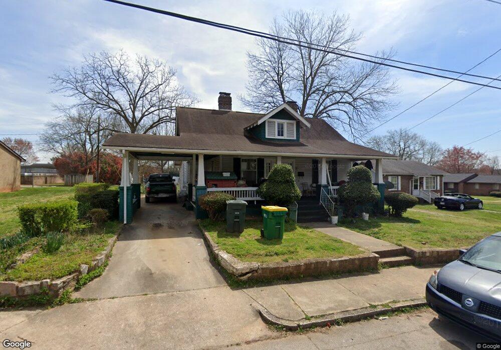
225 S Clay St Salisbury, NC 28144
Estimated Value: $159,000 - $226,000
--
Bed
1
Bath
1,450
Sq Ft
$130/Sq Ft
Est. Value
About This Home
This home is located at 225 S Clay St, Salisbury, NC 28144 and is currently estimated at $188,221, approximately $129 per square foot. 225 S Clay St is a home located in Rowan County with nearby schools including Elizabeth Duncan Koontz Elementary School, Knox Middle School, and North Rowan Middle School.
Ownership History
Date
Name
Owned For
Owner Type
Purchase Details
Closed on
Nov 3, 2021
Sold by
Evans Wanda Michelle
Bought by
Sotelo Guillermo Valdes and Castro Mayra Amaro
Current Estimated Value
Home Financials for this Owner
Home Financials are based on the most recent Mortgage that was taken out on this home.
Original Mortgage
$36,000
Outstanding Balance
$16,935
Interest Rate
2.88%
Mortgage Type
Purchase Money Mortgage
Estimated Equity
$171,286
Purchase Details
Closed on
Jul 27, 1998
Bought by
Evans Wanda Michelle
Create a Home Valuation Report for This Property
The Home Valuation Report is an in-depth analysis detailing your home's value as well as a comparison with similar homes in the area
Home Values in the Area
Average Home Value in this Area
Purchase History
| Date | Buyer | Sale Price | Title Company |
|---|---|---|---|
| Sotelo Guillermo Valdes | $51,000 | None Available | |
| Evans Wanda Michelle | -- | -- |
Source: Public Records
Mortgage History
| Date | Status | Borrower | Loan Amount |
|---|---|---|---|
| Open | Sotelo Guillermo Valdes | $36,000 |
Source: Public Records
Tax History Compared to Growth
Tax History
| Year | Tax Paid | Tax Assessment Tax Assessment Total Assessment is a certain percentage of the fair market value that is determined by local assessors to be the total taxable value of land and additions on the property. | Land | Improvement |
|---|---|---|---|---|
| 2025 | $1,668 | $139,446 | $18,850 | $120,596 |
| 2024 | $1,668 | $139,446 | $18,850 | $120,596 |
| 2023 | $1,668 | $139,446 | $18,850 | $120,596 |
| 2022 | $1,143 | $83,025 | $14,300 | $68,725 |
| 2021 | $1,143 | $83,025 | $14,300 | $68,725 |
| 2020 | $1,143 | $83,025 | $14,300 | $68,725 |
| 2019 | $1,143 | $83,025 | $14,300 | $68,725 |
| 2018 | $996 | $73,297 | $14,300 | $58,997 |
| 2017 | $991 | $73,297 | $14,300 | $58,997 |
| 2016 | $963 | $73,297 | $14,300 | $58,997 |
| 2015 | $969 | $73,297 | $14,300 | $58,997 |
| 2014 | $974 | $74,535 | $12,350 | $62,185 |
Source: Public Records
Map
Nearby Homes
- 301 S Shaver St
- 420 E Bank St
- 409 E Fisher St
- 403 S Long St
- 500 W Council St
- 205 N Martin Luther King jr Ave
- 720 E Council St
- 613 E Liberty St
- 705 E Liberty St
- 119 S Lee St Unit 3
- 316 N Clay St
- 507 Park Ave
- 209 S Main St
- 0 Brown St
- 300 S Main St Unit K
- 501 S Main St
- 123 N Main St
- 505 E Cemetery St
- 322 S Church St
- 5 Cooper St
- 229 S Clay St
- 226 S Clay St
- 216 S Clay St
- 214 S Clay St
- 212 S Clay St
- 518 E Bank St
- 516 E Bank St
- 525 E Fisher St
- 200 S Martin Luther King jr Ave
- 200 S Martin Luther King jr Ave
- 521 E Fisher St
- 512 E Bank St
- 1620 S Boundary St Unit 201
- 517 E Fisher St
- 508 E Bank St
- 524 E Fisher St
- 513 E Bank St
- 530 E Fisher St
- 509 E Fisher St
- 217 S Shaver St