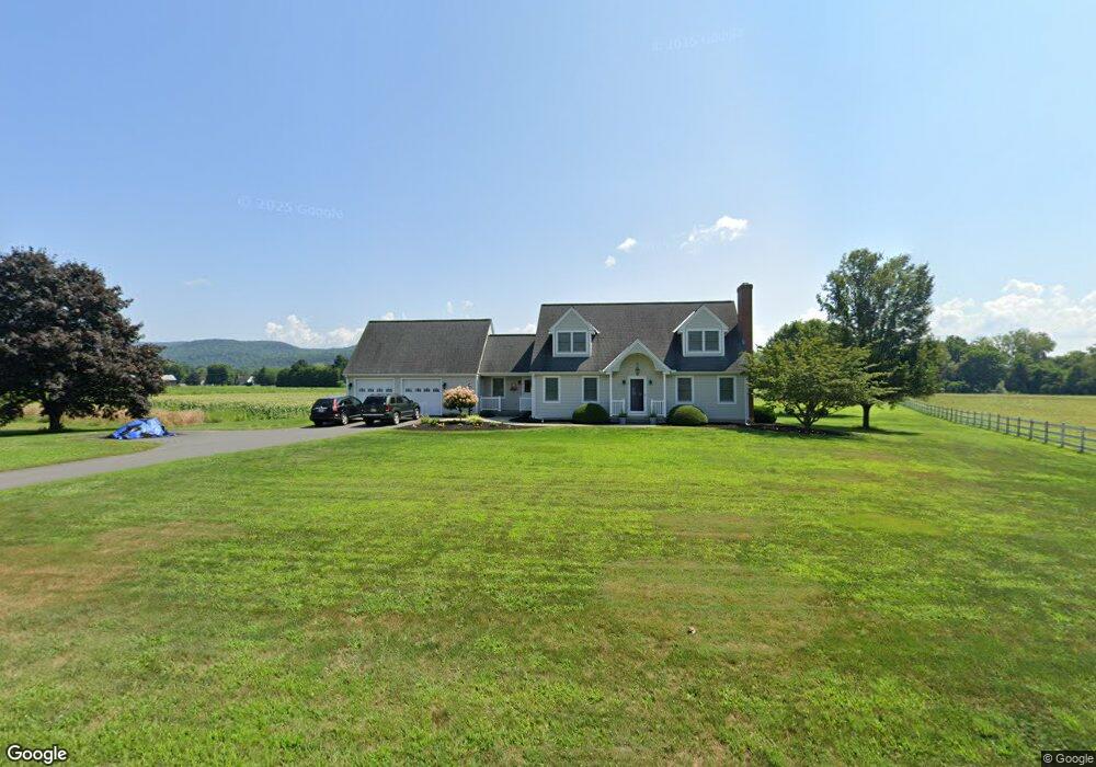
226 River Rd Sunderland, MA 01375
Estimated Value: $600,756 - $697,000
4
Beds
3
Baths
2,538
Sq Ft
$252/Sq Ft
Est. Value
About This Home
This home is located at 226 River Rd, Sunderland, MA 01375 and is currently estimated at $639,439, approximately $251 per square foot. 226 River Rd is a home located in Franklin County with nearby schools including Sunderland Elementary School and Frontier Regional School.
Create a Home Valuation Report for This Property
The Home Valuation Report is an in-depth analysis detailing your home's value as well as a comparison with similar homes in the area
Home Values in the Area
Average Home Value in this Area
Tax History Compared to Growth
Tax History
| Year | Tax Paid | Tax Assessment Tax Assessment Total Assessment is a certain percentage of the fair market value that is determined by local assessors to be the total taxable value of land and additions on the property. | Land | Improvement |
|---|---|---|---|---|
| 2025 | $6,854 | $526,400 | $127,600 | $398,800 |
| 2024 | $6,917 | $526,400 | $127,600 | $398,800 |
| 2023 | $6,362 | $497,000 | $116,000 | $381,000 |
| 2022 | $6,453 | $439,000 | $99,400 | $339,600 |
| 2021 | $2,998 | $391,500 | $92,200 | $299,300 |
| 2020 | $484 | $391,100 | $92,200 | $298,900 |
| 2019 | $553 | $381,300 | $89,500 | $291,800 |
| 2018 | $6,299 | $376,600 | $86,000 | $290,600 |
| 2017 | $3,863 | $375,400 | $86,000 | $289,400 |
| 2016 | $5,499 | $375,100 | $84,200 | $290,900 |
| 2015 | $5,368 | $375,100 | $84,200 | $290,900 |
| 2014 | $5,244 | $375,100 | $84,200 | $290,900 |
Source: Public Records
Map
Nearby Homes
- 146 Old Amherst Rd
- 110 Old Amherst Rd
- 15 S Plain Rd
- Lot C Mountain Rd
- Lot A Mountain Rd
- Lot B Mountain Rd
- 238 N Main St
- 15 Crestview Dr
- 40 Eastern Ave
- 3 Depot Rd
- 32 Swamp Rd
- 24 Graves St
- 0 North St Unit 73407299
- 24 Elm St
- 320 West St
- 13 Capt Lathrop Dr
- 134 Montague Rd
- 73 Depot Rd
- 7 Stage Rd
- 151 Pantry Rd