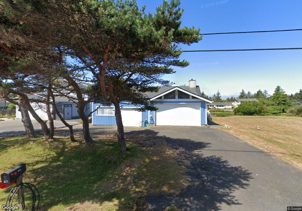
227 Canal Dr NE Ocean Shores, WA 98569
Estimated Value: $299,403 - $402,000
--
Bed
--
Bath
1,189
Sq Ft
$301/Sq Ft
Est. Value
About This Home
This home is located at 227 Canal Dr NE, Ocean Shores, WA 98569 and is currently estimated at $357,851, approximately $300 per square foot. 227 Canal Dr NE is a home located in Grays Harbor County with nearby schools including North Beach Junior/Senior High School.
Ownership History
Date
Name
Owned For
Owner Type
Purchase Details
Closed on
May 7, 2024
Sold by
Goodwin William Robert
Bought by
William R Goodwin Revocable Living Trust and Goodwin
Current Estimated Value
Purchase Details
Closed on
Mar 7, 2018
Sold by
Goodwin Mary E
Bought by
Goodwin William R
Purchase Details
Closed on
Mar 5, 2018
Sold by
Goodwin Mry Ellen Irene
Bought by
Goodwin William Robert
Create a Home Valuation Report for This Property
The Home Valuation Report is an in-depth analysis detailing your home's value as well as a comparison with similar homes in the area
Home Values in the Area
Average Home Value in this Area
Purchase History
| Date | Buyer | Sale Price | Title Company |
|---|---|---|---|
| William R Goodwin Revocable Living Trust | -- | None Listed On Document | |
| Goodwin William R | -- | None Listed On Document | |
| Goodwin William Robert | -- | None Available |
Source: Public Records
Tax History Compared to Growth
Tax History
| Year | Tax Paid | Tax Assessment Tax Assessment Total Assessment is a certain percentage of the fair market value that is determined by local assessors to be the total taxable value of land and additions on the property. | Land | Improvement |
|---|---|---|---|---|
| 2025 | $1,884 | $297,578 | $85,500 | $212,078 |
| 2023 | $1,419 | $293,080 | $103,520 | $189,560 |
| 2022 | $1,983 | $234,601 | $69,000 | $165,601 |
| 2021 | $2,085 | $234,601 | $69,000 | $165,601 |
| 2020 | $1,987 | $201,952 | $60,000 | $141,952 |
| 2019 | $1,666 | $185,192 | $50,000 | $135,192 |
| 2018 | $1,758 | $151,222 | $40,000 | $111,222 |
| 2017 | $1,393 | $150,830 | $40,000 | $110,830 |
| 2016 | $1,353 | $116,985 | $34,500 | $82,485 |
| 2014 | -- | $118,265 | $24,500 | $93,765 |
| 2013 | -- | $132,820 | $35,000 | $97,820 |
Source: Public Records
Map
Nearby Homes
- 213 Canal Dr NE
- 255 Canal Dr NE
- 226 Point Brown Ave NE
- 248 Ensign Ave NW
- 275 Canal Dr NE
- 269 Ensign Ave NW
- 212 Point Brown Ave NE
- 262 Octopus Ave NE
- 198 Octopus Ave NE
- 237 Clover Creek Ave NW
- 324 Mizzen Ave NW
- 247 Clover Creek Ave NW
- 148 N Narwhal Loop NW
- 285 Mast Ave NW
- 172 N Narwhal Loop NW
- 165 N Narwhal Loop NW
- 333 Canal Dr NE
- 284 Mast Ave NW
- 212 Dolphin Ave NE
- 260 Dolphin Ave NE
- 221 Canal Dr NE
- 231 Canal Dr NE
- 221 Canal Dr NE
- 238 Canal Dr NE
- 207 Canal Dr NE
- 228 Canal Dr NE
- 222 Canal Dr NE
- 234 Canal Dr NE
- 214 Canal Dr NE
- 251 Canal Dr NE
- 201 Canal Dr NE
- 242 Canal Dr NE
- 272 Point Brown Ave NE
- 266 Point Brown Ave NE
- 276 Point Brown Ave NE
- 206 Canal Dr NE
- 260 Point Brown Ave NE
- 280 Point Brown Ave NE
- 199 Canal Dr NE
- 256 Point Brown Ave NE