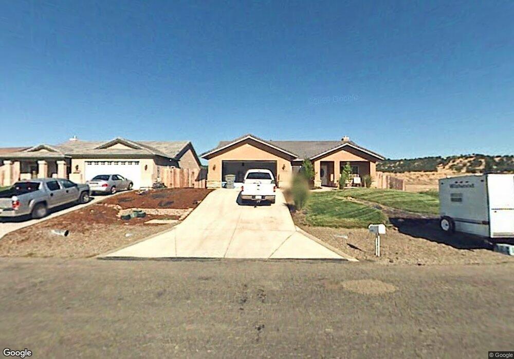
22796 Rio Alto Dr Cottonwood, CA 96022
Estimated Value: $403,926 - $518,000
4
Beds
2
Baths
1,880
Sq Ft
$234/Sq Ft
Est. Value
About This Home
This home is located at 22796 Rio Alto Dr, Cottonwood, CA 96022 and is currently estimated at $440,232, approximately $234 per square foot. 22796 Rio Alto Dr is a home located in Tehama County with nearby schools including Evergreen Elementary School, Bend Elementary School, and Evergreen Middle School.
Ownership History
Date
Name
Owned For
Owner Type
Purchase Details
Closed on
Jun 29, 2022
Sold by
Wing Jeffery D and Wing Joanna
Bought by
Wing Jeffery and Wing Joanna
Current Estimated Value
Purchase Details
Closed on
Mar 22, 2022
Sold by
Wing Jeffery D
Bought by
Wing Jeffery D and Wing Joanna
Purchase Details
Closed on
Aug 19, 2009
Sold by
Shriver Joseph E and Shriver Michelle
Bought by
Wing Jeffrey D
Home Financials for this Owner
Home Financials are based on the most recent Mortgage that was taken out on this home.
Original Mortgage
$201,848
Interest Rate
5.17%
Mortgage Type
VA
Purchase Details
Closed on
Dec 7, 2005
Sold by
Langford Daniel and Langford Sara
Bought by
Shriver Joseph E and Shriver Michelle
Home Financials for this Owner
Home Financials are based on the most recent Mortgage that was taken out on this home.
Original Mortgage
$260,000
Interest Rate
6.25%
Mortgage Type
Fannie Mae Freddie Mac
Purchase Details
Closed on
Aug 16, 2004
Sold by
Davidson Charles K and Davidson Marilyn A
Bought by
Langford Daniel and Langford Sara
Home Financials for this Owner
Home Financials are based on the most recent Mortgage that was taken out on this home.
Original Mortgage
$231,250
Interest Rate
5.94%
Mortgage Type
Unknown
Purchase Details
Closed on
Feb 9, 2004
Sold by
Camacho Luis R and Camacho Martha G
Bought by
Davidson Charles K and Davidson Marilyn A
Home Financials for this Owner
Home Financials are based on the most recent Mortgage that was taken out on this home.
Original Mortgage
$36,575
Interest Rate
6%
Mortgage Type
Unknown
Purchase Details
Closed on
Apr 27, 2002
Sold by
Land Resource & Development Corp
Bought by
Camacho Luis R and Camacho Martha G
Home Financials for this Owner
Home Financials are based on the most recent Mortgage that was taken out on this home.
Original Mortgage
$28,800
Interest Rate
7.13%
Mortgage Type
Seller Take Back
Purchase Details
Closed on
Dec 6, 2001
Sold by
Hill Sydna C
Bought by
Land Resource & Development Corp
Create a Home Valuation Report for This Property
The Home Valuation Report is an in-depth analysis detailing your home's value as well as a comparison with similar homes in the area
Home Values in the Area
Average Home Value in this Area
Purchase History
| Date | Buyer | Sale Price | Title Company |
|---|---|---|---|
| Wing Jeffery | -- | Placer Title | |
| Wing Jeffery D | -- | None Listed On Document | |
| Wing Jeffrey D | $198,000 | Placer Title Company | |
| Shriver Joseph E | $325,000 | Placer Title Company | |
| Langford Daniel | $60,000 | Fidelity National Title | |
| Davidson Charles K | $38,500 | Fidelity Natl Title Co Of Ca | |
| Camacho Luis R | $36,000 | Fidelity National Title Co | |
| Land Resource & Development Corp | -- | Fidelity National Title Co |
Source: Public Records
Mortgage History
| Date | Status | Borrower | Loan Amount |
|---|---|---|---|
| Previous Owner | Wing Jeffrey D | $201,848 | |
| Previous Owner | Shriver Joseph E | $260,000 | |
| Previous Owner | Langford Daniel | $231,250 | |
| Previous Owner | Davidson Charles K | $36,575 | |
| Previous Owner | Camacho Luis R | $28,800 |
Source: Public Records
Tax History Compared to Growth
Tax History
| Year | Tax Paid | Tax Assessment Tax Assessment Total Assessment is a certain percentage of the fair market value that is determined by local assessors to be the total taxable value of land and additions on the property. | Land | Improvement |
|---|---|---|---|---|
| 2025 | $4,179 | $370,990 | $85,761 | $285,229 |
| 2023 | $4,127 | $356,586 | $82,432 | $274,154 |
| 2022 | $2,661 | $240,348 | $60,816 | $179,532 |
| 2021 | $2,617 | $235,636 | $59,624 | $176,012 |
| 2020 | $2,615 | $233,221 | $59,013 | $174,208 |
| 2019 | $2,604 | $228,649 | $57,856 | $170,793 |
| 2018 | $2,494 | $224,167 | $56,722 | $167,445 |
| 2017 | $2,346 | $204,068 | $48,300 | $155,768 |
| 2016 | $2,193 | $194,350 | $46,000 | $148,350 |
| 2015 | $2,192 | $194,350 | $46,000 | $148,350 |
| 2014 | $1,997 | $169,000 | $40,000 | $129,000 |
Source: Public Records
Map
Nearby Homes
- 22730 Rio Alto Dr
- 22626 Rio Alto Dr
- 22570 Rio Alto Dr
- 22784 River View Dr
- 19300 Sloop Ln
- 22747 River View Dr
- 19281 Sloop Ln
- 19228 Alee Place
- 22536 Rio Alto Dr
- 19188 Alee Place
- 19252 Shoal Place
- 19273 Shoal Place
- 19176 Yar Place
- 19173 Yar Place
- 22496 Rio Alto Dr
- 19178 Banner Way
- 19175 Banner Way
- 22599 N Marina Way
- 19237 Sandpiper Ln
- 19821 Antelope Creek Dr
- 22792 Rio Alto Dr
- 22806 Rio Alto Dr
- 22770 Rio Alto Dr
- 22764 Rio Alto Dr
- 22808 Rio Alto Dr
- 22758 Rio Alto Dr Unit River View Drive
- 22752 Rio Alto Dr Unit LOT 35
- 22812 Rio Alto Dr
- 22814 Rio Alto Dr
- 22736 Rio Alto Dr
- 22816 Rio Alto Dr
- 22730 Rio Alto 1weup7muekg4
- 22818 Rio Alto Dr
- 22724 Rio Alto Dr
- 22820 Rio Alto Dr Unit lot 15
- 22820 Rio Alto Dr
- 22718 Rio Alto Dr
- 22824 Rio Alto Dr
- 22826 Rio Alto Dr
- 22828 Rio Alto Dr