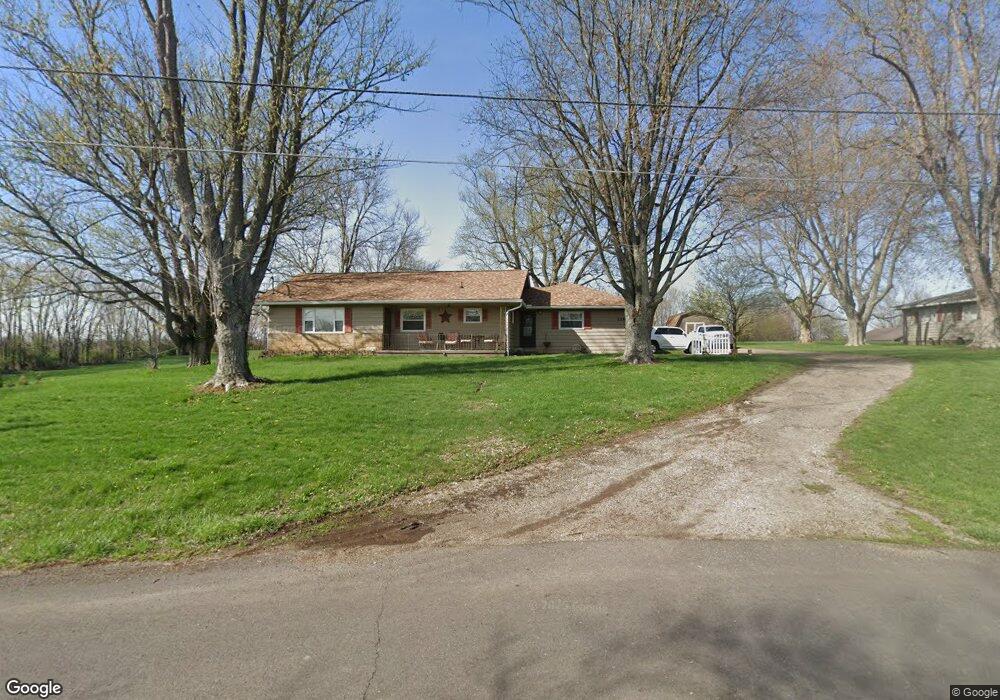
2285 Clay Pike Zanesville, OH 43701
Estimated Value: $196,000 - $264,629
3
Beds
2
Baths
1,364
Sq Ft
$171/Sq Ft
Est. Value
About This Home
This home is located at 2285 Clay Pike, Zanesville, OH 43701 and is currently estimated at $232,657, approximately $170 per square foot. 2285 Clay Pike is a home located in Muskingum County with nearby schools including Philo High School, Zanesville Community School, and Bishop Fenwick School.
Ownership History
Date
Name
Owned For
Owner Type
Purchase Details
Closed on
Jun 7, 2024
Sold by
Vousden Aaron M and Vousden Maria S
Bought by
Vousden Cory J
Current Estimated Value
Home Financials for this Owner
Home Financials are based on the most recent Mortgage that was taken out on this home.
Original Mortgage
$127,724
Outstanding Balance
$126,156
Interest Rate
7.22%
Mortgage Type
New Conventional
Estimated Equity
$106,501
Purchase Details
Closed on
Feb 8, 2005
Sold by
Estate Of John E Vousden
Bought by
Vousden Carol S
Create a Home Valuation Report for This Property
The Home Valuation Report is an in-depth analysis detailing your home's value as well as a comparison with similar homes in the area
Home Values in the Area
Average Home Value in this Area
Purchase History
| Date | Buyer | Sale Price | Title Company |
|---|---|---|---|
| Vousden Cory J | $125,000 | Northwest Title | |
| Vousden Carol S | -- | -- |
Source: Public Records
Mortgage History
| Date | Status | Borrower | Loan Amount |
|---|---|---|---|
| Open | Vousden Cory J | $127,724 |
Source: Public Records
Tax History Compared to Growth
Tax History
| Year | Tax Paid | Tax Assessment Tax Assessment Total Assessment is a certain percentage of the fair market value that is determined by local assessors to be the total taxable value of land and additions on the property. | Land | Improvement |
|---|---|---|---|---|
| 2024 | $1,686 | $50,995 | $6,300 | $44,695 |
| 2023 | $985 | $38,185 | $4,725 | $33,460 |
| 2022 | $960 | $38,185 | $4,725 | $33,460 |
| 2021 | $945 | $38,185 | $4,725 | $33,460 |
| 2020 | $852 | $34,720 | $4,305 | $30,415 |
| 2019 | $850 | $34,720 | $4,305 | $30,415 |
| 2018 | $869 | $34,720 | $4,305 | $30,415 |
| 2017 | $638 | $26,530 | $4,305 | $22,225 |
| 2016 | $613 | $26,540 | $4,310 | $22,230 |
| 2015 | $630 | $26,540 | $4,310 | $22,230 |
| 2013 | $1,008 | $26,540 | $4,310 | $22,230 |
Source: Public Records
Map
Nearby Homes
- 2420 Sherwood Hills
- 2465 Clay Pike
- 440 Stardust Cir
- 0 East Pike Unit 5163133
- 2383 Chandlersville Rd
- 2425 S Pleasant Grove Rd
- 2850 Watson Way
- 1636 Sharon Ave
- 0 Wayne Ridge Rd Unit 5141409
- 240 Mockingbird Hill
- 330 Jordan Ave
- 1380 Wheeling Ave
- 1328 Pallas Ave
- 1365 Sharon (Rear) Ave
- 27 Cemetery Ave
- 1321 Wheeling Ave
- 1345 Eastman St
- 1332 Sunrise Ave
- 0 Greenwood Ave
- 484 Haessler Ave
- 2305 Clay Pike
- 2290 Clay Pike
- 2275 Clay Pike
- 2255 Clay Pike
- 2255 Clay Pike
- 2300 Clay Pike
- 2325 Clay Pike
- 2345 Clay Pike
- 395 Robin Hood Ln
- 385 Robin Hood Ln
- 2224 Clay Pike
- 2235 Clay Pike
- 375 Robin Hood Ln
- 2365 Clay Pike
- 365 Robin Hood Ln
- 2220 Clay Pike
- 2375 Clay Pike
- 370 Robin Hood Ln
- 2185 Clay Pike
- 355 Robin Hood Ln