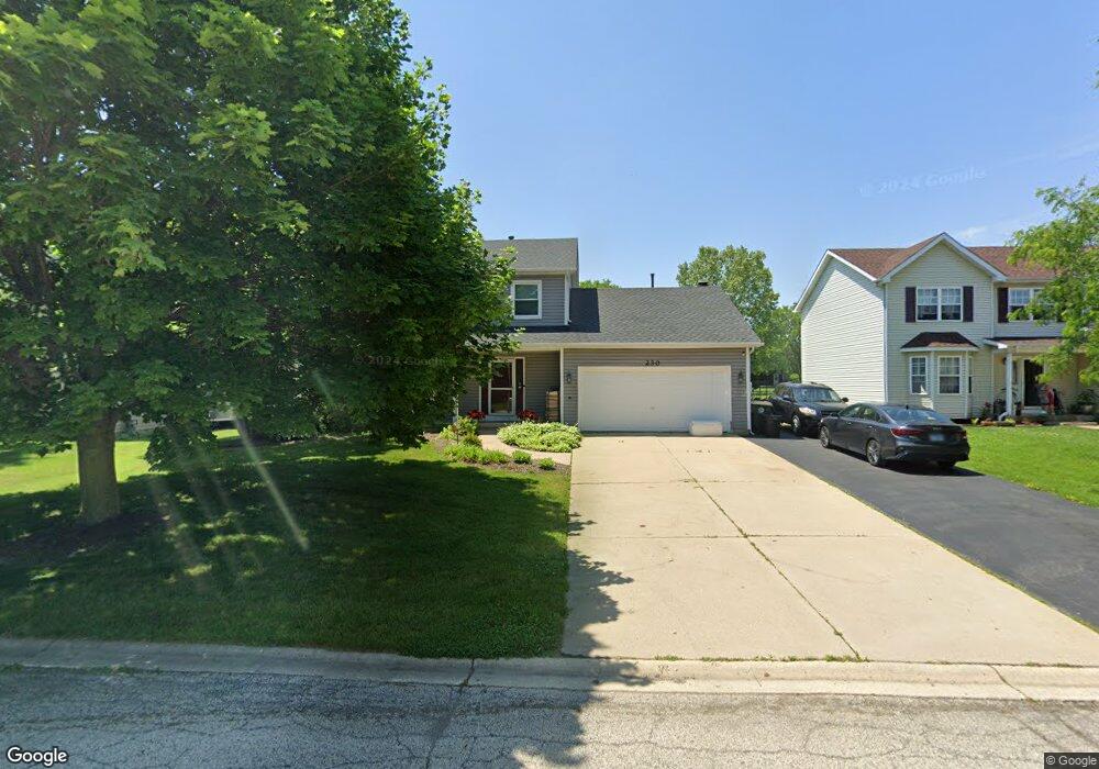
230 Potomac Ln Winthrop Harbor, IL 60096
Estimated Value: $326,252 - $394,000
3
Beds
3
Baths
1,848
Sq Ft
$197/Sq Ft
Est. Value
About This Home
This home is located at 230 Potomac Ln, Winthrop Harbor, IL 60096 and is currently estimated at $364,313, approximately $197 per square foot. 230 Potomac Ln is a home located in Lake County with nearby schools including Westfield School, North Prairie Junior High School, and Zion-Benton Township High School.
Ownership History
Date
Name
Owned For
Owner Type
Purchase Details
Closed on
Feb 23, 1996
Sold by
Vandreese Gregory D and Vandreese Rhonda J
Bought by
Sperry Mark W and Sperry Deborah L
Current Estimated Value
Home Financials for this Owner
Home Financials are based on the most recent Mortgage that was taken out on this home.
Original Mortgage
$161,500
Outstanding Balance
$5,316
Interest Rate
7.07%
Estimated Equity
$358,997
Purchase Details
Closed on
Jun 14, 1994
Sold by
Bank Of Waukegan
Bought by
Vandreese Gregory D and Vandreese Rhonda J
Create a Home Valuation Report for This Property
The Home Valuation Report is an in-depth analysis detailing your home's value as well as a comparison with similar homes in the area
Home Values in the Area
Average Home Value in this Area
Purchase History
| Date | Buyer | Sale Price | Title Company |
|---|---|---|---|
| Sperry Mark W | $170,000 | -- | |
| Vandreese Gregory D | $31,000 | -- |
Source: Public Records
Mortgage History
| Date | Status | Borrower | Loan Amount |
|---|---|---|---|
| Open | Sperry Mark W | $161,500 |
Source: Public Records
Tax History Compared to Growth
Tax History
| Year | Tax Paid | Tax Assessment Tax Assessment Total Assessment is a certain percentage of the fair market value that is determined by local assessors to be the total taxable value of land and additions on the property. | Land | Improvement |
|---|---|---|---|---|
| 2024 | $7,485 | $83,723 | $7,008 | $76,715 |
| 2023 | $7,107 | $77,832 | $6,765 | $71,067 |
| 2022 | $7,107 | $70,938 | $6,610 | $64,328 |
| 2021 | $7,274 | $69,134 | $6,442 | $62,692 |
| 2020 | $7,051 | $65,974 | $6,148 | $59,826 |
| 2019 | $6,876 | $62,594 | $5,833 | $56,761 |
| 2018 | $7,048 | $63,758 | $7,000 | $56,758 |
| 2017 | $6,992 | $59,979 | $6,585 | $53,394 |
| 2016 | $6,807 | $57,101 | $6,269 | $50,832 |
| 2015 | $6,680 | $52,367 | $5,749 | $46,618 |
| 2014 | $7,186 | $57,885 | $12,295 | $45,590 |
| 2012 | $7,072 | $60,153 | $12,777 | $47,376 |
Source: Public Records
Map
Nearby Homes
- 429 Megan Place
- 242 Thompson Ave
- 0 Garnett Ave
- 432 Megan Place
- 436 Megan Place
- 11279 W Russell Rd
- 12122 28th Ave
- 12111 28th Ave
- 43100 N Lewis Ave
- Lt0 39th Ave
- 42908 N Lewis Ave
- 1810 5th St
- Lt0 128th St
- 210 Oak Ln
- 830 Russell Ave
- 630 Whitney Ave
- 3109 11th St
- 737 Franklin Ave
- 3106 13th St
- 1228 Pennsylvania Ave
- 226 Potomac Ln
- 240 Potomac Ln
- 256 Potomac Ln
- 222 Potomac Ln
- 233 Potomac Ln
- 235 Old Darby Ln
- 260 Potomac Ln
- 229 Potomac Ln
- 214 Potomac Ln
- 237 Potomac Ln
- 225 Potomac Ln
- 225 Old Darby Ln
- 257 Potomac Ln
- 208 Potomac Ln
- 261 Potomac Ln
- 221 Potomac Ln
- 253 Potomac Ln
- 215 Old Darby Ln
- 241 Potomac Ln
- 205 Old Darby Ln