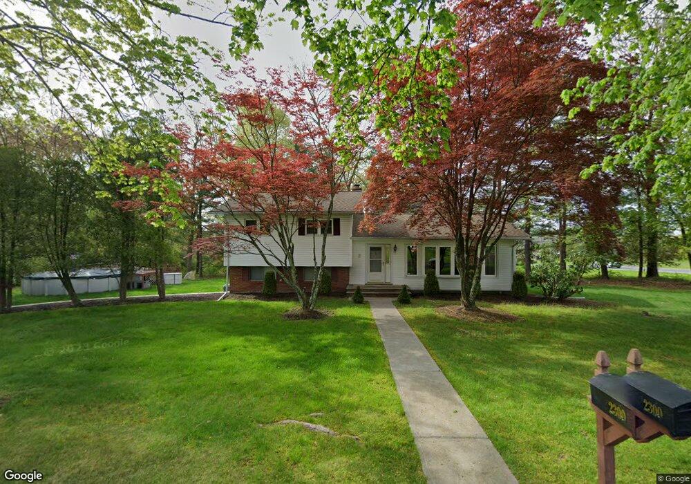
2300 Hawthorne Dr Yorktown Heights, NY 10598
Estimated Value: $706,000 - $806,000
3
Beds
1
Bath
1,470
Sq Ft
$511/Sq Ft
Est. Value
About This Home
This home is located at 2300 Hawthorne Dr, Yorktown Heights, NY 10598 and is currently estimated at $751,195, approximately $511 per square foot. 2300 Hawthorne Dr is a home located in Westchester County with nearby schools including Yorktown High School, Maryel School of New York - Westchester, and St. Patrick School.
Ownership History
Date
Name
Owned For
Owner Type
Purchase Details
Closed on
Apr 6, 2020
Sold by
Salerno Ralph Joseph and Salerno Judith Evelyn
Bought by
Salerno Judith Evelyn
Current Estimated Value
Purchase Details
Closed on
Oct 15, 2003
Sold by
Otero Louis and Otero Ariadna
Bought by
Salerno Ralph Joseph and Salerno Judith Evelyn
Home Financials for this Owner
Home Financials are based on the most recent Mortgage that was taken out on this home.
Original Mortgage
$322,700
Interest Rate
6.05%
Mortgage Type
Unknown
Create a Home Valuation Report for This Property
The Home Valuation Report is an in-depth analysis detailing your home's value as well as a comparison with similar homes in the area
Home Values in the Area
Average Home Value in this Area
Purchase History
| Date | Buyer | Sale Price | Title Company |
|---|---|---|---|
| Salerno Judith Evelyn | -- | Judicial Title | |
| Salerno Ralph Joseph | $415,000 | -- |
Source: Public Records
Mortgage History
| Date | Status | Borrower | Loan Amount |
|---|---|---|---|
| Previous Owner | Salerno Ralph Joseph | $322,700 |
Source: Public Records
Tax History Compared to Growth
Tax History
| Year | Tax Paid | Tax Assessment Tax Assessment Total Assessment is a certain percentage of the fair market value that is determined by local assessors to be the total taxable value of land and additions on the property. | Land | Improvement |
|---|---|---|---|---|
| 2024 | $13,123 | $9,450 | $1,550 | $7,900 |
| 2023 | $12,610 | $9,450 | $1,550 | $7,900 |
| 2022 | $12,176 | $9,450 | $1,550 | $7,900 |
| 2021 | $11,965 | $9,450 | $1,550 | $7,900 |
| 2020 | $11,814 | $9,450 | $1,550 | $7,900 |
| 2019 | $11,395 | $9,450 | $1,550 | $7,900 |
| 2018 | $11,277 | $9,450 | $1,550 | $7,900 |
| 2017 | $7,198 | $9,450 | $1,550 | $7,900 |
| 2016 | $21,991 | $9,450 | $1,550 | $7,900 |
| 2015 | $7,499 | $9,450 | $1,550 | $7,900 |
| 2014 | $7,499 | $9,450 | $1,550 | $7,900 |
| 2013 | $7,499 | $9,450 | $1,550 | $7,900 |
Source: Public Records
Map
Nearby Homes
- 1811 Soundview Ct
- 1804 Soundview Ct
- 1807 Soundview Ct
- 1802 Soundview Ct
- 1813 Soundview Ct
- 1808 Soundview Ct
- 1805 Soundview Ct
- 1815 Soundview Ct
- 1812 Soundview Ct
- 1803 Soundview Ct
- 1817 Soundview Ct
- 1806 Soundview Ct
- 1809 Soundview Ct
- 1819 Soundview Ct
- 1810 Soundview Ct
- 1801 Soundview Ct
- 2327 Vista Ct
- 2022 van Cortlandt Cir
- 1991 Baldwin Rd
- 2164 White Birch Dr
- 2316 Hawthorne Dr
- 2321 Hawthorne Dr
- 2354 Crompond Rd
- 2326 Hawthorne Dr
- 2331 Crompond Rd
- 2323 Crompond Rd
- 2347 Crompond Rd
- 2365 Loring Place
- 2362 Crompond Rd
- 2337 Crompond Rd
- 2334 Hawthorne Dr
- 587 Madison Ct
- 2370 Crompond Rd
- 2375 Loring Place
- 2370 Crompond Rd
- 2340 Hawthorne Dr
- 2367 Crompond Rd
- 589 Madison Ct
- 2381 Loring Place
- 2380 Crompond Rd