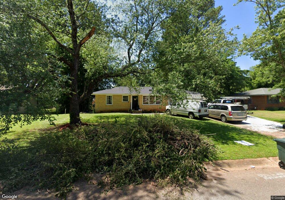
2301 Shady Lane Dr NW Huntsville, AL 35810
Mastin Lake Park NeighborhoodEstimated Value: $122,000 - $204,000
--
Bed
--
Bath
1,086
Sq Ft
$141/Sq Ft
Est. Value
About This Home
This home is located at 2301 Shady Lane Dr NW, Huntsville, AL 35810 and is currently estimated at $153,333, approximately $141 per square foot. 2301 Shady Lane Dr NW is a home with nearby schools including Highlands Elementary School, Ronald E. McNair Junior High School, and Jemison High School.
Ownership History
Date
Name
Owned For
Owner Type
Purchase Details
Closed on
May 10, 2024
Sold by
Rei Dad Nation Llc
Bought by
Jw Empire Llc
Current Estimated Value
Purchase Details
Closed on
Oct 30, 2021
Sold by
Cook Douglas W
Bought by
Rei Dad Nation Llc
Home Financials for this Owner
Home Financials are based on the most recent Mortgage that was taken out on this home.
Original Mortgage
$51,825
Interest Rate
3.14%
Mortgage Type
Construction
Purchase Details
Closed on
May 27, 2021
Sold by
Meigs Frederick K and Estate Of Mattie Lee Swoope Co
Bought by
Cook Douglas W
Create a Home Valuation Report for This Property
The Home Valuation Report is an in-depth analysis detailing your home's value as well as a comparison with similar homes in the area
Home Values in the Area
Average Home Value in this Area
Purchase History
| Date | Buyer | Sale Price | Title Company |
|---|---|---|---|
| Jw Empire Llc | -- | None Listed On Document | |
| Jw Empire Llc | -- | None Listed On Document | |
| Rei Dad Nation Llc | $17,000 | -- | |
| Rei Dad Nation Llc | $17,000 | None Listed On Document | |
| Cook Douglas W | -- | None Available |
Source: Public Records
Mortgage History
| Date | Status | Borrower | Loan Amount |
|---|---|---|---|
| Previous Owner | Rei Dad Nation Llc | $51,825 |
Source: Public Records
Tax History Compared to Growth
Tax History
| Year | Tax Paid | Tax Assessment Tax Assessment Total Assessment is a certain percentage of the fair market value that is determined by local assessors to be the total taxable value of land and additions on the property. | Land | Improvement |
|---|---|---|---|---|
| 2024 | $813 | $11,980 | $3,040 | $8,940 |
| 2023 | $695 | $11,980 | $3,040 | $8,940 |
| 2022 | $770 | $13,280 | $3,040 | $10,240 |
| 2021 | $654 | $11,280 | $2,140 | $9,140 |
| 2020 | $621 | $10,700 | $2,140 | $8,560 |
| 2019 | $579 | $9,980 | $2,140 | $7,840 |
| 2018 | $570 | $9,820 | $0 | $0 |
| 2017 | $570 | $9,820 | $0 | $0 |
| 2016 | $570 | $9,820 | $0 | $0 |
| 2015 | $519 | $8,940 | $0 | $0 |
| 2014 | $448 | $7,720 | $0 | $0 |
Source: Public Records
Map
Nearby Homes
- 4507 Sparkman Dr NW
- 3911 Sparkman Dr NW
- 2410 Halmac Dr NW
- 3702 Broadmor Rd NW
- 4006 Mcewen Dr NW
- 3906 Broadmor Rd NW
- 2420 Redmont Rd NW
- 2111 Shady Lane Cir NW
- 3.92 Acres Sparkman Dr NW
- 2603 Bonnie View Dr
- 2505 Piney Branch Rd NW
- 2215 Morningside Dr NW
- 3927 Shamrock Dr NW
- 3104 Stewart St NW
- 3628 Grizzard Rd NW
- 3605 Sparkman Dr NW
- 3210 Tucker Dr NW
- 2217 Linde St NW
- 2303 Dogwood Ln NW
- 2506 Skyline Dr NW
- 2225 Shady Lane Dr NW
- 2303 Shady Lane Dr NW
- 2223 Shady Lane Dr NW
- 3601 Broadmor Rd NW
- 2222 Shady Lane Dr NW
- 2532 Brookline Dr NW
- 2530 Brookline Dr NW
- 2534 Brookline Dr NW
- 2221 Shady Lane Dr NW
- 2220 Shady Lane Dr NW
- 2528 Brookline Dr NW
- 2526 Brookline Dr NW
- 2302 Shady Lane Dr NW
- 3603 Broadmor Rd NW
- 4407 Sparkman Dr NW
- 4005 Sparkman Dr NW
- 2219 Glen Iris Rd NW
- 2218 Shady Lane Dr NW
- 2219 Shady Lane Dr NW
- 4003 Sparkman Dr NW