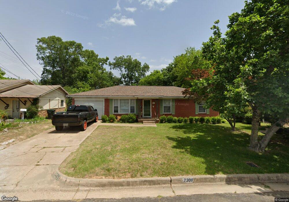
2308 Airline Dr Tyler, TX 75701
Midtown Tyler NeighborhoodEstimated Value: $169,396 - $208,000
--
Bed
2
Baths
1,321
Sq Ft
$148/Sq Ft
Est. Value
About This Home
This home is located at 2308 Airline Dr, Tyler, TX 75701 and is currently estimated at $194,849, approximately $147 per square foot. 2308 Airline Dr is a home located in Smith County with nearby schools including Bell Elementary School, Moore Middle School, and Tyler High School.
Ownership History
Date
Name
Owned For
Owner Type
Purchase Details
Closed on
Aug 30, 2016
Sold by
Etoile Investmetn Ltd
Bought by
Dowdy Darin and Dowdy Courtney
Current Estimated Value
Home Financials for this Owner
Home Financials are based on the most recent Mortgage that was taken out on this home.
Original Mortgage
$96,000
Interest Rate
3.43%
Mortgage Type
Purchase Money Mortgage
Purchase Details
Closed on
May 6, 2008
Sold by
Daniel David Simpson and Daniel John Walter
Bought by
Kimble Charles and Kimble Allison
Home Financials for this Owner
Home Financials are based on the most recent Mortgage that was taken out on this home.
Original Mortgage
$53,000
Interest Rate
5.86%
Mortgage Type
Purchase Money Mortgage
Purchase Details
Closed on
Feb 12, 2008
Sold by
Dodgen Mary Alice
Bought by
Hodge De De Dodgen and Dodgen Jason Daniel
Create a Home Valuation Report for This Property
The Home Valuation Report is an in-depth analysis detailing your home's value as well as a comparison with similar homes in the area
Home Values in the Area
Average Home Value in this Area
Purchase History
| Date | Buyer | Sale Price | Title Company |
|---|---|---|---|
| Dowdy Darin | -- | None Available | |
| Kimble Charles | -- | None Available | |
| Hodge De De Dodgen | -- | None Available |
Source: Public Records
Mortgage History
| Date | Status | Borrower | Loan Amount |
|---|---|---|---|
| Closed | Dowdy Darin | $96,000 | |
| Previous Owner | Kimble Charles | $53,000 |
Source: Public Records
Tax History Compared to Growth
Tax History
| Year | Tax Paid | Tax Assessment Tax Assessment Total Assessment is a certain percentage of the fair market value that is determined by local assessors to be the total taxable value of land and additions on the property. | Land | Improvement |
|---|---|---|---|---|
| 2025 | $2,844 | $185,475 | $24,004 | $161,471 |
| 2024 | $2,844 | $167,174 | $12,168 | $163,850 |
| 2023 | $2,428 | $139,312 | $12,168 | $127,144 |
| 2022 | $2,566 | $130,967 | $12,168 | $118,799 |
| 2021 | $2,501 | $119,223 | $12,168 | $107,055 |
| 2020 | $2,487 | $116,216 | $12,168 | $104,048 |
| 2019 | $2,221 | $101,585 | $6,760 | $94,825 |
| 2018 | $2,093 | $96,249 | $6,760 | $89,489 |
| 2017 | $2,097 | $98,209 | $6,760 | $91,449 |
| 2016 | $1,502 | $70,374 | $6,760 | $63,614 |
| 2015 | $1,169 | $67,627 | $6,760 | $60,867 |
| 2014 | $1,169 | $65,390 | $6,760 | $58,630 |
Source: Public Records
Map
Nearby Homes
- 2408 Hunter St
- 2015 E 5th St
- 2331 Hunter St
- 1715 Ridgeview Dr
- 1914 Parklen St
- 1910 E Lake St
- 834 S Tipton Ave
- 2320 Sarasota Dr
- 2313 Danica Dr
- 2801 Valley View St
- 2713 Tanglewood Dr
- 912 S Palmer Ave
- 1528 E Devine St
- 1730 S Mahon Ave
- 2713 Brentwood Dr
- 2607 Old Henderson Hwy
- 1725 S Mahon Ave
- 837 S Palmer Ave
- 2931 Meadow Brook Trail
- 1929 Oakhurst Cir
- 2304 Airline Dr
- 2312 Airline Dr
- 1400 Golden Rd
- 2309 Airline Dr
- 1414 Golden Rd
- 2318 2318 Airline
- 2307 Airline Dr
- 2311 Airline Dr
- 2318 Airline Dr
- 2305 Airline Dr
- 2307 Lingner Dr
- 2315 Lingner Dr
- 2303 Airline Dr
- 2301 Lingner Dr
- 1428 Golden Rd
- 1416 Golden Rd
- 2322 Airline Dr
- 2321 Lingner Dr
- 2317 Airline Dr
- 2210 Airline Dr