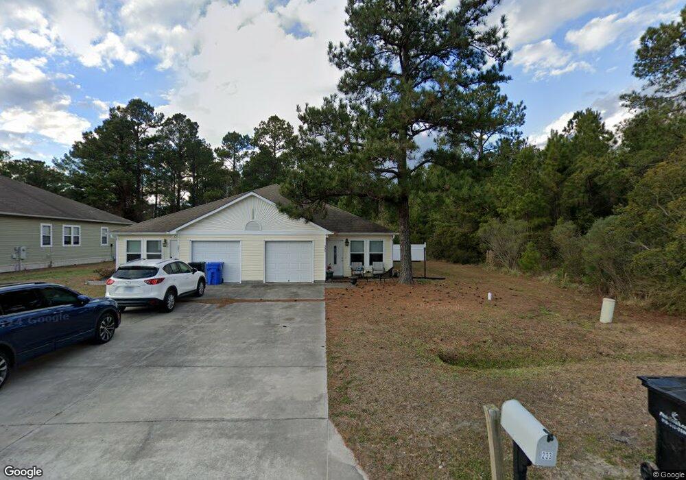
231 Lloyd St Surf City, NC 28445
Estimated Value: $362,857 - $1,198,000
2
Beds
2
Baths
1,000
Sq Ft
$623/Sq Ft
Est. Value
About This Home
This home is located at 231 Lloyd St, Surf City, NC 28445 and is currently estimated at $623,214, approximately $623 per square foot. 231 Lloyd St is a home located in Onslow County with nearby schools including Coastal Elementary, Dixon Elementary School, and Dixon High School.
Ownership History
Date
Name
Owned For
Owner Type
Purchase Details
Closed on
Jun 8, 2017
Sold by
Pearl Valley Llc
Bought by
Hesse David A and Hesse Susan P
Current Estimated Value
Home Financials for this Owner
Home Financials are based on the most recent Mortgage that was taken out on this home.
Original Mortgage
$116,250
Outstanding Balance
$96,722
Interest Rate
4.03%
Mortgage Type
New Conventional
Estimated Equity
$526,492
Purchase Details
Closed on
Feb 19, 2009
Sold by
Royal Builders Of Topsail Island Inc
Bought by
Pearl Valley Llc
Create a Home Valuation Report for This Property
The Home Valuation Report is an in-depth analysis detailing your home's value as well as a comparison with similar homes in the area
Home Values in the Area
Average Home Value in this Area
Purchase History
| Date | Buyer | Sale Price | Title Company |
|---|---|---|---|
| Hesse David A | $155,000 | None Available | |
| Pearl Valley Llc | -- | None Available |
Source: Public Records
Mortgage History
| Date | Status | Borrower | Loan Amount |
|---|---|---|---|
| Open | Hesse David A | $116,250 |
Source: Public Records
Tax History Compared to Growth
Tax History
| Year | Tax Paid | Tax Assessment Tax Assessment Total Assessment is a certain percentage of the fair market value that is determined by local assessors to be the total taxable value of land and additions on the property. | Land | Improvement |
|---|---|---|---|---|
| 2025 | $2,310 | $232,161 | $37,700 | $194,461 |
| 2024 | $2,310 | $232,161 | $37,700 | $194,461 |
| 2023 | $2,310 | $232,161 | $37,700 | $194,461 |
| 2022 | $2,333 | $232,161 | $37,700 | $194,461 |
| 2021 | $1,743 | $159,190 | $18,430 | $140,760 |
| 2020 | $1,743 | $159,190 | $18,430 | $140,760 |
| 2019 | $1,751 | $159,190 | $18,430 | $140,760 |
| 2018 | $1,767 | $159,190 | $18,430 | $140,760 |
| 2017 | $1,998 | $183,320 | $26,390 | $156,930 |
| 2016 | $2,131 | $195,550 | $0 | $0 |
| 2015 | $2,131 | $195,550 | $0 | $0 |
| 2014 | $2,131 | $195,550 | $0 | $0 |
Source: Public Records
Map
Nearby Homes
- 321 N Dyson St
- 301 Kraft St
- 133 Buckhorn Ave
- 1001 Mabel Rawlinson Dr
- 739 Duneridge Ct
- 250 Bream St
- 767 E Ocean Rd
- 435 Belvedere Dr
- 437 Belvedere Dr
- 202 Bungalow Rd
- 9001 Wilmington Hwy
- 423 Morris Landing
- 425 Morris Landing
- 0000 Hines Stump Sound Church Rd
- 429 Morris Landing Rd
- 427 Morris Landing Rd
- 431 Morris Landing Rd
- 1213 Daisy Ct
- 301 Log Cabin Way
- 807 Wildflower Dr