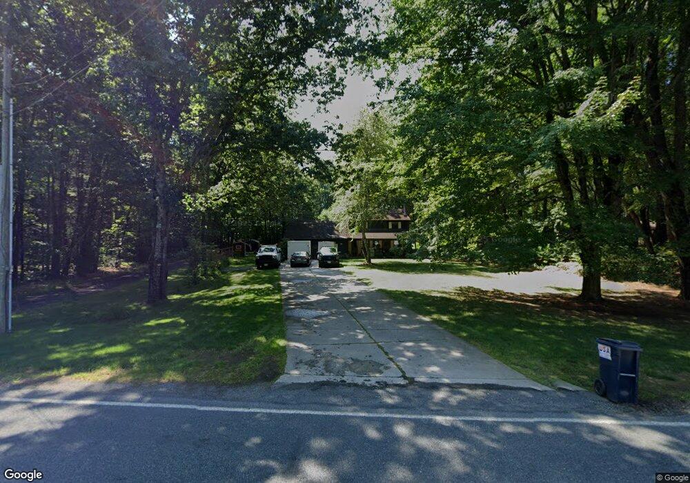
231 Plumtree Rd Sunderland, MA 01375
Estimated Value: $488,000 - $570,000
3
Beds
2
Baths
2,184
Sq Ft
$241/Sq Ft
Est. Value
About This Home
This home is located at 231 Plumtree Rd, Sunderland, MA 01375 and is currently estimated at $527,375, approximately $241 per square foot. 231 Plumtree Rd is a home located in Franklin County with nearby schools including Sunderland Elementary School and Frontier Regional School.
Ownership History
Date
Name
Owned For
Owner Type
Purchase Details
Closed on
Feb 8, 2023
Sold by
Campbell Norma
Bought by
Campbell Norma and Aldrich Timothy W
Current Estimated Value
Purchase Details
Closed on
Mar 11, 2015
Sold by
Mckenna Daniel A Est
Bought by
Campbell Norma
Purchase Details
Closed on
Nov 28, 1988
Sold by
Fydenkevez J R
Bought by
Mckenna Daniel
Create a Home Valuation Report for This Property
The Home Valuation Report is an in-depth analysis detailing your home's value as well as a comparison with similar homes in the area
Home Values in the Area
Average Home Value in this Area
Purchase History
| Date | Buyer | Sale Price | Title Company |
|---|---|---|---|
| Campbell Norma | -- | None Available | |
| Campbell Norma | $136,000 | -- | |
| Mckenna Daniel | $165,000 | -- |
Source: Public Records
Mortgage History
| Date | Status | Borrower | Loan Amount |
|---|---|---|---|
| Previous Owner | Mckenna Daniel | $15,190 | |
| Previous Owner | Mckenna Daniel | $205,744 |
Source: Public Records
Tax History Compared to Growth
Tax History
| Year | Tax Paid | Tax Assessment Tax Assessment Total Assessment is a certain percentage of the fair market value that is determined by local assessors to be the total taxable value of land and additions on the property. | Land | Improvement |
|---|---|---|---|---|
| 2025 | $53 | $405,300 | $124,800 | $280,500 |
| 2024 | $5,326 | $405,300 | $124,800 | $280,500 |
| 2023 | $4,874 | $380,800 | $113,400 | $267,400 |
| 2022 | $4,920 | $334,700 | $97,200 | $237,500 |
| 2021 | $4,805 | $310,200 | $90,100 | $220,100 |
| 2020 | $0 | $310,000 | $90,100 | $219,900 |
| 2019 | $4,633 | $302,200 | $87,500 | $214,700 |
| 2018 | $4,358 | $290,500 | $84,000 | $206,500 |
| 2017 | $0 | $288,300 | $84,000 | $204,300 |
| 2016 | $4,099 | $279,600 | $82,300 | $197,300 |
| 2015 | $4,001 | $279,600 | $82,300 | $197,300 |
| 2014 | $3,909 | $279,600 | $82,300 | $197,300 |
Source: Public Records
Map
Nearby Homes
- 15 S Plain Rd
- 146 Old Amherst Rd
- 110 Old Amherst Rd
- 3 Depot Rd
- 7 Roosevelt St
- 113 Juggler Meadow Rd
- 39 Valley Ln
- Lot 3A-3 Leverett Rd
- 73 Depot Rd
- 88 Farview Way
- 958 E Pleasant St
- 238 N Main St
- 13 Harlow Dr
- 0 Henry St
- 110 Grantwood Dr
- 11 Sheerman Ln
- 320 West St
- 185 Cherry Ln
- 259 Long Plain Rd
- Lot C Mountain Rd
- 237 Plumtree Rd
- 223 Plumtree Rd
- 219 Plumtree Rd
- 241 Plumtree Rd
- 224 Plumtree Rd
- 230 Plumtree Rd
- 236 Plumtree Rd
- 213 Plumtree Rd
- 247 Plumtree Rd
- 242 Plumtree Rd
- 220 Plumtree Rd
- 253 Plumtree Rd
- 207 Plumtree Rd
- 229 Plumtree Rd
- 246 Plumtree Rd
- 226 Plumtree Rd
- 214 Plumtree Rd
- 254 Plumtree Rd
- 208 Plumtree Rd
- 259 Plumtree Rd