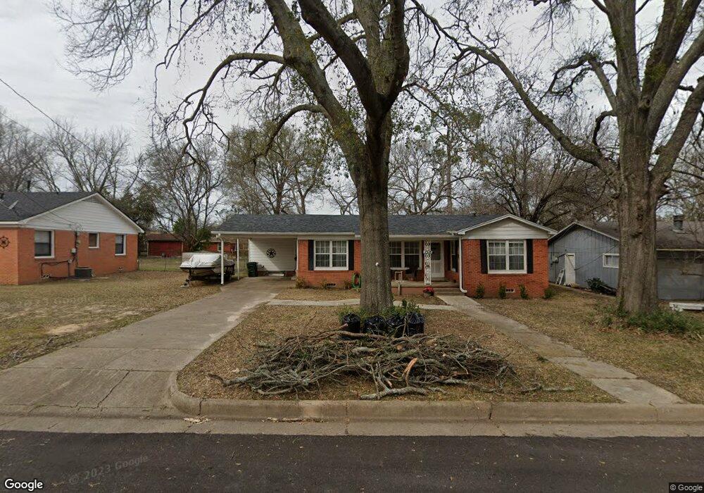
2318 Airline Dr Tyler, TX 75701
Midtown Tyler NeighborhoodEstimated Value: $168,940 - $198,000
--
Bed
2
Baths
1,245
Sq Ft
$149/Sq Ft
Est. Value
About This Home
This home is located at 2318 Airline Dr, Tyler, TX 75701 and is currently estimated at $184,985, approximately $148 per square foot. 2318 Airline Dr is a home located in Smith County with nearby schools including Bell Elementary School, Moore Middle School, and Tyler High School.
Ownership History
Date
Name
Owned For
Owner Type
Purchase Details
Closed on
Oct 17, 2018
Sold by
Reed Property Management Llc
Bought by
Vangerven Pete Van and Vangerven Constance Van
Current Estimated Value
Home Financials for this Owner
Home Financials are based on the most recent Mortgage that was taken out on this home.
Original Mortgage
$112,518
Outstanding Balance
$97,920
Interest Rate
4.5%
Mortgage Type
Purchase Money Mortgage
Estimated Equity
$87,065
Purchase Details
Closed on
Jan 1, 2010
Sold by
Reed Jimmy G
Bought by
Reed Property Management Llc
Home Financials for this Owner
Home Financials are based on the most recent Mortgage that was taken out on this home.
Original Mortgage
$58,547
Interest Rate
4.83%
Mortgage Type
Purchase Money Mortgage
Create a Home Valuation Report for This Property
The Home Valuation Report is an in-depth analysis detailing your home's value as well as a comparison with similar homes in the area
Home Values in the Area
Average Home Value in this Area
Purchase History
| Date | Buyer | Sale Price | Title Company |
|---|---|---|---|
| Vangerven Pete Van | -- | None Available | |
| Reed Property Management Llc | -- | None Available |
Source: Public Records
Mortgage History
| Date | Status | Borrower | Loan Amount |
|---|---|---|---|
| Open | Vangerven Pete Van | $112,518 | |
| Previous Owner | Reed Property Management Llc | $58,547 |
Source: Public Records
Tax History Compared to Growth
Tax History
| Year | Tax Paid | Tax Assessment Tax Assessment Total Assessment is a certain percentage of the fair market value that is determined by local assessors to be the total taxable value of land and additions on the property. | Land | Improvement |
|---|---|---|---|---|
| 2025 | $273 | $183,825 | $31,217 | $152,608 |
| 2024 | $273 | $135,566 | $13,626 | $154,703 |
| 2023 | $2,148 | $133,384 | $13,626 | $119,758 |
| 2022 | $2,195 | $125,505 | $13,626 | $111,879 |
| 2021 | $2,137 | $108,109 | $13,626 | $94,483 |
| 2020 | $1,981 | $105,448 | $13,626 | $91,822 |
| 2019 | $1,841 | $84,176 | $7,570 | $76,606 |
| 2018 | $1,145 | $52,648 | $7,570 | $45,078 |
| 2017 | $1,124 | $52,648 | $7,570 | $45,078 |
| 2016 | $1,185 | $55,527 | $7,570 | $47,957 |
| 2015 | $1,098 | $53,411 | $7,570 | $45,841 |
| 2014 | $1,098 | $51,693 | $7,570 | $44,123 |
Source: Public Records
Map
Nearby Homes
- 2408 Hunter St
- 2015 E 5th St
- 2331 Hunter St
- 1715 Ridgeview Dr
- 1914 Parklen St
- 1910 E Lake St
- 834 S Tipton Ave
- 2320 Sarasota Dr
- 2313 Danica Dr
- 2801 Valley View St
- 2713 Tanglewood Dr
- 912 S Palmer Ave
- 1528 E Devine St
- 1730 S Mahon Ave
- 2713 Brentwood Dr
- 2607 Old Henderson Hwy
- 1725 S Mahon Ave
- 837 S Palmer Ave
- 2931 Meadow Brook Trail
- 1929 Oakhurst Cir
- 2318 2318 Airline
- 2322 Airline Dr
- 2312 Airline Dr
- 2321 Lingner Dr
- 2328 Airline Dr
- 2328 2328 Airline Dr
- 2308 Airline Dr
- 2323 Lingner Dr
- 2315 Lingner Dr
- 2321 2321 Lingner
- 2323 2323 Lingner Dr
- 2311 Airline Dr
- 2321 2321 Airline
- 1400 Golden Rd
- 2325 2325 Airline
- 2309 Airline Dr
- 2331 Lingner Dr
- 2307 Lingner Dr
- 2304 Airline Dr
- 2330 Airline Dr