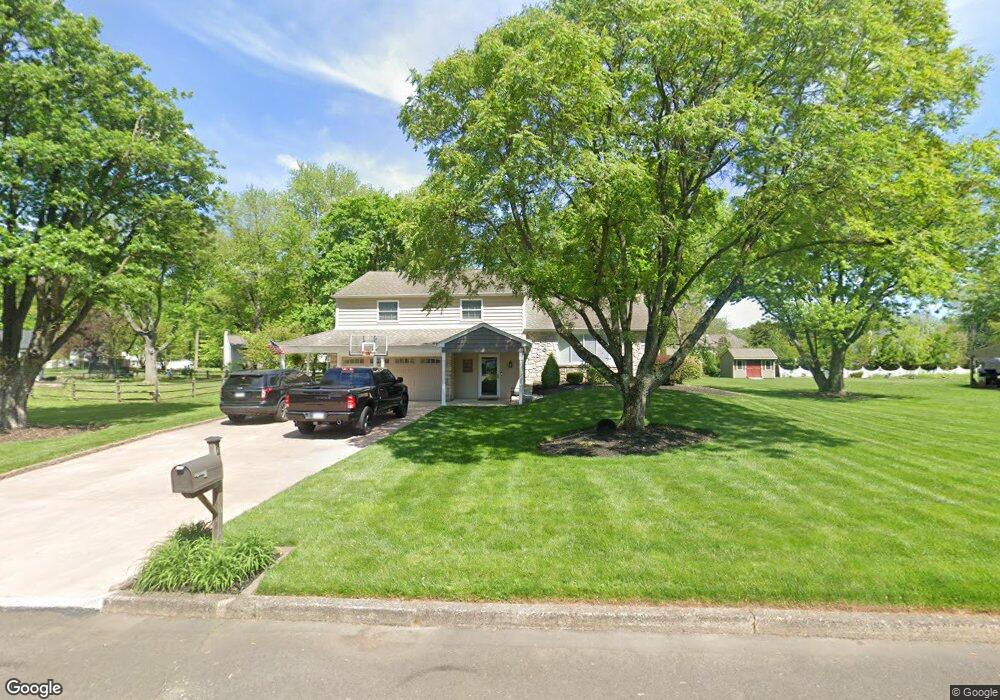
235 Mallard Rd Southampton, PA 18966
Estimated Value: $545,000 - $676,000
4
Beds
2
Baths
1,750
Sq Ft
$354/Sq Ft
Est. Value
About This Home
This home is located at 235 Mallard Rd, Southampton, PA 18966 and is currently estimated at $619,544, approximately $354 per square foot. 235 Mallard Rd is a home located in Bucks County with nearby schools including Holland Elementary School, Holland Middle School, and Council Rock High School - South.
Ownership History
Date
Name
Owned For
Owner Type
Purchase Details
Closed on
Nov 26, 2002
Sold by
Morton Maureen T
Bought by
Mcgowan Wayne R and Mcgowan Kristin E
Current Estimated Value
Home Financials for this Owner
Home Financials are based on the most recent Mortgage that was taken out on this home.
Original Mortgage
$204,000
Outstanding Balance
$88,257
Interest Rate
6.34%
Estimated Equity
$531,287
Purchase Details
Closed on
Jul 7, 1982
Bought by
Morton William H and Morton Maureen T
Create a Home Valuation Report for This Property
The Home Valuation Report is an in-depth analysis detailing your home's value as well as a comparison with similar homes in the area
Home Values in the Area
Average Home Value in this Area
Purchase History
| Date | Buyer | Sale Price | Title Company |
|---|---|---|---|
| Mcgowan Wayne R | $255,000 | -- | |
| Morton William H | $87,400 | -- |
Source: Public Records
Mortgage History
| Date | Status | Borrower | Loan Amount |
|---|---|---|---|
| Open | Mcgowan Wayne R | $204,000 |
Source: Public Records
Tax History Compared to Growth
Tax History
| Year | Tax Paid | Tax Assessment Tax Assessment Total Assessment is a certain percentage of the fair market value that is determined by local assessors to be the total taxable value of land and additions on the property. | Land | Improvement |
|---|---|---|---|---|
| 2025 | $6,086 | $31,600 | $7,000 | $24,600 |
| 2024 | $6,086 | $31,600 | $7,000 | $24,600 |
| 2023 | $5,736 | $31,600 | $7,000 | $24,600 |
| 2022 | $5,684 | $31,600 | $7,000 | $24,600 |
| 2021 | $5,504 | $31,600 | $7,000 | $24,600 |
| 2020 | $5,380 | $31,600 | $7,000 | $24,600 |
| 2019 | $5,150 | $31,600 | $7,000 | $24,600 |
| 2018 | $5,058 | $31,600 | $7,000 | $24,600 |
| 2017 | $4,863 | $31,600 | $7,000 | $24,600 |
| 2016 | $4,863 | $31,600 | $7,000 | $24,600 |
| 2015 | -- | $31,600 | $7,000 | $24,600 |
| 2014 | -- | $31,600 | $7,000 | $24,600 |
Source: Public Records
Map
Nearby Homes
- 258 Woodlake Dr
- 6 Rolling Hills Dr
- 270 Rocksville Rd
- 65 Witherington Dr
- 29 Langhorne Ave
- 537 Ashton Cir
- 6 Windy Knoll Dr
- 27 Rocking Horse Way
- 18 Prince Cir
- 98 Twigkenham Dr
- 7 Bennett Place
- 1 Falcon Dr Unit 203
- 518 Pebble Ridge Ct
- 21019 Bennett Place Unit 7
- 415 Fox Hollow Dr
- 2 Falcon Dr Unit 202
- 428 Fox Hollow Dr
- 147 Watergate Dr
- 125 Fox Hollow Dr
- 52 Dalton Way