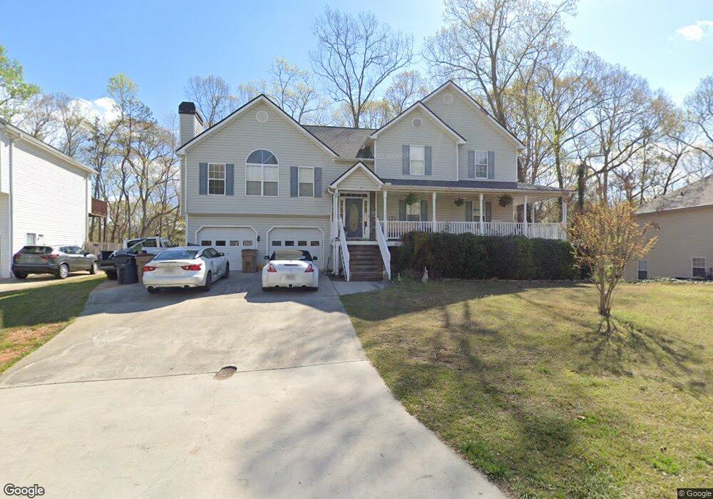
235 Sable Trace Dr Acworth, GA 30102
Oak Grove NeighborhoodEstimated Value: $442,000 - $452,182
4
Beds
3
Baths
2,630
Sq Ft
$170/Sq Ft
Est. Value
About This Home
This home is located at 235 Sable Trace Dr, Acworth, GA 30102 and is currently estimated at $447,091, approximately $169 per square foot. 235 Sable Trace Dr is a home located in Cherokee County with nearby schools including Oak Grove Elementary School, E. T. Booth Middle School, and Etowah High School.
Ownership History
Date
Name
Owned For
Owner Type
Purchase Details
Closed on
Nov 20, 2020
Sold by
Marchant Marilyn L
Bought by
Marchant Marilyn L and Marchant Kevin C
Current Estimated Value
Purchase Details
Closed on
Oct 17, 2002
Sold by
Gravley Max
Bought by
Marchant Marilyn L
Home Financials for this Owner
Home Financials are based on the most recent Mortgage that was taken out on this home.
Original Mortgage
$186,675
Interest Rate
6.21%
Mortgage Type
New Conventional
Create a Home Valuation Report for This Property
The Home Valuation Report is an in-depth analysis detailing your home's value as well as a comparison with similar homes in the area
Home Values in the Area
Average Home Value in this Area
Purchase History
| Date | Buyer | Sale Price | Title Company |
|---|---|---|---|
| Marchant Marilyn L | -- | -- | |
| Marchant Marilyn L | $196,600 | -- |
Source: Public Records
Mortgage History
| Date | Status | Borrower | Loan Amount |
|---|---|---|---|
| Previous Owner | Marchant Marilyn L | $186,675 |
Source: Public Records
Tax History Compared to Growth
Tax History
| Year | Tax Paid | Tax Assessment Tax Assessment Total Assessment is a certain percentage of the fair market value that is determined by local assessors to be the total taxable value of land and additions on the property. | Land | Improvement |
|---|---|---|---|---|
| 2025 | $1,001 | $178,916 | $34,000 | $144,916 |
| 2024 | $973 | $179,880 | $34,000 | $145,880 |
| 2023 | $1,031 | $182,400 | $34,000 | $148,400 |
| 2022 | $907 | $145,120 | $32,000 | $113,120 |
| 2021 | $884 | $118,880 | $24,000 | $94,880 |
| 2020 | $858 | $111,120 | $22,000 | $89,120 |
| 2019 | $837 | $105,600 | $22,000 | $83,600 |
| 2018 | $812 | $94,880 | $19,200 | $75,680 |
| 2017 | $827 | $234,100 | $19,200 | $74,440 |
| 2016 | $2,379 | $210,100 | $19,200 | $64,840 |
| 2015 | $2,140 | $187,700 | $15,200 | $59,880 |
| 2014 | $2,100 | $184,000 | $13,000 | $60,600 |
Source: Public Records
Map
Nearby Homes
- 400 Sable Trace Cove
- 148 Sable Trace Trail
- 6390 Woodstock Rd
- 307 Queensbury Walk
- 6312 Woodstock Rd
- 626 Spanish Oak Dr
- 423 Royal Oak Dr
- 154 Bryon Ln
- 271 Oak Grove Way
- 140 Bryon Ln
- 5574 Oak Grove Dr
- 5666 Goldfield Dr
- 402 Royal Oak Dr
- 302 Seth Way
- The Fenton Plan at Buice Lake - Madison
- The Davis Plan at Buice Lake - Madison
- 1768 Balsa Ln
- 5689 Woodland Dr
- 233 Sable Trace Dr
- 237 Sable Trace Dr
- 240 Sable Trace Dr
- 239 Sable Trace Dr
- 242 Sable Trace Dr
- 231 Sable Trace Dr
- 238 Sable Trace Dr
- 244 Sable Trace Dr
- 241 Sable Trace Dr
- 317 Sable Trace Pass
- 229 Sable Trace Dr
- 315 Sable Trace Pass
- 246 Sable Trace Dr
- 319 Sable Trace Pass
- 243 Sable Trace Dr
- 585 Lee Dr
- 248 Sable Trace Dr
- 236 Sable Trace Dr
- 227 Sable Trace Dr
- 245 Sable Trace Dr