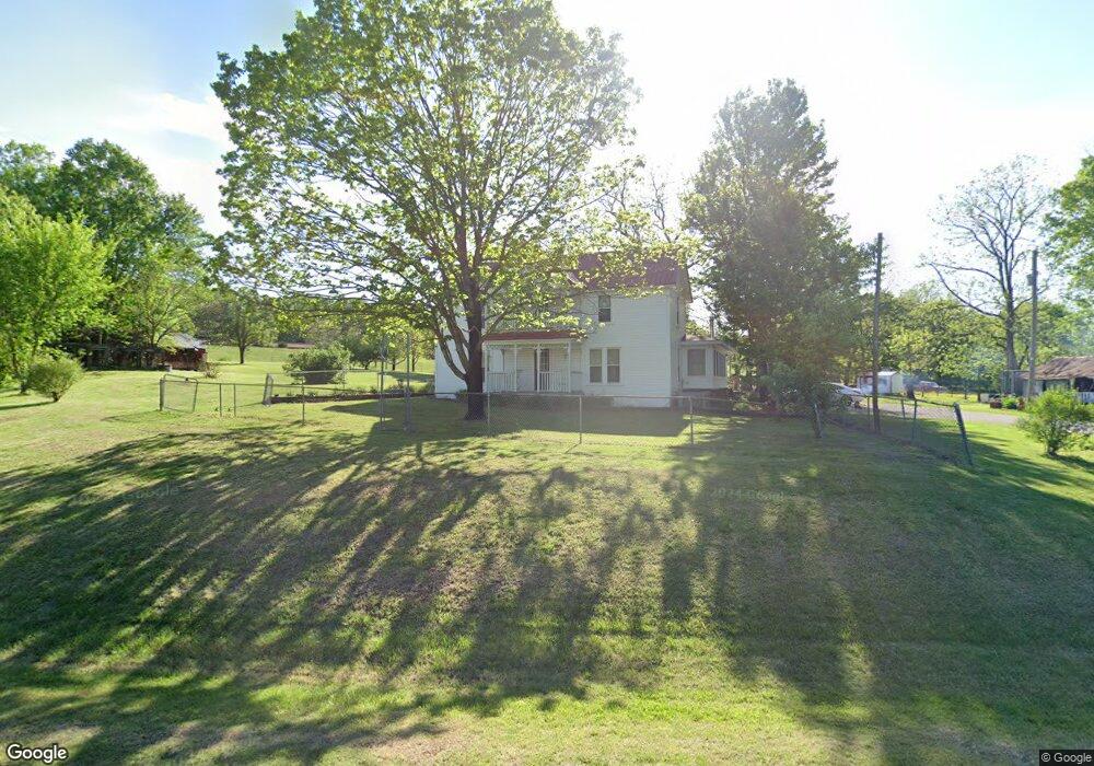
23555 W Mountain Rd Decatur, AR 72722
Estimated Value: $347,000 - $542,000
--
Bed
--
Bath
2,686
Sq Ft
$168/Sq Ft
Est. Value
About This Home
This home is located at 23555 W Mountain Rd, Decatur, AR 72722 and is currently estimated at $451,128, approximately $167 per square foot. 23555 W Mountain Rd is a home with nearby schools including Decatur Northside Elementary School, Decatur Middle School, and Decatur High School.
Ownership History
Date
Name
Owned For
Owner Type
Purchase Details
Closed on
Dec 29, 2005
Sold by
Mccollum Winona Christine
Bought by
Mccollum W Chris
Current Estimated Value
Purchase Details
Closed on
Nov 20, 2003
Bought by
Mccollum P
Purchase Details
Closed on
Jan 11, 1999
Bought by
Mccollum P
Purchase Details
Closed on
Dec 2, 1998
Bought by
Mccollum Tr
Purchase Details
Closed on
Mar 12, 1990
Bought by
Int Mccollum 1 and Int 5
Purchase Details
Closed on
Dec 30, 1976
Bought by
Patricia Mccollum Tr 1/10 Int
Create a Home Valuation Report for This Property
The Home Valuation Report is an in-depth analysis detailing your home's value as well as a comparison with similar homes in the area
Home Values in the Area
Average Home Value in this Area
Purchase History
| Date | Buyer | Sale Price | Title Company |
|---|---|---|---|
| Mccollum W Chris | -- | None Available | |
| Mccollum P | -- | -- | |
| Mccollum P | -- | -- | |
| Mccollum Tr | -- | -- | |
| Int Mccollum 1 | -- | -- | |
| Kristi Particia Patrick Roff | -- | -- | |
| Patricia Mccollum Tr 1/10 Int | -- | -- |
Source: Public Records
Tax History Compared to Growth
Tax History
| Year | Tax Paid | Tax Assessment Tax Assessment Total Assessment is a certain percentage of the fair market value that is determined by local assessors to be the total taxable value of land and additions on the property. | Land | Improvement |
|---|---|---|---|---|
| 2025 | $1,058 | $43,435 | $6,828 | $36,607 |
| 2024 | $975 | $43,435 | $6,828 | $36,607 |
| 2023 | $929 | $30,710 | $2,580 | $28,130 |
| 2022 | $573 | $30,710 | $2,580 | $28,130 |
| 2021 | $530 | $30,710 | $2,580 | $28,130 |
| 2020 | $492 | $17,370 | $2,070 | $15,300 |
| 2019 | $492 | $17,370 | $2,070 | $15,300 |
| 2018 | $472 | $17,370 | $2,070 | $15,300 |
| 2017 | $472 | $17,370 | $2,070 | $15,300 |
| 2016 | $472 | $17,370 | $2,070 | $15,300 |
| 2015 | $829 | $17,630 | $1,850 | $15,780 |
| 2014 | $484 | $17,630 | $1,850 | $15,780 |
Source: Public Records
Map
Nearby Homes
- 0 W Mountain Rd Unit 1318276
- 0 Carlton Dr Unit 1312560
- 22842 Carlton Dr
- 23775 Carlton Dr
- TBD Georgia Flat Rd
- 24530 Coon's Hollow Rd
- 24530 & 24540 Coon's Hollow Rd
- 22083 W Mountain Rd
- 24530 & 24540 Coon Hollow Rd
- 10918 Blue Bird Rd
- 10604 Arkansas 43
- 9037 Pine Grove Rd
- 9065 Pine Grove Rd
- 11228 Benson Rd
- 7.32 Acres Shady Black Oak Way
- 0 Tucker Rd
- 11138 Georgia Flat Rd
- 40ac Tucker Rd
- . Tucker Rd
- 12087 Georgia Flat Rd
- 0 County Rd 22 (B)
- 0 County Rd 22 (A)
- 0 Off W Mountain Rd Unit 646283
- 0 Off W Mountain Rd Unit 647966
- 23639 W Mountain Rd
- 23620 W Mountain Rd
- 23630 W Mountain Rd
- 23657 W Mountain Rd
- tbd W Mountain Rd
- 23680 W Mountain Rd
- 23401 W Mountain Rd
- 23451 W Mountain Rd
- 23671 W Mountain Rd
- 23671 W Mountain Rd
- TBD Main St
- 23688 W Mountain Rd
- 23695 W Mountain Rd
- 23414 W Mountain Rd
- 23391 W Highway 102
- 23402 W Mountain Rd