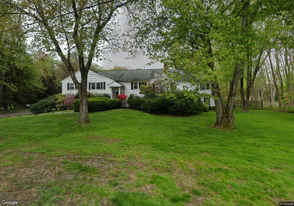
24 Balsam Rd Briarcliff Manor, NY 10510
Estimated Value: $1,130,000 - $1,380,000
3
Beds
2
Baths
2,334
Sq Ft
$562/Sq Ft
Est. Value
About This Home
This home is located at 24 Balsam Rd, Briarcliff Manor, NY 10510 and is currently estimated at $1,312,565, approximately $562 per square foot. 24 Balsam Rd is a home located in Westchester County with nearby schools including Todd Elementary School, Briarcliff Middle School, and Briarcliff High School.
Ownership History
Date
Name
Owned For
Owner Type
Purchase Details
Closed on
Apr 24, 2025
Sold by
Remy Marilyn Therese
Bought by
Colton Scott and Colton Suzanne R
Current Estimated Value
Purchase Details
Closed on
Oct 14, 2010
Sold by
Colton Scott and Colton Suzanne R
Bought by
Colton Scott and Colton Suzanne R
Purchase Details
Closed on
Mar 12, 2001
Sold by
Remy Marilyn T
Bought by
Colton Scott and Colton Suzanne R
Home Financials for this Owner
Home Financials are based on the most recent Mortgage that was taken out on this home.
Original Mortgage
$325,000
Interest Rate
6.97%
Mortgage Type
Purchase Money Mortgage
Create a Home Valuation Report for This Property
The Home Valuation Report is an in-depth analysis detailing your home's value as well as a comparison with similar homes in the area
Home Values in the Area
Average Home Value in this Area
Purchase History
| Date | Buyer | Sale Price | Title Company |
|---|---|---|---|
| Colton Scott | -- | Amtrust Title | |
| Colton Scott | -- | None Available | |
| Colton Scott | $550,000 | All New York Title Agency In |
Source: Public Records
Mortgage History
| Date | Status | Borrower | Loan Amount |
|---|---|---|---|
| Previous Owner | Colton Scott | $325,000 |
Source: Public Records
Tax History Compared to Growth
Tax History
| Year | Tax Paid | Tax Assessment Tax Assessment Total Assessment is a certain percentage of the fair market value that is determined by local assessors to be the total taxable value of land and additions on the property. | Land | Improvement |
|---|---|---|---|---|
| 2024 | $33,813 | $1,247,100 | $457,000 | $790,100 |
| 2023 | $31,848 | $1,150,500 | $457,000 | $693,500 |
| 2022 | $31,360 | $1,034,400 | $457,000 | $577,400 |
| 2021 | $30,401 | $966,800 | $457,000 | $509,800 |
| 2020 | $28,923 | $966,800 | $457,000 | $509,800 |
| 2019 | $29,254 | $914,200 | $457,000 | $457,200 |
| 2018 | $35,057 | $914,200 | $457,000 | $457,200 |
| 2017 | $19,357 | $914,200 | $457,000 | $457,200 |
| 2016 | $360,285 | $887,600 | $457,000 | $430,600 |
| 2015 | $24,519 | $55,000 | $12,300 | $42,700 |
| 2014 | $24,519 | $55,000 | $12,300 | $42,700 |
| 2013 | $24,519 | $55,000 | $12,300 | $42,700 |
Source: Public Records
Map
Nearby Homes
- 320 Cedar Dr W
- 417 Long Hill Rd E
- 345 Elm Rd
- 518 Pleasantville Rd
- 858 Pleasantville Rd
- 620 Sleepy Hollow Rd
- 10 Shadow Tree Ln
- 134 Dalmeny Rd
- 27 Hardscrabble Rd
- 24 Sleepy Hollow Rd
- 37 Tulip Rd
- 134 Pleasantville Rd
- 51 Choate Ln
- 7 Dunn Ln
- 409 Central Dr
- 333 N State Rd Unit 55
- 76 Sarles Ln
- 590 Bedford Rd Unit 7
- 177 Old Briarcliff Rd
- 3 Holbrook Rd
- 181 Long Hill Rd E
- 163 Long Hill Rd E
- 29 Balsam Rd
- 44 Hawthorn Place
- 30 Hawthorn Place
- 54 Hawthorn Place
- 199 Long Hill Rd E
- 149 Long Hill Rd E
- 33 Tuttle Rd
- 41 Tuttle Rd
- 3 Cedar Dr E
- 55 Tuttle Rd
- 49 Tuttle Rd
- 5 Tuttle Rd
- 57 Balsam Rd
- 45 Hawthorn Place
- 11 Cedar Dr E
- 10 Cedar Dr E
- 31 Hawthorn Place
- 190A Long Hill Rd E