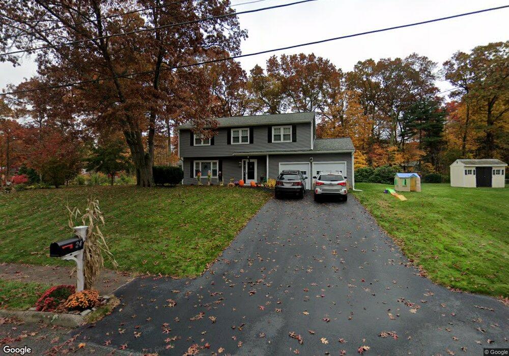
24 Florence Cir Medway, MA 02053
Estimated Value: $716,418 - $845,000
4
Beds
3
Baths
2,115
Sq Ft
$372/Sq Ft
Est. Value
About This Home
This home is located at 24 Florence Cir, Medway, MA 02053 and is currently estimated at $785,855, approximately $371 per square foot. 24 Florence Cir is a home located in Norfolk County with nearby schools including John D. McGovern Elementary School, Burke-Memorial Elementary, and Medway Middle School.
Ownership History
Date
Name
Owned For
Owner Type
Purchase Details
Closed on
Oct 23, 2009
Sold by
Odonnell John F and Odonnell Kathleen A
Bought by
Kranz Gary D and Burkle Sarah
Current Estimated Value
Home Financials for this Owner
Home Financials are based on the most recent Mortgage that was taken out on this home.
Original Mortgage
$355,933
Outstanding Balance
$232,537
Interest Rate
5.09%
Mortgage Type
Purchase Money Mortgage
Estimated Equity
$553,318
Purchase Details
Closed on
Aug 30, 1991
Sold by
Strassell Peter A and Strassell Linda A
Bought by
Odonnell John F and Odonnell Kathleen A
Home Financials for this Owner
Home Financials are based on the most recent Mortgage that was taken out on this home.
Original Mortgage
$138,800
Interest Rate
9.44%
Mortgage Type
Purchase Money Mortgage
Create a Home Valuation Report for This Property
The Home Valuation Report is an in-depth analysis detailing your home's value as well as a comparison with similar homes in the area
Home Values in the Area
Average Home Value in this Area
Purchase History
| Date | Buyer | Sale Price | Title Company |
|---|---|---|---|
| Kranz Gary D | $362,500 | -- | |
| Odonnell John F | $174,900 | -- |
Source: Public Records
Mortgage History
| Date | Status | Borrower | Loan Amount |
|---|---|---|---|
| Open | Kranz Gary D | $355,933 | |
| Previous Owner | Odonnell John F | $157,000 | |
| Previous Owner | Odonnell John F | $135,500 | |
| Previous Owner | Odonnell John F | $138,800 |
Source: Public Records
Tax History Compared to Growth
Tax History
| Year | Tax Paid | Tax Assessment Tax Assessment Total Assessment is a certain percentage of the fair market value that is determined by local assessors to be the total taxable value of land and additions on the property. | Land | Improvement |
|---|---|---|---|---|
| 2025 | $8,667 | $608,200 | $323,400 | $284,800 |
| 2024 | $8,758 | $608,200 | $323,400 | $284,800 |
| 2023 | $8,665 | $543,600 | $294,300 | $249,300 |
| 2022 | $7,686 | $454,000 | $217,600 | $236,400 |
| 2021 | $7,644 | $437,800 | $203,100 | $234,700 |
| 2020 | $7,259 | $414,800 | $182,400 | $232,400 |
| 2019 | $6,898 | $406,500 | $182,400 | $224,100 |
| 2018 | $6,937 | $392,800 | $174,100 | $218,700 |
| 2017 | $6,863 | $383,000 | $167,900 | $215,100 |
| 2016 | $6,824 | $376,800 | $161,700 | $215,100 |
| 2015 | $6,577 | $360,600 | $149,200 | $211,400 |
| 2014 | $6,377 | $338,500 | $149,200 | $189,300 |
Source: Public Records
Map
Nearby Homes
- 22 Sunset Dr
- 14 Heritage Dr
- 36 Lovering St
- 12 Lovering St
- 3 Meryl St
- 106 Holliston St
- 50 Main St
- 176 Main St Unit 3
- 280 Village St Unit D2
- 19 Sycamore Way Unit L40
- 28 Wellington St
- 4 Shaw St
- 1 Walnut Ln
- 30 Broken Tree Rd
- 20 Broad St Unit 6
- 20 Broad St Unit A
- 20 Broad St Unit 4
- 5 Fales St
- 220 Main St Unit 220
- 116 Winthrop St