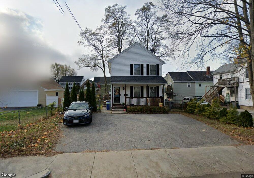
24 North St Haverhill, MA 01830
Lower Acres NeighborhoodEstimated Value: $464,000 - $570,000
3
Beds
2
Baths
1,344
Sq Ft
$374/Sq Ft
Est. Value
About This Home
This home is located at 24 North St, Haverhill, MA 01830 and is currently estimated at $502,128, approximately $373 per square foot. 24 North St is a home located in Essex County with nearby schools including Dr. Paul Nettle Middle School.
Ownership History
Date
Name
Owned For
Owner Type
Purchase Details
Closed on
Oct 29, 2004
Sold by
Hemond Julia S and Hemond Raymond N
Bought by
Pyburn Timothy J
Current Estimated Value
Home Financials for this Owner
Home Financials are based on the most recent Mortgage that was taken out on this home.
Original Mortgage
$264,906
Interest Rate
5.74%
Mortgage Type
Purchase Money Mortgage
Purchase Details
Closed on
Jun 4, 2001
Sold by
Rfaco Llc
Bought by
Hemond Raymond and Hemond Julia S
Purchase Details
Closed on
Dec 22, 1994
Sold by
Jones Robert J
Bought by
Orange Street Dev Inc
Purchase Details
Closed on
Oct 12, 1988
Sold by
-Cullen Albert B
Bought by
Jones Robert J
Create a Home Valuation Report for This Property
The Home Valuation Report is an in-depth analysis detailing your home's value as well as a comparison with similar homes in the area
Home Values in the Area
Average Home Value in this Area
Purchase History
| Date | Buyer | Sale Price | Title Company |
|---|---|---|---|
| Pyburn Timothy J | $267,000 | -- | |
| Hemond Raymond | $172,600 | -- | |
| Orange Street Dev Inc | $6,000 | -- | |
| Jones Robert J | $5,000 | -- |
Source: Public Records
Mortgage History
| Date | Status | Borrower | Loan Amount |
|---|---|---|---|
| Open | Jones Robert J | $253,038 | |
| Closed | Jones Robert J | $266,346 | |
| Closed | Jones Robert J | $264,906 |
Source: Public Records
Tax History Compared to Growth
Tax History
| Year | Tax Paid | Tax Assessment Tax Assessment Total Assessment is a certain percentage of the fair market value that is determined by local assessors to be the total taxable value of land and additions on the property. | Land | Improvement |
|---|---|---|---|---|
| 2025 | $4,190 | $391,200 | $136,500 | $254,700 |
| 2024 | $3,977 | $373,800 | $127,400 | $246,400 |
| 2023 | $3,928 | $352,300 | $127,400 | $224,900 |
| 2022 | $3,783 | $297,400 | $116,800 | $180,600 |
| 2021 | $3,574 | $265,900 | $100,100 | $165,800 |
| 2020 | $3,494 | $256,900 | $95,600 | $161,300 |
| 2019 | $3,414 | $244,700 | $83,400 | $161,300 |
| 2018 | $3,281 | $230,100 | $78,900 | $151,200 |
| 2017 | $3,224 | $215,100 | $72,800 | $142,300 |
| 2016 | $3,117 | $202,900 | $63,700 | $139,200 |
| 2015 | $3,115 | $202,900 | $63,700 | $139,200 |
Source: Public Records
Map
Nearby Homes
- 5 Kimball St
- 8 Dustin St
- 17 Vine St
- 11 York St Unit 11
- 9 York St Unit 9
- 151 Franklin St
- 48 Portland St
- 23 Lewis St
- 25 Portland St
- 25-27 Dover St
- 192 Franklin St
- 6 Dexter St
- 13-15 Arlington St
- 17 Arlington St
- 23 Arlington St
- 34 7th Ave
- 4 Michael Anthony Rd
- 2 Michael Anthony Rd
- 7 Clinton St Unit 4
- 8 Bartlett Ave Unit 5