Estimated Value: $381,651 - $430,000
4
Beds
4
Baths
2,260
Sq Ft
$179/Sq Ft
Est. Value
About This Home
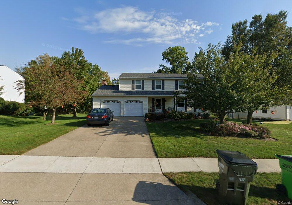
This home is located at 2405 Silver Springs Dr, Stow, OH 44224 and is currently estimated at $404,413, approximately $178 per square foot. 2405 Silver Springs Dr is a home located in Summit County with nearby schools including Stow-Munroe Falls High School, Primrose School of Hudson, and Holy Family Elementary School.
Ownership History
Date
Name
Owned For
Owner Type
Purchase Details
Closed on
Aug 31, 2017
Sold by
Vidd Robert J and Vidd Linda F
Bought by
Funai John T and Funai Stephanie C
Current Estimated Value
Home Financials for this Owner
Home Financials are based on the most recent Mortgage that was taken out on this home.
Original Mortgage
$206,910
Outstanding Balance
$173,062
Interest Rate
3.96%
Mortgage Type
New Conventional
Estimated Equity
$231,351
Create a Home Valuation Report for This Property
The Home Valuation Report is an in-depth analysis detailing your home's value as well as a comparison with similar homes in the area
Home Values in the Area
Average Home Value in this Area
Purchase History
| Date | Buyer | Sale Price | Title Company |
|---|---|---|---|
| Funai John T | $229,900 | Nova Title Agency Inc |
Source: Public Records
Mortgage History
| Date | Status | Borrower | Loan Amount |
|---|---|---|---|
| Open | Funai John T | $206,910 |
Source: Public Records
Tax History Compared to Growth
Tax History
| Year | Tax Paid | Tax Assessment Tax Assessment Total Assessment is a certain percentage of the fair market value that is determined by local assessors to be the total taxable value of land and additions on the property. | Land | Improvement |
|---|---|---|---|---|
| 2025 | $6,144 | $109,239 | $17,738 | $91,501 |
| 2024 | $6,144 | $109,239 | $17,738 | $91,501 |
| 2023 | $6,144 | $109,239 | $17,738 | $91,501 |
| 2022 | $5,231 | $82,040 | $12,852 | $69,188 |
| 2021 | $4,683 | $82,040 | $12,852 | $69,188 |
| 2020 | $4,602 | $82,040 | $12,850 | $69,190 |
| 2019 | $4,232 | $70,450 | $12,850 | $57,600 |
| 2018 | $4,163 | $70,450 | $12,850 | $57,600 |
| 2017 | $3,281 | $70,450 | $12,850 | $57,600 |
| 2016 | $3,377 | $62,520 | $12,850 | $49,670 |
| 2015 | $3,281 | $62,520 | $12,850 | $49,670 |
| 2014 | $3,284 | $62,520 | $12,850 | $49,670 |
| 2013 | $3,205 | $61,540 | $12,850 | $48,690 |
Source: Public Records
Map
Nearby Homes
- 2327 Crockett Cir
- 2380 Port Williams Dr Unit 2380
- 4944 Friar Rd Unit D
- 4901 Pebblehurst Dr
- 0 Stow Rd Unit 5102979
- 4901 Independence Cir Unit B
- 5217 Beckett Ridge
- V/L Norton Rd
- 1884 Village Ct Unit X66
- 4630 Red Willow Rd
- 2684 Serra Vista Dr
- 1938 Higby Dr
- 1627 Cypress Ct
- 4322 Lorwood Dr
- 1664 Cypress Ct
- 1668 Cypress Ct
- 5431 Diana Lynn Dr
- 4604 Muirwood Place
- 1808 Higby Dr Unit A
- 1525 Spruce Hill Dr
- 2415 Silver Springs Dr
- 2397 Silver Springs Dr
- 2425 Silver Springs Dr
- 2387 Silver Springs Dr
- 2406 Silver Springs Dr
- 2394 Silver Springs Dr
- 1307 Silver
- 2433 Silver Springs Dr
- 2379 Silver Springs Dr
- 2428 Silver Springs Dr
- 4948 Silver Cir
- 2384 Silver Springs Dr
- 2369 Silver Springs Dr
- 2443 Silver Springs Dr
- 2374 Silver Springs Dr
- 4949 Silver Cir
- 4943 Silver Cir
- 4940 Silver Cir
- 2361 Silver Springs Dr
- 2364 Silver Springs Dr