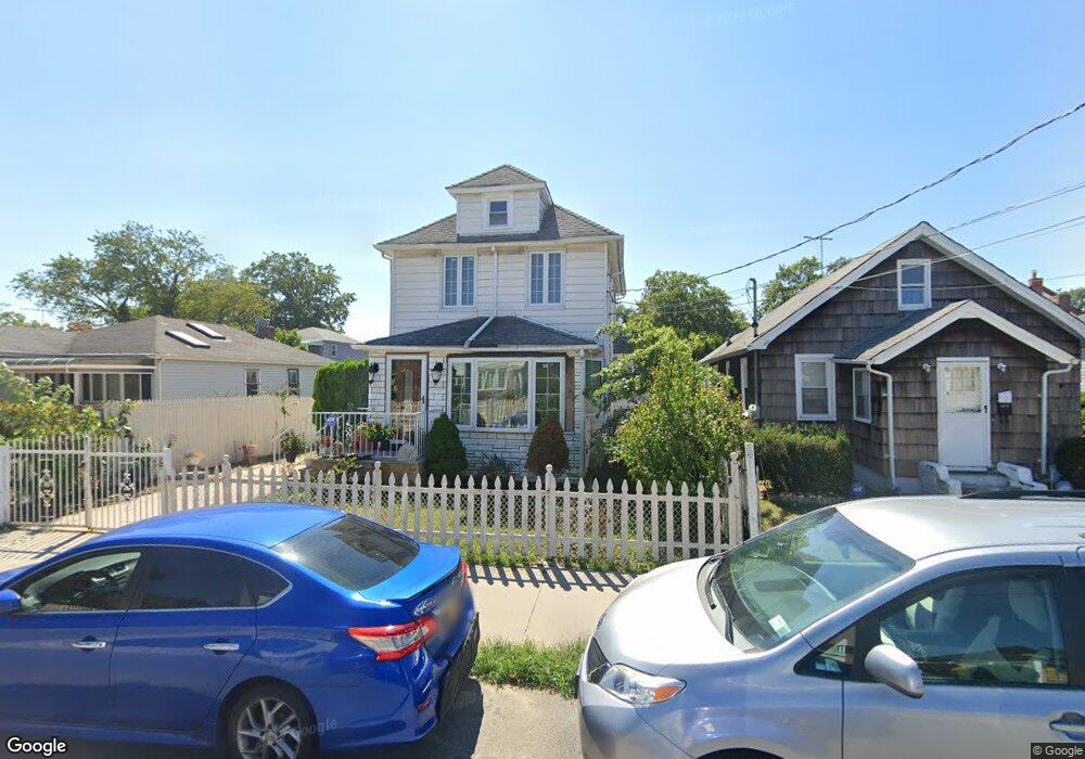
243-14 132nd Ave Rosedale, NY 11422
Rosedale NeighborhoodEstimated Value: $730,000 - $808,640
4
Beds
4
Baths
1,380
Sq Ft
$560/Sq Ft
Est. Value
About This Home
This home is located at 243-14 132nd Ave, Rosedale, NY 11422 and is currently estimated at $772,910, approximately $560 per square foot. 243-14 132nd Ave is a home located in Queens County with nearby schools including P.S. 38 - Rosedale, Collaborative Arts Middle School, and Mona Prep.
Ownership History
Date
Name
Owned For
Owner Type
Purchase Details
Closed on
Sep 14, 2018
Sold by
Mcdonald Stanford J and Mcdonald Vinnese E
Bought by
Lema Maria J and Lema Mario C
Current Estimated Value
Home Financials for this Owner
Home Financials are based on the most recent Mortgage that was taken out on this home.
Original Mortgage
$428,000
Outstanding Balance
$372,473
Interest Rate
4.5%
Mortgage Type
Purchase Money Mortgage
Estimated Equity
$400,438
Purchase Details
Closed on
Apr 28, 2004
Sold by
Louis Francoise Adonis and Louis Michel Lesly
Bought by
Mcdonald Stanford J and Mcdonald Vinnese E
Home Financials for this Owner
Home Financials are based on the most recent Mortgage that was taken out on this home.
Original Mortgage
$313,500
Interest Rate
5.47%
Mortgage Type
Purchase Money Mortgage
Create a Home Valuation Report for This Property
The Home Valuation Report is an in-depth analysis detailing your home's value as well as a comparison with similar homes in the area
Home Values in the Area
Average Home Value in this Area
Purchase History
| Date | Buyer | Sale Price | Title Company |
|---|---|---|---|
| Lema Maria J | $535,000 | -- | |
| Mcdonald Stanford J | $330,000 | -- |
Source: Public Records
Mortgage History
| Date | Status | Borrower | Loan Amount |
|---|---|---|---|
| Open | Lema Maria J | $428,000 | |
| Previous Owner | Mcdonald Stanford J | $313,500 |
Source: Public Records
Tax History Compared to Growth
Tax History
| Year | Tax Paid | Tax Assessment Tax Assessment Total Assessment is a certain percentage of the fair market value that is determined by local assessors to be the total taxable value of land and additions on the property. | Land | Improvement |
|---|---|---|---|---|
| 2025 | $5,354 | $28,232 | $7,465 | $20,767 |
| 2024 | $5,354 | $26,656 | $7,060 | $19,596 |
| 2023 | $5,354 | $26,656 | $6,981 | $19,675 |
| 2022 | $5,271 | $34,500 | $9,900 | $24,600 |
| 2021 | $5,248 | $33,120 | $9,900 | $23,220 |
| 2020 | $4,980 | $31,920 | $9,900 | $22,020 |
| 2019 | $4,354 | $31,140 | $9,900 | $21,240 |
| 2018 | $4,230 | $22,213 | $8,311 | $13,902 |
| 2017 | $4,186 | $22,003 | $9,168 | $12,835 |
| 2016 | $3,844 | $22,003 | $9,168 | $12,835 |
| 2015 | $2,284 | $19,606 | $9,542 | $10,064 |
| 2014 | $2,284 | $18,511 | $9,230 | $9,281 |
Source: Public Records
Map
Nearby Homes
- 132-29 Brookville Blvd
- 11 Jefferson Ave
- 131- 44 Laurelton Pkwy Unit Lower
- 131-30 Laurelton Pkwy Unit Upper
- 35 Harvard St
- 23432 133rd Ave Unit LOWER
- 211 Ash St
- 64 Ormonde Blvd
- 131-31 234th St Unit 2nd Fl
- 130-21 235th St
- 234-5 133rd Ave Unit Lower
- 131-09 234th St Unit Lower Level
- 134-33 242nd St
- 131-56 234th St Unit Lower
- 131-66 234th St Unit Lower
- 131-74 234th St Unit 1
- 234-16 130th Ave
- 233-6 131st Ave Unit 1
- 63 Cumberland Place
- 128-35 Brookville Blvd
- 24302 132nd Ave
- 24306 132nd Ave
- 243-06 132nd Ave
- 24310 132nd Ave
- 243-21 132nd Ave
- 24314 132nd Ave
- 24301 132nd Ave
- 243-01 132nd Ave Unit 2
- 243-01 132nd Ave
- 243-05 132nd Ave
- 24222 132nd Ave
- 24307 132nd Rd
- 243-01 132nd Rd
- 13133 243rd St
- 24305 132nd Ave
- 24311 132nd Rd
- 24301 132nd Rd
- 24311 132nd Rd
- 24311 132nd Ave
- 24311 132nd Ave