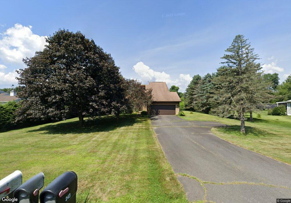
243 Hadley Rd Sunderland, MA 01375
Estimated Value: $456,000 - $619,000
3
Beds
3
Baths
1,929
Sq Ft
$278/Sq Ft
Est. Value
About This Home
This home is located at 243 Hadley Rd, Sunderland, MA 01375 and is currently estimated at $536,071, approximately $277 per square foot. 243 Hadley Rd is a home located in Franklin County with nearby schools including Sunderland Elementary School and Frontier Regional School.
Create a Home Valuation Report for This Property
The Home Valuation Report is an in-depth analysis detailing your home's value as well as a comparison with similar homes in the area
Home Values in the Area
Average Home Value in this Area
Tax History Compared to Growth
Tax History
| Year | Tax Paid | Tax Assessment Tax Assessment Total Assessment is a certain percentage of the fair market value that is determined by local assessors to be the total taxable value of land and additions on the property. | Land | Improvement |
|---|---|---|---|---|
| 2025 | $64 | $493,500 | $123,300 | $370,200 |
| 2024 | $6,485 | $493,500 | $123,300 | $370,200 |
| 2023 | $5,958 | $465,500 | $112,100 | $353,400 |
| 2022 | $6,028 | $410,100 | $96,100 | $314,000 |
| 2021 | $3,373 | $368,600 | $89,100 | $279,500 |
| 2020 | $27 | $367,900 | $89,100 | $278,800 |
| 2019 | $27 | $357,800 | $86,500 | $271,300 |
| 2018 | $5,070 | $338,000 | $83,000 | $255,000 |
| 2017 | $2,971 | $339,100 | $83,000 | $256,100 |
| 2016 | $4,987 | $340,200 | $81,400 | $258,800 |
| 2015 | $4,868 | $340,200 | $81,400 | $258,800 |
| 2014 | $4,756 | $340,200 | $81,400 | $258,800 |
Source: Public Records
Map
Nearby Homes
- 146 Old Amherst Rd
- 110 Old Amherst Rd
- 15 S Plain Rd
- 238 N Main St
- 3 Depot Rd
- Lot C Mountain Rd
- Lot A Mountain Rd
- Lot B Mountain Rd
- 15 Crestview Dr
- 40 Eastern Ave
- 32 Swamp Rd
- 24 Graves St
- 0 North St Unit 73407299
- 24 Elm St
- 320 West St
- 134 Montague Rd
- 13 Capt Lathrop Dr
- 73 Depot Rd
- 7 Roosevelt St
- 113 Juggler Meadow Rd